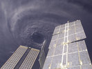
We all know what happened on friday the 13th of august 2004
Hurricane Charley slammed into Punta Gorda Florida much stronger then expected
the area was flattened as we know
about now Charley was a cat 2 (officially it was but I believe it was stronger by a bit) slamming into the western parts of cuba
It was seemingly on a collision course for Tampa in which if it followed it would have possibly been andrew all over again
Although it didn't people can say it was bad enough to earn it's place with the classic storms like andrew and camille
One year ago today friday the 13th 2004 a long tragic day
Moderator: S2k Moderators
Forum rules

The posts in this forum are NOT official forecasts and should not be used as such. They are just the opinion of the poster and may or may not be backed by sound meteorological data. They are NOT endorsed by any professional institution or STORM2K. For official information, please refer to products from the National Hurricane Center and National Weather Service.
-
Anonymous
-
Anonymous
Re: One year ago today friday the 13th 2004 a long tragic da
Hurricane Floyd wrote:We all know what happened on friday the 13th of august 2004
Hurricane Charley slammed into Punta Gorda Florida much stronger then expected
the area was flattened as we know
about now Charley was a cat 2 (officially it was but I believe it was stronger by a bit) slamming into the western parts of cuba
It was seemingly on a collision course for Tampa in which if it followed it would have possibly been andrew all over again
Although it didn't people can say it was bad enough to earn it's place with the classic storms like andrew and camille
Charley was 105 kt (120 mph) in Cuba due to extensive damage there.
0 likes
-
wxmann_91

- Category 5

- Posts: 8013
- Age: 34
- Joined: Fri Jul 15, 2005 2:49 pm
- Location: Southern California
- Contact:
No.
Charley was one of those "classic" Gulf storms. Look at Lili, Ivan, Opal, Dennis, etc. The fact is that shortwave troughs that dig down and pick these up usually enhance outflow in the beginning (thus allowing those storms to undergo rapid strengthening), but, as the shear that enhances outflow reaches the storm, the storm suddenly weakens. So, Charley probably peaked or could've climbed just a bit higher, but not to Cat 5, and had it made landfall to the north, the shear would've begun to impact it.
Then again, we might never know. But it's good to speculate.
0 likes
-
Anonymous
wxmann_91 wrote:No.
Charley was one of those "classic" Gulf storms. Look at Lili, Ivan, Opal, Dennis, etc. The fact is that shortwave troughs that dig down and pick these up usually enhance outflow in the beginning (thus allowing those storms to undergo rapid strengthening), but, as the shear that enhances outflow reaches the storm, the storm suddenly weakens. So, Charley probably peaked or could've climbed just a bit higher, but not to Cat 5, and had it made landfall to the north, the shear would've begun to impact it.
Then again, we might never know. But it's good to speculate.
It was 6 mph away from Cat 5.
0 likes
-
Weatherman911
- Tropical Depression

- Posts: 91
- Joined: Sat Sep 18, 2004 2:23 pm
- Location: Cape Coral, FL.
- Contact:
-
Jim Cantore
-
Jim Cantore
-
Derek Ortt
very unlikely it would have become any stronger. It hit likely at maximum intensity
Wind shear was significantly increasing at the time of landfall, dry air was starting to work its way into the citculation, and an outer eye wall was forming. 3-5 more hours likely would have resulted in a cat 3 landfall, not a cat 5
Also, Charley is NOT a Classic Gulf Hurricane. The WC of Florida, as I have said many times, is considered to be a part of the East Coast for Climo purposes (the entire Florida Penunsula is considered as the East Coast as Climo records sugests that the pattern of hits there is the same as the EC, which is totally different from the rest of the GOM)
0 likes
-
Weatherman911
- Tropical Depression
- Posts: 91
- Joined: Sat Sep 18, 2004 2:23 pm
- Location: Cape Coral, FL.
- Contact:
Local newspaper on-line about Hurricane Charley
This is a local newspaper on-line for SW FL.
_______________________________
The News-Press, Hurricane Charley
http://www.news-press.com/apps/pbcs.dll ... 30527/1053
_______________________________
The News-Press, Hurricane Charley
http://www.news-press.com/apps/pbcs.dll ... 30527/1053
0 likes
-
Weatherman911
- Tropical Depression
- Posts: 91
- Joined: Sat Sep 18, 2004 2:23 pm
- Location: Cape Coral, FL.
- Contact:
News snip from The News-Press
(snip)
FRIDAY, AUG. 13
Charley bobbed and weaved for a bit. Weather Service forecasters predicted it would pass us about 70 miles out in the Gulf, far enough away to barely brush us with winds and rain. The weather was supposed to be modest by comparison. But then local TV weather forecasters broke with the official forecast. Charley is turning ever so slightly, they said, headed for landfall nearby.
By the time Charley screamed onto land at 3:45 p.m. he had grown from a Category 3 to a Category 4, packing winds of 145 miles per hour.
Charley struck fast and ran. The wind swirled around us. The Gulf waters surged toward the shore and the skies darkened. People tried to peek outside as the storm passed, but afterwinds kept them homebound or shelter-bound into the evening. Those away from homes didn't know how hard they had been hit.
We were hit hard on many fronts. But the big horror was Charlotte County. Hardly anyone had power - about 90 percent of the homes in Lee County were dark and hot." Wind peeled the roof off mobile homes and rain took the belongings.
It is an overused term, but, let's be honest - it looked like a war zone.
(/snip)
0 likes
-
Jim Cantore
-
Jim Cantore
-
Josephine96
1 year ago right now.. I was still "hunkered down".. scared out of my life.. though I wouldn't admit it..
The winds were starting to die down here already I think.. but the power was out.. I had been hunkered down in a bathroom for over an hour.. praying as I had heard things slamming against the house, things getting ripped off my house.. and praying for no windows to break or for the roof not to be ripped off..
The winds were starting to die down here already I think.. but the power was out.. I had been hunkered down in a bathroom for over an hour.. praying as I had heard things slamming against the house, things getting ripped off my house.. and praying for no windows to break or for the roof not to be ripped off..
0 likes

Who is online
Users browsing this forum: wwizard and 73 guests