Irene a New England storm?

This is the general tropical discussion area. Anyone can take their shot at predicting a storms path.

Moderator: S2k Moderators

Forum rules

The posts in this forum are NOT official forecasts and should not be used as such. They are just the opinion of the poster and may or may not be backed by sound meteorological data. They are NOT endorsed by any professional institution or STORM2K. For official information, please refer to products from the National Hurricane Center and National Weather Service.

Help Support Storm2K
Message
Author
User avatar
wxwatcher91
Category 5
Category 5
Posts: 1606
Joined: Wed Jul 06, 2005 2:43 pm
Location: Keene, NH
Contact:

Irene a New England storm?

#1 Postby wxwatcher91 » Thu Aug 11, 2005 5:57 am

ok I'll take the bashing...

The following post is NOT an official forecast and should not be used as such. It is just the opinion of the poster and may or may not be backed by sound meteorological data. It is NOT endorsed by any professional institution including storm2k.org For Official Information please refer to the NHC and NWS products.

It is ALSO not a WISHCAST!

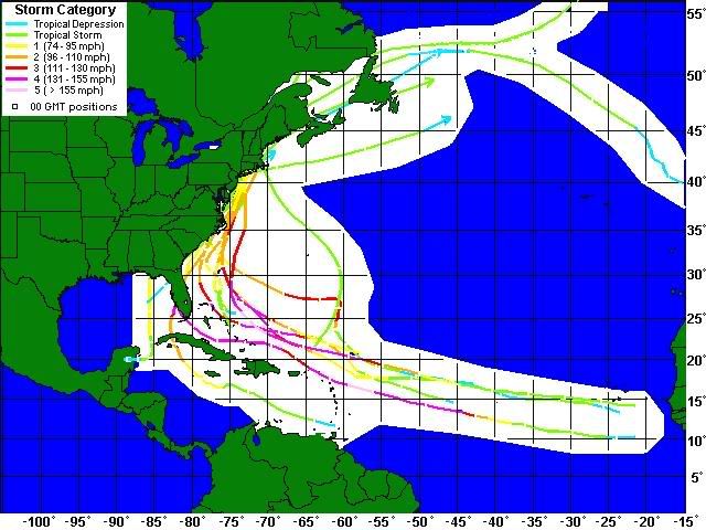
the current NHC forecast track points to NC right now however the models point a bit north and east of the offical forecast, which would lead Irene up to New England... to make it clear to everyone, I am still going with the forecast for landfall from SC northward... it is still too early to go with anything more particular than that really.

here are the current model plots:

Image

Image

right now it looks like NC could get hit or at least swiped by the western edge of Irene.

also a lot is uncertain because of the questionability of the location of the center...

right now I would first like the opions of others and also for others to not rule out New England.
0 likes   

User avatar
wxwatcher91
Category 5
Category 5
Posts: 1606
Joined: Wed Jul 06, 2005 2:43 pm
Location: Keene, NH
Contact:

#2 Postby wxwatcher91 » Thu Aug 11, 2005 6:03 am

oh and one other thing for people who like to look at historical maps... I have put together some of the tracks of New England storms onto one map so you can check it out... the track information is from wunderground.

Image

the map includes Charley 2004, Floyd 1999, Bob 1991, Gloria 1985, Agnes 1972, Brenda 1960, Donna 1960, Diane 1955, Carol 1954, Hurricane #7 1944, Hurricane #4 1938, and Tropical Storm #5 1923.
0 likes   

User avatar
WindRunner
Category 5
Category 5
Posts: 5806
Age: 34
Joined: Fri Jul 29, 2005 8:07 pm
Location: Warrenton, VA, but Albany, NY for school
Contact:

#3 Postby WindRunner » Thu Aug 11, 2005 6:10 am

I like that 06Z CONU run, looks perfect! :lol:
0 likes   

User avatar
wxwatcher91
Category 5
Category 5
Posts: 1606
Joined: Wed Jul 06, 2005 2:43 pm
Location: Keene, NH
Contact:

#4 Postby wxwatcher91 » Thu Aug 11, 2005 6:14 am

WindRunner wrote:I like that 06Z CONU run, looks perfect! :lol:


yeah especially the 96 to 120hr forecast... let's see has Irene moving at about 30mph and also has it turning on a dime when it enters PA... sounds about right... see all the NHC has to do is look at the right model... CONU fits it. :lol: :lol:
0 likes   

Matt-hurricanewatcher

#5 Postby Matt-hurricanewatcher » Thu Aug 11, 2005 6:17 am

If it keeps moving north its chances of becoming a fish increase.
0 likes   

User avatar
wxwatcher91
Category 5
Category 5
Posts: 1606
Joined: Wed Jul 06, 2005 2:43 pm
Location: Keene, NH
Contact:

#6 Postby wxwatcher91 » Thu Aug 11, 2005 6:28 am

Matt-hurricanewatcher wrote:If it keeps moving north its chances of becoming a fish increase.


yeah that's why right now the best chance for Irene to hit New England is for it to follow the NHC forecasted track if not even south of it and then make a more abrupt turn just east of the Bahamas... that is pretty much the average track for most New England storms as you can see on the history map...
0 likes   

Air Force Met
Military Met
Military Met
Posts: 4372
Age: 56
Joined: Tue Jul 08, 2003 9:30 am
Location: Roan Mountain, TN

#7 Postby Air Force Met » Thu Aug 11, 2005 7:01 am

Matt-hurricanewatcher wrote:If it keeps moving north its chances of becoming a fish increase.


Let's face it...if it had been this organized the whole time...it would be a fish already. :D
0 likes   

User avatar
dougjp
Tropical Depression
Tropical Depression
Posts: 94
Joined: Wed Aug 11, 2004 6:46 am
Location: Ontario, Canada, eh? Hazel survivor :)

#8 Postby dougjp » Thu Aug 11, 2005 7:31 am

Every one of those past New England storms was lower than Irene. However we haven't seen SSTs as they are now, being much higher than in past years. And I notice the biggest variation in SSTs compared to past years happens to be in the zone late in the forecast, possibly changing the storm's intensity and therefore directional resistance.

'Uncharted territory' ?
0 likes   

du1st

#9 Postby du1st » Thu Aug 11, 2005 8:45 am

No way if it moves north it will be a fish. This is no coast hugger.
0 likes   

User avatar
tallbunch
Category 1
Category 1
Posts: 297
Joined: Sat Sep 13, 2003 12:35 pm
Location: hilton head Island, SC

#10 Postby tallbunch » Thu Aug 11, 2005 8:52 am

look how they always go North and skip GA. That's weird.
0 likes   

Brent
S2K Supporter
S2K Supporter
Posts: 38266
Age: 37
Joined: Sun May 16, 2004 10:30 pm
Location: Tulsa Oklahoma
Contact:

#11 Postby Brent » Thu Aug 11, 2005 8:58 am

tallbunch wrote:look how they always go North and skip GA. That's weird.


Coastline juts in(unlike Florida and the Outer Banks which jut out)... hurricane hasn't hit Georgia in more than 100 years.
0 likes   
#neversummer

User avatar
Persepone
Category 2
Category 2
Posts: 755
Joined: Wed Sep 10, 2003 9:32 pm
Location: Cape Cod, MA
Contact:

#12 Postby Persepone » Thu Aug 11, 2005 10:19 am

Well, it may be possible. For the first time in 6 years, suddenly there is hurricane information available locally and for the first time I've actually seen preparation information posted (Ch. 12 RI website) for the population up here.

So apparently someone thinks that it is at least a remote possibility that we may get something up here in New England this season and that it is better to be safe than sorry and at least tell people what a hurricane is, the basics of how to prepare for one, etc.

It's possible, of course, that it is just random chance that this information suddenly appeared locally....
0 likes   

HurricaneBill
Category 5
Category 5
Posts: 3420
Joined: Sun Apr 11, 2004 5:51 pm
Location: East Longmeadow, MA, USA

#13 Postby HurricaneBill » Thu Aug 11, 2005 1:13 pm

Hurricane David hit Georgia in 1979.
0 likes   

User avatar
wxwatcher91
Category 5
Category 5
Posts: 1606
Joined: Wed Jul 06, 2005 2:43 pm
Location: Keene, NH
Contact:

#14 Postby wxwatcher91 » Thu Aug 11, 2005 1:49 pm

Persepone wrote:Well, it may be possible. For the first time in 6 years, suddenly there is hurricane information available locally and for the first time I've actually seen preparation information posted (Ch. 12 RI website) for the population up here.

So apparently someone thinks that it is at least a remote possibility that we may get something up here in New England this season and that it is better to be safe than sorry and at least tell people what a hurricane is, the basics of how to prepare for one, etc.

It's possible, of course, that it is just random chance that this information suddenly appeared locally....


is that http://www.wpri.com ??? just wondering...
0 likes   

Sanibel
Category 5
Category 5
Posts: 10385
Joined: Mon Aug 30, 2004 11:06 pm
Location: Offshore SW Florida

#15 Postby Sanibel » Thu Aug 11, 2005 2:02 pm

The trough should push it out to sea. Right?
0 likes   

User avatar
wxwatcher91
Category 5
Category 5
Posts: 1606
Joined: Wed Jul 06, 2005 2:43 pm
Location: Keene, NH
Contact:

#16 Postby wxwatcher91 » Thu Aug 11, 2005 3:13 pm

I know it refreshes up where I posted it this mornign but just to bring it down to show everyone the update:

Image
^^^ for the NHC models, the GFDL track is the one with the best chance of striking New England. the official NHC forecast track is a bit to the left and on that track could strike NJ before striking New England. the others besides the BAMD and the UKMET (fish forecast) turn Irene to the west by 120hours.

Image
^^^for the global models (the NHC models are included but I already addressed them), a track between the NHC official forecast and the CONU forecast track would take Irene to New England. what is interesting is that most of the models actually make Irene a fish... this will be very interesting to watch...
0 likes   

User avatar
wxwatcher91
Category 5
Category 5
Posts: 1606
Joined: Wed Jul 06, 2005 2:43 pm
Location: Keene, NH
Contact:

#17 Postby wxwatcher91 » Thu Aug 11, 2005 7:27 pm

Image[/img]
0 likes   

User avatar
wxwatcher91
Category 5
Category 5
Posts: 1606
Joined: Wed Jul 06, 2005 2:43 pm
Location: Keene, NH
Contact:

#18 Postby wxwatcher91 » Thu Aug 11, 2005 7:38 pm

000
FXUS61 KBOX 112210
AFDBOX

AREA FORECAST DISCUSSION UPDATE
NATIONAL WEATHER SERVICE TAUNTON MA
610 PM EDT THU AUG 11 2005

.LONG TERM (SATURDAY THROUGH THURSDAY)...
A LOT OF UNCERTAINTY IN THE EXTENDED PORTION OF THE FORECAST...
LARGELY DUE TO TRACK AND IMPACT OF IRENE.


BEYOND SUNDAY...FOLLOWED THE LEAD OF HPC...WHICH WAS IN GOOD
AGREEMENT WITH THE GFS ENSEMBLES. THE BIG QUESTION IS WHERE WILL
IRENE BE IN RELATION TO THE COLD FRONT FROM SUNDAY NIGHT. CURRENT
EXPECTATIONS ARE FOR IRENE TO INTERACT WITH THIS FRONT TUESDAY
SOMEWHERE OFF THE CAROLINA COAST. PLEASE SEE THE LATEST STATEMENTS
FROM THE TROPICAL PREDICTION CENTER CONCERNING IRENE FOR MORE
DETAILS.
0 likes   

User avatar
wxwatcher91
Category 5
Category 5
Posts: 1606
Joined: Wed Jul 06, 2005 2:43 pm
Location: Keene, NH
Contact:

#19 Postby wxwatcher91 » Fri Aug 12, 2005 6:11 am

000
FXUS61 KBOX 120917 AAA
AFDBOX

AREA FORECAST DISCUSSION..ST ADDITION..
NATIONAL WEATHER SERVICE TAUNTON MA
516 AM EDT FRI AUG 12 2005

.LONG TERM (SATURDAY NIGHT THROUGH THURSDAY)...
COLD FRONT WILL GRADUALLY SINK ACROSS THE REGION SUNDAY NIGHT...THEN
STALL SOUTH OF THE REGION MONDAY. HIGH THETA-E AIR AND GOOD MOISTURE
CONVERGENCE ALONG AND AHEAD OF THE FRONT...ALONG WITH DIURNAL
INSTABILITY WILL LEAD TO INCREASING CHANCES FOR SHOWERS AND
THUNDERSTORMS...ESPECIALLY OVER NORTHERN INTERIOR LOCATIONS SUNDAY
AND SUNDAY NIGHT. INCREASED POPS TO LIKELY OVER THOSE LOCATIONS.
MORE FAVORABLE JET DYNAMICS LAG BEHIND THE COLD FRONT. THE COLD
FRONT REMAINS NEARLY PARALLEL TO THE UPPER LEVEL FLOW AS IT SEEPS
SOUTHWARD SUNDAY NIGHT AND MONDAY MORNING. THUS HAVE EXTENDED THE
CHANCE OF SHOWERS INTO MONDAY. ATTENTION WILL BECOME MORE FOCUSED
ON IRENE...ITS TRACK AND INTENIFICATION BY MONDAY. TPC TRACK BRINGS
THE CENTER CLOSE TO THE NORTH CAROLINA COAST TUESDAY. WHETHER IRENE
MAKES LANDFALL ACROSS THE CAROLINAS OR GETS SWEPT OUT TO SEA BY THE
WESTERLIES REMAINS SOMEWHAT UNCERTAIN AT THIS TIME. MAIN CONCERN AT
THIS TIME WILL BE IRENE'S MARINE IMPACT WITH RESPECT TO SOUTHERLY
SWELL AND POTENTIAL RIPTIDES. PLEASE REFER TO THE LATEST TPC
STATEMENTS REGARDING IRENE...AND THE MARINE DISCUSSION BELOW WITH
RESPECT TO SWELL FORECAST. LATEST TPC DISCUSSION SHIFTS THE TRACK
OF IRENE 2-3 DEGREES FURTHER EAST. DUE TO TRACK UNCERTAINTY WILL
HIGHLIGHT THE SWELL/RIPTIDE POTENTIAL IN THE HAZARDOUS WEATHER
OUTLOOK AT THIS TIME.
0 likes   

User avatar
JamesFromMaine2
Category 4
Category 4
Posts: 989
Joined: Tue Jul 19, 2005 1:38 am
Location: Portland Maine USA
Contact:

#20 Postby JamesFromMaine2 » Fri Aug 12, 2005 8:52 am

I am in Maine and the meteorologests here in Maine were saying that it MIGHT be a threat to Maine and it was something we needed to keep an eye on!
0 likes   


Return to “Talkin' Tropics”

Who is online

Users browsing this forum: pepecool20 and 234 guests