Those day 5 numbers put it in the northeast GOM - central Florida.
Not to put any stock in them, but the storm should moves wnw across Florida and into the GOM, as an early general motion.
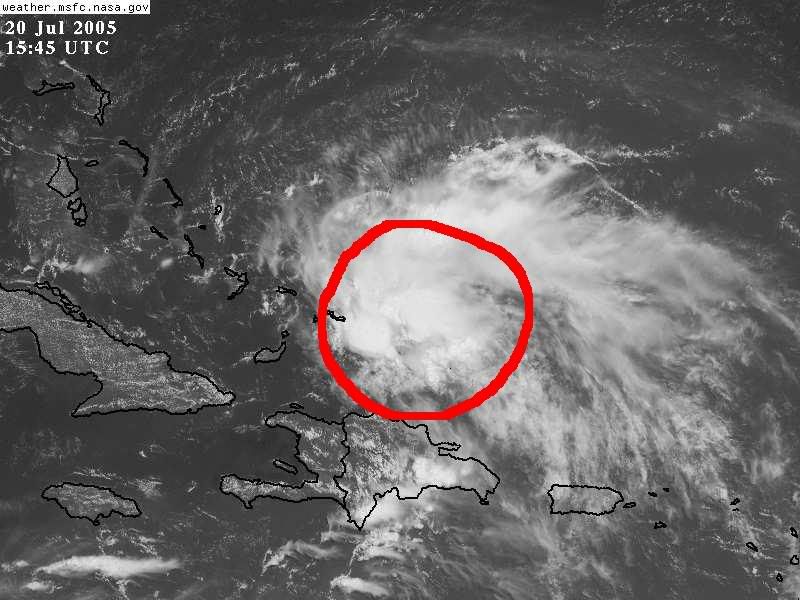
90L Invest
Moderator: S2k Moderators
Forum rules

The posts in this forum are NOT official forecasts and should not be used as such. They are just the opinion of the poster and may or may not be backed by sound meteorological data. They are NOT endorsed by any professional institution or STORM2K. For official information, please refer to products from the National Hurricane Center and National Weather Service.
-
PTrackerLA

- Category 5

- Posts: 5281
- Age: 42
- Joined: Thu Oct 10, 2002 8:40 pm
- Location: Lafayette, LA
-
jlauderdal
- S2K Supporter

- Posts: 7240
- Joined: Wed May 19, 2004 5:46 am
- Location: NE Fort Lauderdale
- Contact:
cycloneye wrote: TROPICAL DEPRESSION INVEST (AL902005) ON 20050720 1200 UTC
...00 HRS... ...12 HRS... ...24 HRS... ...36 HRS...
050720 1200 050721 0000 050721 1200 050722 0000
LAT LON LAT LON LAT LON LAT LON
BAMD 20.7N 69.4W 22.5N 71.9W 23.9N 73.9W 24.8N 75.6W
BAMM 20.7N 69.4W 22.3N 72.8W 23.8N 75.6W 25.2N 78.0W
A98E 20.7N 69.4W 22.0N 71.8W 23.4N 74.0W 24.8N 76.2W
LBAR 20.7N 69.4W 22.2N 71.8W 23.5N 73.9W 24.4N 75.7W
SHIP 25KTS 30KTS 36KTS 39KTS
DSHP 25KTS 30KTS 36KTS 39KTS
...48 HRS... ...72 HRS... ...96 HRS... ..120 HRS...
050722 1200 050723 1200 050724 1200 050725 1200
LAT LON LAT LON LAT LON LAT LON
BAMD 25.2N 77.3W 25.6N 80.9W 26.1N 85.0W 27.4N 89.3W
BAMM 26.4N 79.9W 28.2N 82.3W 29.0N 84.2W 29.8N 86.4W
A98E 26.1N 78.5W 29.3N 81.5W 30.9N 82.4W 31.3N 80.2W
LBAR 25.2N 77.0W 26.2N 78.9W 27.4N 80.2W 28.4N 81.5W
SHIP 42KTS 44KTS 45KTS 43KTS
DSHP 42KTS 29KTS 32KTS 30KTS
...INITIAL CONDITIONS...
LATCUR = 20.7N LONCUR = 69.4W DIRCUR = 300DEG SPDCUR = 13KT
LATM12 = 19.5N LONM12 = 67.0W DIRM12 = 297DEG SPDM12 = 13KT
LATM24 = 18.3N LONM24 = 64.5W
WNDCUR = 25KT RMAXWD = 45NM WNDM12 = 20KT
CENPRS = 1014MB OUTPRS = 1016MB OUTRAD = 150NM SDEPTH = D
RD34NE = 0NM RD34SE = 0NM RD34SW = 0NM RD34NW = 0NM
miami nws has been talking about this are for a few days now and everything appears on schedule timing wise.
0 likes

-
gkrangers
-
PTrackerLA
- Category 5
- Posts: 5281
- Age: 42
- Joined: Thu Oct 10, 2002 8:40 pm
- Location: Lafayette, LA


-
Stormcenter
- S2K Supporter
- Posts: 6689
- Joined: Wed Sep 03, 2003 11:27 am
- Location: Houston, TX


-
cycloneye

- Admin

- Posts: 148856
- Age: 69
- Joined: Thu Oct 10, 2002 10:54 am
- Location: San Juan, Puerto Rico
alicia-w wrote:are the plot points at 12 hour intervals?
12-24-36-48-72-96-120 hours intervals are the plots.
0 likes
Visit the Caribbean-Central America Weather Thread where you can find at first post web cams,radars
and observations from Caribbean basin members Click Here
and observations from Caribbean basin members Click Here
-
lilbump3000

- Category 4

- Posts: 966
- Age: 38
- Joined: Sat Sep 20, 2003 10:09 am
- Location: New Orleans, Louisiana
- Contact:
-
PTrackerLA
- Category 5
- Posts: 5281
- Age: 42
- Joined: Thu Oct 10, 2002 8:40 pm
- Location: Lafayette, LA
-
HouTXmetro

- Category 5
- Posts: 3949
- Joined: Sun Jun 13, 2004 6:00 pm
- Location: District of Columbia, USA

Model runs show NW turn into NW Florida. Impactweather.....private company....states the same.
0 likes
The following post is NOT an official forecast and should not be used as such. It is just the opinion of the poster and may or may not be backed by sound meteorological data. It is NOT endorsed by any professional institution including storm2k.org For Official Information please refer to the NHC and NWS products.
-
cycloneye
- Admin
- Posts: 148856
- Age: 69
- Joined: Thu Oct 10, 2002 10:54 am
- Location: San Juan, Puerto Rico
I can tell all that it was a big rain producer and some gusty winds (I clocked 32 mph) as it passed thru here last night.
0 likes
Visit the Caribbean-Central America Weather Thread where you can find at first post web cams,radars
and observations from Caribbean basin members Click Here
and observations from Caribbean basin members Click Here
0 likes
The following post is NOT an official forecast and should not be used as such. It is just the opinion of the poster and may or may not be backed by sound meteorological data. It is NOT endorsed by any professional institution including storm2k.org For Official Information please refer to the NHC and NWS products.
Who is online
Users browsing this forum: No registered users and 90 guests