Seeing how the 18Z NOGAPS shifted to the right the way it did, I would expect NHC to shift their track to something like a tip of the Yucatan brush or a western passage of the Yucatan channel with a bend towards the west after that... a slight change that gives them space to change further once they see the 00Z global outputs...
NHC had been favoring the NOGAPS/European side of the consenus...with NOGAPS shifting right, the only global model on the NHC's left is the European, and even then, only slightly...
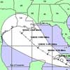
00:00z Model Guidance,GFDL,Bam Models to Texas
Moderator: S2k Moderators
Forum rules

The posts in this forum are NOT official forecasts and should not be used as such. They are just the opinion of the poster and may or may not be backed by sound meteorological data. They are NOT endorsed by any professional institution or STORM2K. For official information, please refer to products from the National Hurricane Center and National Weather Service.
-
SkeetoBite

- S2K Supporter

- Posts: 515
- Age: 60
- Joined: Fri Sep 03, 2004 8:25 am
- Contact:

-
swimaster20
- Category 1

- Posts: 285
- Joined: Tue Nov 23, 2004 2:41 pm
- Location: The Heart of Cajun Country
-
Stratosphere747
- Category 5

- Posts: 3772
- Joined: Thu Sep 11, 2003 8:34 pm
- Location: Surfside Beach/Freeport Tx
- Contact:
-
Stormcenter
- S2K Supporter
- Posts: 6689
- Joined: Wed Sep 03, 2003 11:27 am
- Location: Houston, TX
Rainband wrote:I wouldn't go as far as LA yetcajungal wrote:It is not that much further north. And it is still a good ways away. Just pay attention if you live anywhere on the Texas or SW Louisiana coastline.
I think it's reasonable to put SW LA. in the caution area if in fact the models keep on trending northward.
0 likes


What is responsible for the Northward trend? Is the ridge that is supposed to be "protecting" the Northern Gulf now weakening? If it is, it would be fair to say at this point it is anybody's ball game from the LA Coast to Mexico... I could be wrong, I would really like some educated opinions on this!
0 likes


-
InimanaChoogamaga
-
soonertwister
- Category 5
- Posts: 1091
- Joined: Mon Jun 16, 2003 2:52 pm
Colorado needs the rain badly, but not the kind of rain that Emily could bring if not forced back to the east.
Emily potentially poses the only hurricane scenario that frightens me for Colorado, the organized tropical depression remnants of a major hurricane going north from NE Mexico, and stalling along and just to the east of the Colorado front range mountains, say somewhere around Pueblo or Colorado Springs.
If a big tropical system stalled there in July, the chances are good that it could just sit there for a while as a cutoff low, sucking Gulf moisture into the circulation, and bringing torrential rains because of elevation change for the circulation to the north of the center.
Literally, you could see 5-8-10 inches of rain daily for days on end right up against the eastern foothills. That would solve any short term drought, but it would be an absolute catastrophe for Colorado.
The only doomsday hurricane scenario for the Centennial state.
0 likes
Who is online
Users browsing this forum: No registered users and 43 guests