What was the highest Measured Wind

This is the general tropical discussion area. Anyone can take their shot at predicting a storms path.

Moderator: S2k Moderators

Forum rules

The posts in this forum are NOT official forecasts and should not be used as such. They are just the opinion of the poster and may or may not be backed by sound meteorological data. They are NOT endorsed by any professional institution or STORM2K. For official information, please refer to products from the National Hurricane Center and National Weather Service.

Help Support Storm2K
Message
Author
User avatar
swimaster20
Category 1
Category 1
Posts: 285
Joined: Tue Nov 23, 2004 2:41 pm
Location: The Heart of Cajun Country

#21 Postby swimaster20 » Sun Jul 10, 2005 3:30 pm

bahamaswx wrote:
Brent wrote:Anderson Cooper and John Zarrella are on CNN right now in Pensacola... trees are snapping all around and debris is flying. :eek:

I think this was a Cat 3.


Cooper and Zarrella aren't seeing anything near Cat3 conditions.


However, they were about 13 miles inland, we haven't seen anything on the islands yet.
0 likes   

rtd2
Category 5
Category 5
Posts: 1183
Joined: Tue Aug 12, 2003 12:45 pm
Location: Biloxi, MS

#22 Postby rtd2 » Sun Jul 10, 2005 3:30 pm

Brent wrote:
stu wrote:Wind speed at 5K - 7K feet is no good - we need real world (and not gusts) from ground obs.


There were no Cat 3 winds in Ivan observed, but they happened.

I don't even remember a gust near 121 mph reported in Ivan.


Good point good! Only so many instruments set up to monitor!
0 likes   

Horatio 'Cane

#23 Postby Horatio 'Cane » Sun Jul 10, 2005 3:31 pm

120 MPH--although Opal Beach has reported winds in the 75-80 Knot vicinity.
0 likes   

PurdueWx80
Professional-Met
Professional-Met
Posts: 2720
Joined: Fri Aug 13, 2004 8:33 pm
Location: Madison, WI
Contact:

#24 Postby PurdueWx80 » Sun Jul 10, 2005 3:34 pm

One of the two following factors likely contributed to the weakening trend - we'll find out at the end of the season when best track comes out:

1. Eyewall replacement cycle occurred so that "weaker" phase of cyclone was during landfall.

2. Hurricane Cindy (which I have a feeling will be the case after best track comes out for her) left behind significantly cooler waters in the far northern Gulf, right where Dennis began weakening.

Perhaps it's a combo of both.

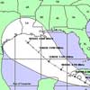
Also, the storm JUST made landfall, we'll be hearing about estimated/measured winds for days (once power is restored and such) and we have yet to see the extent of damage in the area. No sense in getting fussy over what this storm was at landfall this soon.
0 likes   

Brent
S2K Supporter
S2K Supporter
Posts: 38266
Age: 37
Joined: Sun May 16, 2004 10:30 pm
Location: Tulsa Oklahoma
Contact:

#25 Postby Brent » Sun Jul 10, 2005 3:34 pm

bahamaswx wrote:
Brent wrote:Anderson Cooper and John Zarrella are on CNN right now in Pensacola... trees are snapping all around and debris is flying. :eek:

I think this was a Cat 3.


Cooper and Zarrella aren't seeing anything near Cat3 conditions.


True... HOWEVER they are well inland and they were in the Western Eyewall, typically not where the strongest winds are.
0 likes   
#neversummer

User avatar
stu
Tropical Storm
Tropical Storm
Posts: 218
Age: 58
Joined: Thu Sep 25, 2003 4:37 pm
Location: England
Contact:

#26 Postby stu » Sun Jul 10, 2005 3:44 pm

We need the ground Obs from Elgin Airforce base
0 likes   

jpigott
Category 2
Category 2
Posts: 692
Joined: Fri Sep 03, 2004 1:31 pm
Location: North Palm Beach, Florida

#27 Postby jpigott » Sun Jul 10, 2005 3:45 pm

gust to 110mph - heard that on CNN or MSNBC can't remember which one
0 likes   

otowntiger
Category 5
Category 5
Posts: 1932
Joined: Tue Aug 31, 2004 7:06 pm

#28 Postby otowntiger » Sun Jul 10, 2005 3:56 pm

jpigott wrote:gust to 110mph - heard that on CNN or MSNBC can't remember which one


A cat 1 could muster that, key word being "gusts".
0 likes   

Sanibel
Category 5
Category 5
Posts: 10385
Joined: Mon Aug 30, 2004 11:06 pm
Location: Offshore SW Florida

#29 Postby Sanibel » Sun Jul 10, 2005 4:02 pm

From the radar image you could see Dennis took a huge slug of dry air in from the SW and wrapped it right into the core. The lack of rain being reported confirmed this.

The west side 121mph was due to the deep convection being pushed to the NW eyewall because of this.


Dennis had a core and movement like Charley, but faded just before shore like Ivan...
0 likes   

User avatar
Hurricaneman
Category 5
Category 5
Posts: 7404
Age: 45
Joined: Tue Aug 31, 2004 3:24 pm
Location: central florida

#30 Postby Hurricaneman » Sun Jul 10, 2005 4:05 pm

cat 2 110 at most
0 likes   

User avatar
stu
Tropical Storm
Tropical Storm
Posts: 218
Age: 58
Joined: Thu Sep 25, 2003 4:37 pm
Location: England
Contact:

#31 Postby stu » Sun Jul 10, 2005 4:07 pm

0 likes   

User avatar
stu
Tropical Storm
Tropical Storm
Posts: 218
Age: 58
Joined: Thu Sep 25, 2003 4:37 pm
Location: England
Contact:

#32 Postby stu » Sun Jul 10, 2005 4:46 pm

Very interesting project and we have a have a 130pmh gust at least from a tower in Navarre Beach


http://users.ce.ufl.edu/~fcmp/

3.0 Sec 53.9 m/s ( 120.7 mph) @ 104.4° @ 10/19:19:24
2.0 Sec 54.1 m/s ( 121.0 mph) @ 104.6° @ 10/19:19:25
1.0 Sec 56.5 m/s ( 126.3 mph) @ 106.3° @ 10/19:22:45
0.1 Sec 58.9 m/s ( 131.8 mph) @ 104.3° @ 10/19:22:45


http://grove.ufl.edu/~fcmp/Dennis/T0/NO ... -09-00.txt
0 likes   

gkrangers

#33 Postby gkrangers » Sun Jul 10, 2005 5:07 pm

The eastern eyewall hit largely unpopulated areas and barrier islands. There will be a lack of surface observations.

Don't let this lull people into calling Dennis a 950mb Category 1 hurricane.
0 likes   

Derecho
Category 5
Category 5
Posts: 1011
Joined: Sat Mar 15, 2003 3:15 pm

#34 Postby Derecho » Sun Jul 10, 2005 8:35 pm

A FLORIDA COASTAL MONITORING PROGRAM TOWER...ON THE COAST NEAR
NAVARRE BEACH FLORIDA...REPORTED SUSTAINED WINDS OF 99 MPH...WITH
GUSTS TO 121 MPH...NEAR THE TIME OF LANDFALL.


I'd say there's a good chance it ends up as a Cat 2 landfall in the final report.
0 likes   

jpigott
Category 2
Category 2
Posts: 692
Joined: Fri Sep 03, 2004 1:31 pm
Location: North Palm Beach, Florida

#35 Postby jpigott » Sun Jul 10, 2005 8:46 pm

can anyone tell me what the highest recorded (not estimated) sustained wind and gust that has been found in a hurricane when it made landfall
0 likes   

User avatar
Swimdude
Category 5
Category 5
Posts: 2270
Joined: Mon Jul 26, 2004 11:57 am
Location: Houston, TX

#36 Postby Swimdude » Sun Jul 10, 2005 9:25 pm

Can someone tell me why we're questioning whether this was a cat. 3 or not? It's not like EVERYONE is going to experience 120 mph sustained winds. That's just not going to happen. Even if the eye went directly over you, that's not likely. Of course it was a cat. 3.
0 likes   

User avatar
Aslkahuna
Professional-Met
Professional-Met
Posts: 4550
Joined: Thu Feb 06, 2003 5:00 pm
Location: Tucson, AZ
Contact:

#37 Postby Aslkahuna » Sun Jul 10, 2005 11:53 pm

Highest recorded gust in a landfalling hurricane is probably the 186 mph gust recorded at Blue Hill Observatory during the 1938 Long Island Express. The analysis recently posted elsewhere shows that the maximum sustained surface wind at landfall in Dennis was 107 kt (122 mph) 7 miles east of the center. This is a Cat 3 landfall but the extreme winds were very limited in areal coverage.

Steve
0 likes   

Foladar

#38 Postby Foladar » Mon Jul 11, 2005 1:06 am

I say leave it a cat 3 and stop worrying about it.
There's plenty more other storms to worry about instead :eek:
0 likes   


Return to “Talkin' Tropics”

Who is online

Users browsing this forum: No registered users and 61 guests