TD3/Cindy Analysis and Forecast

This is the general tropical discussion area. Anyone can take their shot at predicting a storms path.

Moderator: S2k Moderators

Forum rules

The posts in this forum are NOT official forecasts and should not be used as such. They are just the opinion of the poster and may or may not be backed by sound meteorological data. They are NOT endorsed by any professional institution or STORM2K. For official information, please refer to products from the National Hurricane Center and National Weather Service.

Help Support Storm2K
Message
Author
wxboy

TD3/Cindy Analysis and Forecast

#1 Postby wxboy » Sun Jul 03, 2005 9:29 pm

DISCLAIMER:The following post is NOT an official forecast and should not be used as such. It is just the opinion of the poster and may or may not be backed by sound meteorological data. It is NOT endorsed by any professional institution including storm2k.org For Official Information please refer to the NHC and NWS products.


Image

OK. This is my first analysis thread over on Storm2K, so I'm going to get right into it.

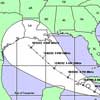
First off, I will explain the graphic above. The blue line shows the overall flow pattern and ridge, which may be weakening as the system enters the GOM. The purple shows the circulation around where I think the LLC is located, with the red showing outflow patterns. Lastly, the yellow shows the track.

OK. Now into analysis. The storm is beginning to move over the Yucatan and therefore will pretty much stop intensifying for 12-18 hours. However, there may be a quick burst that could bring it up to a TS before completely entering the Yucatan. It will be interesting to see what the 11 AM advisory says.

After it emerges into the SW GOM, it should begin to slow down as the steering pattern weakens. This could be a period on late Monday into Tuesday where a good amount of intensification occurs. The system will be going over some very warm watter eddies in the GOM. By late Tuesday, the system should start to slowly re-curve and could be a Cat1/Cat2 hurricane. Then, it should make landfall in LA somewhere around Wed. night or Thurs. My intensity for now would be around 105 mph at landfall.

Stay tuned for updates from me as the system progresses.
0 likes   

User avatar
cajungal
Category 5
Category 5
Posts: 2336
Age: 49
Joined: Sun Mar 14, 2004 9:34 pm
Location: Schriever, Louisiana (60 miles southwest of New Orleans)

#2 Postby cajungal » Sun Jul 03, 2005 9:31 pm

Funny that everyone is saying hurricane. New Orleans news here is laughing it off. Saying weak TS at most and won't effect us much here in southeast Louisiana.
0 likes   

User avatar
Ixolib
Category 5
Category 5
Posts: 2741
Age: 68
Joined: Sun Aug 08, 2004 8:55 pm
Location: Biloxi, MS

#3 Postby Ixolib » Sun Jul 03, 2005 9:36 pm

cajungal wrote:Funny that everyone is saying hurricane. New Orleans news here is laughing it off. Saying weak TS at most and won't effect us much here in southeast Louisiana.


Which news station is saying that? It'll be interesting to see what the local mets are saying at 10pm.
0 likes   

CYCLONE MIKE
Category 5
Category 5
Posts: 2183
Joined: Tue Aug 31, 2004 6:04 pm
Location: Gonzales, LA

#4 Postby CYCLONE MIKE » Sun Jul 03, 2005 9:37 pm

Yeah cajungal just you wait though. I am positive that once Tuesday rolls around and everyone is back after the long weekend it will be a totally different story, if the system intensifies as people are saying. Imagine the news crews tuesday starting a mass panic in SE LA over a cat 2 storm in the GOM headed towards southern LA. It seems the local news mets are always last for everything when it comes to weather :wink:
0 likes   

wxboy

#5 Postby wxboy » Sun Jul 03, 2005 9:37 pm

gonna do a quick update. As of 11 AM, still a TD!
0 likes   

User avatar
sunny
Category 5
Category 5
Posts: 7031
Joined: Fri Aug 06, 2004 2:11 pm
Location: New Orleans

#6 Postby sunny » Sun Jul 03, 2005 9:40 pm

cajungal wrote:Funny that everyone is saying hurricane. New Orleans news here is laughing it off. Saying weak TS at most and won't effect us much here in southeast Louisiana.


Who said that? From what I am hearing, they are saying to watch closely.
0 likes   

User avatar
Wpwxguy
S2K Supporter
S2K Supporter
Posts: 427
Joined: Sun Sep 12, 2004 2:10 pm
Location: Southeast Louisiana
Contact:

#7 Postby Wpwxguy » Sun Jul 03, 2005 9:46 pm

I think the mets in New Orleans are just being conservative. After so many close calls and storms completely missing the area when they thought they would hit, they are just waiting to be sure. People in N.O. get pretty upset over these things, its a whole lotta headache. Don't say your in danger till you have the facts. Good policy. However I do think their tune will change tomorrow. IMO

Bill
0 likes   

User avatar
Wpwxguy
S2K Supporter
S2K Supporter
Posts: 427
Joined: Sun Sep 12, 2004 2:10 pm
Location: Southeast Louisiana
Contact:

#8 Postby Wpwxguy » Sun Jul 03, 2005 9:47 pm

Thats what I heard also Sunny.
0 likes   

User avatar
LSU2001
S2K Supporter
S2K Supporter
Posts: 1711
Age: 58
Joined: Sat Sep 11, 2004 11:01 pm
Location: Cut Off, Louisiana

#9 Postby LSU2001 » Sun Jul 03, 2005 9:48 pm

Remember the Evacs must start at least 50 hours out for the plan to work. I think this is just the kind of system that can and will throw a monkey wrench into the plan. Just my 2 cents worth.
TIm
0 likes   
Personal Forecast Disclaimer:
The posts in this forum are NOT official forecast and should not be used as such. They are NOT endorsed by any professional institution or storm2k.org. For official information, please refer to the NHC and NWS products.

User avatar
swimaster20
Category 1
Category 1
Posts: 285
Joined: Tue Nov 23, 2004 2:41 pm
Location: The Heart of Cajun Country

#10 Postby swimaster20 » Sun Jul 03, 2005 9:56 pm

lsu2001 wrote:Remember the Evacs must start at least 50 hours out for the plan to work. I think this is just the kind of system that can and will throw a monkey wrench into the plan. Just my 2 cents worth.
TIm


I agree! But why should we be surprised, after all, Louisiana officials came up with it. :eek: :lol: :lol:
0 likes   

Stormcenter
S2K Supporter
S2K Supporter
Posts: 6685
Joined: Wed Sep 03, 2003 11:27 am
Location: Houston, TX

#11 Postby Stormcenter » Sun Jul 03, 2005 10:06 pm

What mets are saying this? My brother lives in N.O. and he said no one has said that.
0 likes   

User avatar
Swimdude
Category 5
Category 5
Posts: 2270
Joined: Mon Jul 26, 2004 11:57 am
Location: Houston, TX

#12 Postby Swimdude » Sun Jul 03, 2005 10:52 pm

Did I not say this... I'm out of town... Storm comes to Houston. Third year in a row. *Sigh* Didn't I say this a week ago?

So my forecast, relying on nothing other than my being gone, is a Houston hit.
0 likes   

User avatar
Hurricaneman
Category 5
Category 5
Posts: 7404
Age: 45
Joined: Tue Aug 31, 2004 3:24 pm
Location: central florida

#13 Postby Hurricaneman » Sun Jul 03, 2005 10:55 pm

Will probably become named on tuesday
0 likes   


Return to “Talkin' Tropics”

Who is online

Users browsing this forum: KirbyDude25 and 530 guests