Typhoon Sonca
Moderator: S2k Moderators
Forum rules

The posts in this forum are NOT official forecasts and should not be used as such. They are just the opinion of the poster and may or may not be backed by sound meteorological data. They are NOT endorsed by any professional institution or STORM2K. For official information, please refer to products from the National Hurricane Center and National Weather Service.
-
James

- Category 5

- Posts: 1531
- Joined: Tue Aug 24, 2004 10:29 am
- Location: Gloucestershire, England
- Contact:
Typhoon Sonca
Well, a new invest has popped up in the W. Pacific. We are approaching the time of year when things start to get more active out there, but I'm not quite sure about this one. It's pretty far south, and I can think of only one storm that developed around that latitude, and that was Typhoon Vamei back in 2001. Having said that, Kujira in 2003 developed pretty far south. Still, if it happened before it can happen again I suppose. Time will definitely tell on this one. Anyone have any thoughts?
Last edited by James on Sat Apr 23, 2005 3:44 pm, edited 5 times in total.
0 likes
-
James
- Category 5
- Posts: 1531
- Joined: Tue Aug 24, 2004 10:29 am
- Location: Gloucestershire, England
- Contact:
From the JTWC:
THE AREA OF CONVECTION PREVIOUSLY LOCATED NEAR
6.0N6 138.8E0 IS NOW LOCATED NEAR 6.1N7 137.5E6 APPROXIMATELY 180 NM EAST-SOUTHEAST OF PALAU, MICRONESIA. RECENT ANIMATED MULTI-SPECTRAL IMAGERY REVEALS INCREASING CONVECTION PERsISTING OVER A LOW
LEVEL CIRCULATION CENTER (LLCC). UPPER LEVEL ANALYSIS INDICATES GOOD POLEWARD OUTFLOW AND LOW VERTICAL WINDSHEAR. MAXIMUM SUSTAINED WINDS ARE ESTIMATED BETWEEN 15 AND 20 KNOTS. MINIMUM SEA LEVEL PRESSURE IS
ESTIMATED TO BE NEAR 1006 MB. THE POTENTIAL FOR THE DEVELOPMENT OF A SIGNIFICANT TROPICAL CYCLONE WITHIN THE NEXT 24 HOURS IS UPGRADED TO FAIR.
0 likes
-
HURAKAN

- Professional-Met

- Posts: 46086
- Age: 38
- Joined: Thu May 20, 2004 4:34 pm
- Location: Key West, FL
- Contact:

SUBJ/TROPICAL CYCLONE FORMATION ALERT 180030Z APR 05//
WTPN22 PGTW 180030
RMKS/
1. FORMATION OF A SIGNIFICANT TROPICAL CYCLONE IS POSSIBLE WITHIN
A 200 NM RADIUS OF 6.1N7 139.9E2 WITHIN THE NEXT 12 TO 24 HOURS.
AVAILABLE DATA DOES NOT JUSTIFY ISSUANCE OF NUMBERED TROPICAL CY
CLONE WARNINGS AT THIS TIME. WINDS IN THE AREA ARE ESTIMATED TO
BE 20 TO 25 KNOTS. METSAT IMAGERY AT 172330Z6 INDICATES THAT A
CIRCULATION CENTER IS LOCATED NEAR 6.1N7 139.9E2. THE SYSTEM IS
MOVING EASTWARD AT 03 KNOTS.
2. REMARKS:
3. THIS ALERT WILL BE REISSUED, UPGRADED TO WARNING OR CANCELLED BY 190030Z3.
4. SEE REF A FOR DETAILS ON A TROPICAL CYCLONE FORMATION ALERT
LOCATED NEAR 125.0N8 2.9E1
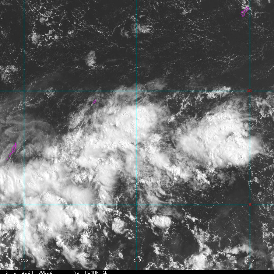
On the satellites images, the system doesn't look very organizated, convection is rather ragged, and rain bands are almost non-existant. Moreover, is not common to see a Western Pacific system at such low latitude moving eastward rather than westward.
0 likes

-
HURAKAN
- Professional-Met
- Posts: 46086
- Age: 38
- Joined: Thu May 20, 2004 4:34 pm
- Location: Key West, FL
- Contact:
depotoo wrote:i have lost my link for the invests page - can someone post it please. tia!
http://www.nrlmry.navy.mil/tc_pages/tc_home.html
0 likes
-
HURAKAN
- Professional-Met
- Posts: 46086
- Age: 38
- Joined: Thu May 20, 2004 4:34 pm
- Location: Key West, FL
- Contact:
WTPN21 PGTW 180030
MSGID/GENADMIN/NAVPACMETOCCEN PEARL HARBOR HI/JTWC//
SUBJ/TROPICAL CYCLONE FORMATION ALERT/180021ZAPR05//
RMKS/
1. FORMATION OF A SIGNIFICANT TROPICAL CYCLONE IS POSSIBLE WITHIN A
200 NM RADIUS OF 6.1N7 139.9E2 WITHIN THE NEXT 12 TO 24 HOURS.
AVAILABLE DATA DOES NOT JUSTIFY ISSUANCE OF NUMBERED TROPICAL
CYCLONE WARNINGS AT THIS TIME. WINDS IN THE AREA ARE ESTIMATED TO
BE 20 TO 25 KNOTS. METSAT IMAGERY AT 172330Z6 INDICATES THAT A
CIRCULATION CENTER IS LOCATED NEAR 6.1N7 139.9E2. THE SYSTEM IS
MOVING EASTWARD AT 03 KNOTS.
2. REMARKS: THE AREA OF CONVECTION PREVIOUSLY LOCATED NEAR 6.1N7
139.7E0 IS NOW LOCATED NEAR 6.1N7 139.7E0, APPROXIMATELY 310 NM EAST-
SOUTHEAST OF PALAU, MICRONESIA. RECENT MULTISPECTRAL SATELLITE
IMAGERY REVEALS THE CONVECTION BECOMING BETTER ORGANIZED OVER A LOW
LEVEL CIRCULATION CENTER (LLCC). UPPER LEVEL ANALYSIS INDICATES LOW
TO MODERATE VERTICAL WIND SHEAR AND GOOD POLEWARD OUTFLOW. MAXIMUM
SUSTAINED WINDS ARE ESTIMATED AT 20 TO 25 KNOTS. MINIMUM SEA LEVEL
PRESSURE IS ESTIMATED TO BE NEAR 1002 MB. THE POTENTIAL FOR THE
DEVELOPMENT OF A SIGNIFICANT TROPICAL CYCLONE WITHIN THE NEXT 24
HOURS IS UPGRADED TO GOOD.
3. THIS ALERT WILL BE REISSUED, UPGRADED TO WARNING OR CANCELLED BY
190030Z3.//
0 likes

-
senorpepr

- Military Met/Moderator

- Posts: 12542
- Age: 43
- Joined: Fri Aug 22, 2003 9:22 pm
- Location: Mackenbach, Germany
- Contact:
Looks like the model ensembles have 94W slowly developing into at least a depression (remember... that's model guidance and may not be exactly what happens) over the next few days at it passes through Micronesia headed toward the central Philippines. Regardless to development, this will definately be something to monitor over the next week.
0 likes
-
HURAKAN
- Professional-Met
- Posts: 46086
- Age: 38
- Joined: Thu May 20, 2004 4:34 pm
- Location: Key West, FL
- Contact:
Special Weather Statement
SPECIAL WEATHER STATEMENT
NATIONAL WEATHER SERVICE TIYAN GU
400 PM GUAM LST WED APR 20 2005
PMZ161-171-201800-
REPUBLIC OF PALAU-YAP STATE-
415 PM GUAM LST WED APR 20 2005
...TROPICAL DISTURBANCE DEVELOPING SOUTHEAST OF YAP...
THE JOINT TYPHOON WARNING CENTER HAS ISSUED A TROPICAL CYCLONE
FORMATION ALERT ON THE DISTURBANCE SOUTHEAST OF YAP. ALTHOUGH STILL
A WEAK CIRCULATION...THERE IS POTENTIAL FOR THIS SYSTEM TO BECOME A
TROPICAL DEPRESSION IN THE NEXT 12 TO 24 HOURS.
AT 3 PM GUAM LST...THE CIRCULATION CENTER WAS LOCATED NEAR LATITUDE
7.9 DEGREES NORTH AND LONGITUDE 143.3 DEGREES EAST...OR ABOUT
370 MILES EAST-SOUTHEAST OF YAP
290 MILES EAST-SOUTHEAST OF ULITHI
230 MILES SOUTHEAST OF FAIS
100 MILES WEST-SOUTHWEST OF FARAULEP, AND
610 MILES EAST OF PALAU.
THE DISTURBANCE IS MOVING SOUTH-SOUTHWESTWARD AT 7 MPH.
DURING THE NEXT 24 HOURS...THE DISTURBANCE IS EXPECTED TO TAKE A
NORTHWEST TRACK AND INCREASE IN FORWARD SPEED. THE SYSTEM IS
EXPECTED TO INTENSIFY...PERHAPS BECOMING A TROPICAL STORM BY
THURSDAY OR FRIDAY.
THERE ARE NO TROPICAL STORM WATCHES OR WARNINGS IN EFFECT AT THIS
TIME. RESIDENTS IN WESTERN YAP STATE AND THE REPUBLIC OF PALAU
SHOULD CLOSELY MONITOR THIS DISTURBANCE.
THIS WHAT GUAM HAS TO SAY TOWARD INVEST 94.
0 likes

Who is online
Users browsing this forum: No registered users and 118 guests