check off of hat
Moderator: S2k Moderators
Forum rules

The posts in this forum are NOT official forecasts and should not be used as such. They are just the opinion of the poster and may or may not be backed by sound meteorological data. They are NOT endorsed by any professional institution or STORM2K. For official information, please refer to products from the National Hurricane Center and National Weather Service.


-
P.K.

- Professional-Met

- Posts: 5149
- Joined: Thu Sep 23, 2004 5:57 pm
- Location: Watford, England
- Contact:
From the TWD:
ATLANTIC...
DEEP-LAYERED TROUGH CONTINUES TO SPREAD E ACROSS THE W ATLC AS
THE CUT-OFF UPPER LOW OFF THE SOUTH CAROLINA COAST PUSHES THE
ASSOCIATED COLD FRONT E OF BERMUDA DURING THE DAY THU. THE
REMAINDER OF THE ATLC BASIN IS DOMINATED BY BROAD...STRONG
SURFACE HIGH PRESSURE WITH THE MAIN RIDGE ALONG 32N40W TO NEAR
THE LEEWARD ISLANDS. THE UPPER FLOW IS DOMINATED BY TROUGH OVER
THE CENTRAL ATLC WITH A WEAKENING UPPER CUT-OFF LOW CENTERED
NEAR 23N38W. THE STRONGEST UPPER LEVEL WESTERLY FLOW HAS BEEN
SUPPRESSED TO S OF 13N EXTENDING TO THE EQUATOR ALTHOUGH ITCZ
CONVECTION HAS BECOME VERY ACTIVE ESPECIALLY E OF 20W WHERE THE
VERTICAL SHEAR IS NOT QUITE AS STRONG.
0 likes
-
MGC

- S2K Supporter

- Posts: 5940
- Joined: Sun Mar 23, 2003 9:05 pm
- Location: Pass Christian MS, or what is left.
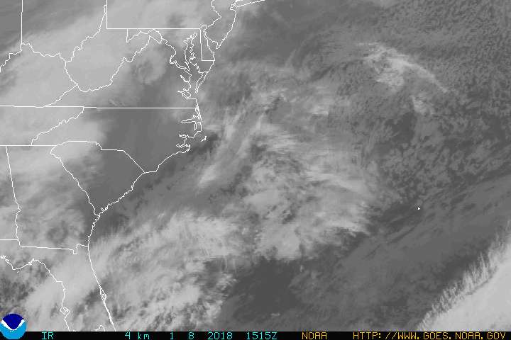
Take a day off and this pops up. Nice little low, too bad its not July or August. I think the convective burst that occured was due to the lows passage over the Gulf Stream. As the low moves ESE or so, it should get over cooler waters. I'd give only a 10% chance of it being declared ST. It will be a good preseason practice run for all of us.....MGC
0 likes
-
Stormsfury

- Category 5

- Posts: 10549
- Age: 53
- Joined: Wed Feb 05, 2003 6:27 pm
- Location: Summerville, SC
this is the same system responsible for producing the large hail in James Island two days ago... and I'll attest to the air behind the system being quite chilly for this time of year. Baroclinically driven cut-off low just like the last 5 or 6 in the last month.
Yeah, Ana developed in 2003 with SST's in the 70's. But this one is still drawing quite a bit of cool air behind itself in its wake. Yesterday, it would have resembled something quite interesting, but deformation bands tend to have the same look over land as well ...
SF
Yeah, Ana developed in 2003 with SST's in the 70's. But this one is still drawing quite a bit of cool air behind itself in its wake. Yesterday, it would have resembled something quite interesting, but deformation bands tend to have the same look over land as well ...
SF
0 likes
-
cyclonaut

Who is online
Users browsing this forum: No registered users and 52 guests