About to be topped? Tallahasee's 1851 Hurricane

This is the general tropical discussion area. Anyone can take their shot at predicting a storms path.

Moderator: S2k Moderators

Forum rules

The posts in this forum are NOT official forecasts and should not be used as such. They are just the opinion of the poster and may or may not be backed by sound meteorological data. They are NOT endorsed by any professional institution or STORM2K. For official information, please refer to products from the National Hurricane Center and National Weather Service.

Help Support Storm2K
Message
Author
User avatar
Storminole
Tropical Depression
Tropical Depression
Posts: 70
Age: 64
Joined: Wed Aug 11, 2004 5:53 pm
Location: Tallahassee, FL

About to be topped? Tallahasee's 1851 Hurricane

#1 Postby Storminole » Sat Sep 11, 2004 11:20 am

As a student both of history and severe weather I have investigated Tallahassee's hurricane history. The last 3 to strike this area were all Category 1 storms at landfall. Those were Alma (1966), Agnes (1972) and Kate (1985).

Other storms have caused significant damage along the coast while bringing little wind inland. Apalachee Bay's shallow waters and the gradual slope of the Continental Shelf make it one of the most susceptible areas in the country to storm surge. A major hurricane could sweep a storm surge inland for many miles in Wakulla County. Tallahassee itself is on high ground, especially for Florida. Much of the city is at 200+ elevation, heavily forested--and highly vulnerable to wind damage.

Tallahassee's worst ever hurricane is probably an August 1851 storm, which lashed the city with extreme winds. The account of the storm makes clear from its description of the wind directions (east shifting to south) that Tallahassee was hit by the right side--the worst case scenario.

This event is referred to as "the storm of all storms--the great hurricane remembered by all of Tallahassee's pioneers and a conversation piece for many years after the [Civil] war."

Here is a newspaper account published a week following the hurricane in Tallahassee's Floridian and Journal:

"It lasted from an early hour of the morning on Saturday [August 23], till near dawn on Sunday--at first the wind blowing in squalls more or less frequent from the East, then about noon, Saturday, going around Southward, and increasing in violence and long-continued blasts till it rose to a furious gale, which was about its worst at two o'clock next morning, and after that gradually abating, till daylight. It was raining nearly all the while in great torrents.

Trees of all sorts and sizes were broken down or torn from their roots, and those that remained were rudely stripped of many of their limbs and much of their foilage. Houses were unroofed, some blown down, and others greatly injured, and fences generally, in whole or in part, were thrown to the earth. Altogether, the scene as it presented itself here on Sunday morning was a vast chaos of destruction and of entangled streets and yards.

The tin roofing of the Capitol was torn off, a window blown in, much of the glass broken, and several of the rooms drenched with water--but the books and archives were very little injured. Captain Bonds's Warehouse was left a complete wreck. The "Exchange" buildings unroofed. The Hoc building, formerly occupied for the Floridian office, partly unroofed and much injured. The Market House prostrated. Many other houses sustained damage....we cannon undertake to estimate the loss the storm has caused...there will be immense loss in consequence."


This hurricane also destroyed the Baptist Church, the Masonic Hall and a number of homes and buildings in nearby Quincy.

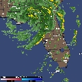
It's apparent to me that Ivan, now forecast to make a direct strike on Tallahassee--with Cat 3 or 4 winds--could exceed the 1851 event to become the worst-ever hurricane to hit this area. I don't know the words to express the dread I am now feeling at this prospect.

(Source: Ante-Bellum Tallahassee, Bertram H. Groene, 1971)
0 likes   

chakalakasp

#2 Postby chakalakasp » Sat Sep 11, 2004 12:51 pm

No, Ivan is forecast to strike anywhere from Missisisipi to Miami. You are misinterpreting the forecast track.
0 likes   

catzmeow
Tropical Low
Tropical Low
Posts: 38
Joined: Thu Sep 09, 2004 8:03 am
Location: Tallahassee

#3 Postby catzmeow » Sat Sep 11, 2004 12:53 pm

Storminole...

Do you plan to evacuate?
0 likes   

Brent
S2K Supporter
S2K Supporter
Posts: 38266
Age: 37
Joined: Sun May 16, 2004 10:30 pm
Location: Tulsa Oklahoma
Contact:

#4 Postby Brent » Sat Sep 11, 2004 12:53 pm

No... the middle of the track points right at Tallahassee. That's the highest probability right now according to the NHC...
0 likes   
#neversummer

catzmeow
Tropical Low
Tropical Low
Posts: 38
Joined: Thu Sep 09, 2004 8:03 am
Location: Tallahassee

#5 Postby catzmeow » Sat Sep 11, 2004 12:54 pm

Supply update:

The Lowes and Home Depot on Capital Circle Northeast were sold out of 1/2 and 5/8" plywood as of this morning, but received a new shipment about 12 p.m. It's not predicted to last long, and there are long lines in those stores.

There may be plywood available in thomasville, GA, we've heard. My hubby got some of the new shipment, he said it was going fast.

It appears people are taking this one seriously.

Catz
0 likes   

browe29
Tropical Low
Tropical Low
Posts: 25
Joined: Sat Sep 11, 2004 9:02 am
Location: Tallahassee, FL

#6 Postby browe29 » Sat Sep 11, 2004 1:12 pm

catzmeow wrote:Supply update:

The Lowes and Home Depot on Capital Circle Northeast were sold out of 1/2 and 5/8" plywood as of this morning, but received a new shipment about 12 p.m. It's not predicted to last long, and there are long lines in those stores.

There may be plywood available in thomasville, GA, we've heard. My hubby got some of the new shipment, he said it was going fast.

It appears people are taking this one seriously.

Catz


Mulvaney's is out of generators until next week. Sears doesn't expect another shipment until Tuesday. Not sure what plywood will do for you if you have a lot of trees around your house like me. The public in Tallahassee doesn't realize yet that the models have had Tallahassee as the target.
0 likes   

-=-
Tropical Low
Tropical Low
Posts: 11
Joined: Fri Sep 10, 2004 10:28 am

#7 Postby -=- » Sat Sep 11, 2004 1:14 pm

catzmeow wrote:Supply update:

The Lowes and Home Depot on Capital Circle Northeast were sold out of 1/2 and 5/8" plywood as of this morning, but received a new shipment about 12 p.m. It's not predicted to last long, and there are long lines in those stores.

There may be plywood available in thomasville, GA, we've heard. My hubby got some of the new shipment, he said it was going fast.

It appears people are taking this one seriously.

Catz

I went to PetSmart to buy some kitten food and I could even get parking. I had to park outside of that complex ;;. That place was crazy.
0 likes   

chakalakasp

#8 Postby chakalakasp » Sat Sep 11, 2004 1:15 pm

Brent wrote:No... the middle of the track points right at Tallahassee. That's the highest probability right now according to the NHC...


The middle track, especially this far out, is insignificant. The NHS tells people again and again that only the cone is important. The fact that this middle "line" takes it through any particular point in 72 to 84 hours is insignificant. They understand their typical forecast margin of error, which they have arrived at through statistical post-mortem analysis of their own forecasts. They indicate this average margin of error with the cone. Thus, only the cone can be relied upon with confidence to forecast statisical liklihood of the track, and only the cone is referenced by the NHS. That line you are so attached too will probably move in the next 48 hours.

You will notice in the probabilities that there is actually a 4% chance that the storm will landfall within 65 nm of New Orleans by Tuesday at 8AM. The NHS is not pinning a landfall tail on the Florida panhandle donkey yet, and the fact that the "line" goes through Tallahassee is insignificant.
0 likes   

MBryant
Category 1
Category 1
Posts: 416
Joined: Fri Aug 27, 2004 7:13 pm
Location: Orange, Texas

#9 Postby MBryant » Sat Sep 11, 2004 1:19 pm

testing
0 likes   

Mello1
Category 1
Category 1
Posts: 363
Joined: Mon Sep 15, 2003 2:08 pm
Location: Chicago

#10 Postby Mello1 » Sat Sep 11, 2004 1:23 pm

Storminole: Great historical perspective....
0 likes   

Mello1
Category 1
Category 1
Posts: 363
Joined: Mon Sep 15, 2003 2:08 pm
Location: Chicago

#11 Postby Mello1 » Sat Sep 11, 2004 1:24 pm

chakalakasp wrote:
Brent wrote:No... the middle of the track points right at Tallahassee. That's the highest probability right now according to the NHC...


The middle track, especially this far out, is insignificant. The NHS tells people again and again that only the cone is important. The fact that this middle "line" takes it through any particular point in 72 to 84 hours is insignificant. They understand their typical forecast margin of error, which they have arrived at through statistical post-mortem analysis of their own forecasts. They indicate this average margin of error with the cone. Thus, only the cone can be relied upon with confidence to forecast statisical liklihood of the track, and only the cone is referenced by the NHS. That line you are so attached too will probably move in the next 48 hours.

You will notice in the probabilities that there is actually a 4% chance that the storm will landfall within 65 nm of New Orleans by Tuesday at 8AM. The NHS is not pinning a landfall tail on the Florida panhandle donkey yet, and the fact that the "line" goes through Tallahassee is insignificant.


I think the point here is that the panhandle is very much in play and folks in that area have to start making plans right now. A smart thing to do at this point.
0 likes   

chakalakasp

#12 Postby chakalakasp » Sat Sep 11, 2004 1:34 pm

I think the point here is that the panhandle is very much in play and folks in that area have to start making plans right now. A smart thing to do at this point.


Agreed! My point is that so is the entire southern and west coast of Florida is also very much in play, and people in those areas should be making plans. People in MS and AL and eastern LA should be watching this very closely, as the forecast hints that they may be in play as well. Suggesting that the storm is forecast by the NHS to strike a particular city in Florida 80+ hours from now is misleading and innacurate.
0 likes   

User avatar
N2FSU
S2K Supporter
S2K Supporter
Posts: 1069
Joined: Thu Sep 04, 2003 2:04 pm
Location: Tallahassee, FL

#13 Postby N2FSU » Sat Sep 11, 2004 1:46 pm

The fact that Tallahassee is in the center of the path at this time IS significant. I normally wouldn't think so, but coupled with the fact that the FSU Superensemble has had this storm going into Apalachicola for the last 48 hours, LONG before all of the other models started shifting west, makes it very scary and very possible. I hope that everyone holding onto this right trend theory are right, for my sake, but right now that would mean I have to bet against the FSU SE AND all of the other models, which just keep trending west. Read up on the accuracy of the FSU SE and see why I'm so concerned. Again, if it was this far west on it's own I could maybe rationalize it, as it was 48 hrs ago as everythng else took it in to SW FL. Now they're clustering up here. Cat 3-4 here would be catastrophic.
0 likes   

User avatar
Storminole
Tropical Depression
Tropical Depression
Posts: 70
Age: 64
Joined: Wed Aug 11, 2004 5:53 pm
Location: Tallahassee, FL

#14 Postby Storminole » Sat Sep 11, 2004 1:59 pm

Catzmeow,

If Ivan comes in as predicted (135 mph), I don't expect that I'll stick around. Five years ago, I saved some advice off a football message board. This was from someone who aided relatives in the immediate aftermath of Andrew.

1. Never, ever even consider staying in front of a storm like Andrew. Do everything you can to secure your home, grab your insurance policy, any irreplacable heirlooms and family photos, get a camera and take a picture of the rest, and LEAVE. For those who stay through the harrowing storm, the experience will mark them for a long time. The fear I saw in people's eyes was incredible.

2. When you return, you may not be able to find your house, even if it is still there. Everything will look different. The usual landmarks will look very different. And a lot of the street signs will be gone.

3. When you return, plan to be without electricity for up to 4 weeks or more. If you are on a pump/well, there won't be any water either. Some folks forgot that little detail. Ice is a huge commodity, as is clean underwear. Generators are also nice to have.

4. Those who live nearby but are not devastated (my situation then), plan to spend several weekends helping your friends recover. The assurance that there is a normal world out there will help them deal with the situation. They will never forget the smallest act of "kindness" (their eyes) or duty (your eyes).

If this scares the you know what out of you, good. If you live in the path of this a landfalling major hurricane, you need to feel the urgency, if you don't already.
0 likes   


Return to “Talkin' Tropics”

Who is online

Users browsing this forum: Hurricane2022, mitchell, wwizard and 26 guests