Eclipse over, WNW movement resumed.

This is the general tropical discussion area. Anyone can take their shot at predicting a storms path.

Moderator: S2k Moderators

Forum rules

The posts in this forum are NOT official forecasts and should not be used as such. They are just the opinion of the poster and may or may not be backed by sound meteorological data. They are NOT endorsed by any professional institution or STORM2K. For official information, please refer to products from the National Hurricane Center and National Weather Service.

Help Support Storm2K
Message
Author
calidoug
Category 1
Category 1
Posts: 480
Joined: Sun Sep 07, 2003 3:13 pm

Eclipse over, WNW movement resumed.

#1 Postby calidoug » Sat Sep 11, 2004 1:59 am

0 likes   

Lockhart
Tropical Storm
Tropical Storm
Posts: 174
Joined: Thu Sep 02, 2004 4:34 am
Location: Miami, FL

#2 Postby Lockhart » Sat Sep 11, 2004 2:02 am

If this keeps up, the eye might never hit Jamaica at all. Amazing.
0 likes   

NorthGaWeather

#3 Postby NorthGaWeather » Sat Sep 11, 2004 2:04 am

due west per recon
0 likes   

calidoug
Category 1
Category 1
Posts: 480
Joined: Sun Sep 07, 2003 3:13 pm

#4 Postby calidoug » Sat Sep 11, 2004 2:04 am

It appears to be tracing an outline of the island, about 20 miles offshore. Must be all the group prayers.
0 likes   

calidoug
Category 1
Category 1
Posts: 480
Joined: Sun Sep 07, 2003 3:13 pm

#5 Postby calidoug » Sat Sep 11, 2004 2:05 am

Not due west per vision. Compare 0345Z and 0645Z satellite frames.
0 likes   

NorthGaWeather

#6 Postby NorthGaWeather » Sat Sep 11, 2004 2:06 am

from the last recon message it moved due west from the 2 am advisory. Recon doesn't lie my friend.
0 likes   

User avatar
WeatherNLU
Tropical Storm
Tropical Storm
Posts: 218
Joined: Fri Aug 29, 2003 12:50 pm

#7 Postby WeatherNLU » Sat Sep 11, 2004 2:07 am

calidoug wrote:Not due west per vision. Compare 0345Z and 0645Z satellite frames.


Use the MSFC tool. No way is it on the same WNW course it had been previously.
0 likes   

Lockhart
Tropical Storm
Tropical Storm
Posts: 174
Joined: Thu Sep 02, 2004 4:34 am
Location: Miami, FL

#8 Postby Lockhart » Sat Sep 11, 2004 2:08 am

They must be using some formula to determine the center, because to the naked eye, the center of Ivan clearly went a little North of West in those 3 hours. Perhaps the shape of the eye changed slightly, and their positioning reflects that. All the better, I suppose.
0 likes   

User avatar
Windspeed
Tropical Storm
Tropical Storm
Posts: 129
Joined: Thu Jun 10, 2004 11:38 am

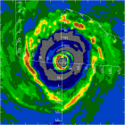
From 3:45UTC to 6:45UTC...

#9 Postby Windspeed » Sat Sep 11, 2004 2:08 am

...that is a more west trach than wnw. In fact, if you plot the past 7 hours, this storm has been virtually parellel to the south shoreline of Jamaica.
0 likes   

rtd2
Category 5
Category 5
Posts: 1183
Joined: Tue Aug 12, 2003 12:45 pm
Location: Biloxi, MS

#10 Postby rtd2 » Sat Sep 11, 2004 2:09 am

quote"It appears to be tracing an outline of the island, about 20 miles offshore. Must be all the group prayers."


called it...NO JAMAICA L/F
0 likes   

calidoug
Category 1
Category 1
Posts: 480
Joined: Sun Sep 07, 2003 3:13 pm

#11 Postby calidoug » Sat Sep 11, 2004 2:09 am

Gee... Maybe that's because 2AM != 0345Z

2AM = 0600Z.

Perhaps you should try *actually looking* at the 0345Z frame, and comparing with the 0645Z frame.

You'll see about a 290 motion if you do.
0 likes   

Lockhart
Tropical Storm
Tropical Storm
Posts: 174
Joined: Thu Sep 02, 2004 4:34 am
Location: Miami, FL

#12 Postby Lockhart » Sat Sep 11, 2004 2:11 am

Lol. There I went, coming up with a complicated reason for something that actually didn't happen. :-)
0 likes   

User avatar
Agua
Category 5
Category 5
Posts: 1138
Joined: Thu Jul 31, 2003 4:54 pm
Location: Biloxi, Mississippi

#13 Postby Agua » Sat Sep 11, 2004 2:11 am

Yeah, last six hours look about 280 - 290.
0 likes   

calidoug
Category 1
Category 1
Posts: 480
Joined: Sun Sep 07, 2003 3:13 pm

#14 Postby calidoug » Sat Sep 11, 2004 2:12 am

Sigh. The south shoreline of Jamaica is not a straight line.

It runs WNW from the southernmost point.
0 likes   

LowMug

#15 Postby LowMug » Sat Sep 11, 2004 2:12 am

calidoug wrote:It appears to be tracing an outline of the island, about 20 miles offshore. Must be all the group prayers.


Yea must be...I wonder why all the Grenada prayer groups didn't work...

Let's not bring religion into this folks...purely science here
0 likes   

btsgmdad
Category 1
Category 1
Posts: 371
Joined: Tue Aug 17, 2004 9:51 am
Location: Lincoln Park, MI

#16 Postby btsgmdad » Sat Sep 11, 2004 2:13 am

If it keeps this kind of movement up it might make the Yucatan Channel. Didn't Joe Bastardi say something about Ivan getting to the Gulf without hitting Jamaica or Cuba?
0 likes   

NorthGaWeather

#17 Postby NorthGaWeather » Sat Sep 11, 2004 2:14 am

Well actually the 11pm advisory compared to the 2am shows a slightly south of west motion. 17.5 N at 11pm and 17.4 at 2am. Recon was still 17.4.
0 likes   

calidoug
Category 1
Category 1
Posts: 480
Joined: Sun Sep 07, 2003 3:13 pm

#18 Postby calidoug » Sat Sep 11, 2004 2:14 am

Lockhart wrote:Lol. There I went, coming up with a complicated reason for something that actually didn't happen. :-)


It did happen, at least for those special people who have a great need to see something other than reality. :lol:
0 likes   

calidoug
Category 1
Category 1
Posts: 480
Joined: Sun Sep 07, 2003 3:13 pm

#19 Postby calidoug » Sat Sep 11, 2004 2:17 am

All I'm saying is that from 3:30 ago through 30 minutes ago, the storm is moving about 285-290.
0 likes   

Lockhart
Tropical Storm
Tropical Storm
Posts: 174
Joined: Thu Sep 02, 2004 4:34 am
Location: Miami, FL

#20 Postby Lockhart » Sat Sep 11, 2004 2:17 am

From Calvin and Hobbes: "It's not denial. I'm just very selective about what I accept as reality."
0 likes   


Return to “Talkin' Tropics”

Who is online

Users browsing this forum: pepecool20 and 246 guests