
18Z GFS - Straight to Haiti???
Moderator: S2k Moderators
Forum rules

The posts in this forum are NOT official forecasts and should not be used as such. They are just the opinion of the poster and may or may not be backed by sound meteorological data. They are NOT endorsed by any professional institution or STORM2K. For official information, please refer to products from the National Hurricane Center and National Weather Service.
-
cycloneye

- Admin

- Posts: 148499
- Age: 69
- Joined: Thu Oct 10, 2002 10:54 am
- Location: San Juan, Puerto Rico
For that scenario to happen Ivan would haved to begin to move WNW from now but it is still moving west 280.
0 likes
Visit the Caribbean-Central America Weather Thread where you can find at first post web cams,radars
and observations from Caribbean basin members Click Here
and observations from Caribbean basin members Click Here

http://www.nco.ncep.noaa.gov/pmb/nwprod ... loop.shtml
Interesting....
The GFS does have him continue moving west until tomorrow morning. We shall see i supose.
-Eric
Interesting....
The GFS does have him continue moving west until tomorrow morning. We shall see i supose.
-Eric
0 likes


TS Zack wrote:Erica a Hurricane just cannot make a turn straight North like it is doing. The only way for that to happen is if the Greatest Trough in the world dropped down. I don't even see a trough near the Caribbean.
First i didnt say it would, second it doesn't take a north turn. Look at the loop again, it makes a broad wnw to nw turn. Which is very well possible. If there is a blocking high to its west, and the high to the north east backs off, leaving a channel in which the remnants of Frances are degrading the high further... sure its possible. It won't necissarily occur but its possible, and its not the idrect north turn you are talking about.
-Eric
0 likes

-
FungusMoldlyColdcuts
never, no way, impossible, west, etc etc...
speculation, it's one model, it's a gradual turn, it's further east than last run. just because it's turning the storm east of your area and by this model you're out of the path of the storm, does not mean it's wrong. nor does it mean it's right. guidance people, guidance.
speculation, it's one model, it's a gradual turn, it's further east than last run. just because it's turning the storm east of your area and by this model you're out of the path of the storm, does not mean it's wrong. nor does it mean it's right. guidance people, guidance.
0 likes
-
FungusMoldlyColdcuts
FungusMoldlyColdcuts wrote:never, no way, impossible, west, etc etc...
speculation, it's one model, it's a gradual turn, it's further east than last run. just because it's turning the storm east of your area and by this model you're out of the path of the storm, does not mean it's wrong. nor does it mean it's right. guidance people, guidance.
I am sorry, i read your post many times and can not discern what it was you were trying to convey.
The grammar/english skills on this board are degrading faster than a hurricane in the north pole.
Could you please re-write it...
-Eric
0 likes

-
x-y-no

- Category 5

- Posts: 8359
- Age: 65
- Joined: Wed Aug 11, 2004 12:14 pm
- Location: Fort Lauderdale, FL
FungusMoldlyColdcuts wrote:never, no way, impossible, west, etc etc...
speculation, it's one model, it's a gradual turn, it's further east than last run. just because it's turning the storm east of your area and by this model you're out of the path of the storm, does not mean it's wrong. nor does it mean it's right. guidance people, guidance.
Whatever.
I think it's perfectly obvious that I'm not influenced one way or the other by the proximity of a track to my location, and I also don't see the point in interjecting this restatement of the obvious into a discussion of a model run.
I post and discuss about the models because I'm trying to get a grasp of their strengths and weaknesses. That's all.
0 likes
-
huricanwatcher

- Category 3

- Posts: 893
- Age: 65
- Joined: Sat Sep 13, 2003 6:09 pm
- Location: Kirkwood NY
- Contact:
TS Zack wrote:Erica a Hurricane just cannot make a turn straight North like it is doing. The only way for that to happen is if the Greatest Trough in the world dropped down. I don't even see a trough near the Caribbean.
since when? they are going to do strange things way beyond all of us... leave it up to the forecasters and hope they are doing a good job. But then again, sometimes these storms are beyond them.. nuff said
0 likes
-
FungusMoldlyColdcuts
the weakness here is, the GFS cant get a handle on the strength of the ridge and the influence of the trough. Much like last time, the GFS will undergo some serious differences with the amplitude of the ridge in the atlantic, the trough in the east CONUS and the shortwave energy moving through canada towards the central/east US. I hope this helped you grasp the weakness
0 likes
-
huricanwatcher
- Category 3
- Posts: 893
- Age: 65
- Joined: Sat Sep 13, 2003 6:09 pm
- Location: Kirkwood NY
- Contact:


I don't trust GFS, but...
...hope that track could somehow pan out; the "fish" part that is (sorry, Haiti and Gitmo!).
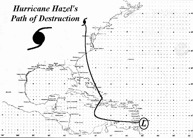
PS: PLEASE don't EVER refer to Hazel again!!!

Regards,
Millibar
PS: PLEASE don't EVER refer to Hazel again!!!
Regards,
Millibar
0 likes
FungusMoldlyColdcuts wrote:the weakness here is, the GFS cant get a handle on the strength of the ridge and the influence of the trough. Much like last time, the GFS will undergo some serious differences with the amplitude of the ridge in the atlantic, the trough in the east CONUS and the shortwave energy moving through canada towards the central/east US. I hope this helped you grasp the weakness
I already was well aware of all of that, i simply could not read your post... thanks. I disagree however. The GFS was all over the place, but has begun to level off over the past few runs since the introduction of the synoptic data.
It is beginning to more closely mirror the ECMWF, Nogaps, and Ukmet...
I suppose we shall all see tomorrow what the outcome will be, by the 11am if we don't see a pronounced wnw track, then i agree this is going to be a much lower lat storm. The blocking over the GOM still shows an inability for it to head in that direction. The GFDL shows this high, however it drives the storm right into it...?
-Eric
Edit:
The rest of the GFS was finally uploaded...
It now shows the storm recurving out over the bahamas into the atlantic, heading NE...
This should definately throw a wrench into some of the models reliant on it.
0 likes
-
FungusMoldlyColdcuts
Who is online
Users browsing this forum: No registered users and 151 guests