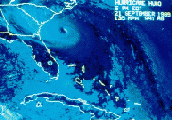
don't forget you can pick up meteosat images from the NRL site...the most recent image is right at 18Z...looks to me the center is around 13.5N 46W.
http://tcweb.fnmoc.navy.mil/tc-bin/tc_home.cgi
MW
Hey...Updated Satellite Images...
Moderator: S2k Moderators
Forum rules
The posts in this forum are NOT official forecasts and should not be used as such. They are just the opinion of the poster and may or may not be backed by sound meteorological data. They are NOT endorsed by any professional institution or STORM2K. For official information, please refer to products from the National Hurricane Center and National Weather Service.
- charleston_hugo_veteran
- S2K Supporter

- Posts: 1590
- Joined: Thu Sep 04, 2003 12:47 pm
- Location: Charleston, S.C.
http://www.cira.colostate.edu/ramm/rmsd ... PICAL.html check that out. Talk about a strong cat 1 hurricane as progged already. After looking at that close up floater, I wouldn't doubt it's a hurricane at this point.
0 likes
Who is online
Users browsing this forum: No registered users and 62 guests


