First let me say that I in no way blame the NHC for not forecasting a Charlotte Harbor landfall. I'm well aware that of the inexact science of forecasting. And that that the landfall area was within the zone of the hurricane warning, and the possibility of intensification was mentioned (as it usually is).
My problems with the 11 am advisory do not concern forecasting--the prediction of what the storm would do in the future. My contention is that the TPC failed to accurately inform of what the storm was doing right then. That's not about forecasting or speculation, that's about the accurate reporting of real-time data.
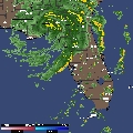
First, the 11 am advisory ignored the NNE motion of the storm that had been underway for 3 hours. They reported the present motion of the storm as due north (360) when that was plainly incorrect. My recollection of the radar loops was that the NNE heading was by that time very consistent, not a "wobble." Enough so for Steve Lyons to advise within an hour that Port Charlotte would receive a direct hit. At that very time, however, the standing TPC latest advisory still had the storm going due north, leading in turn to a prediction that the storm center would pass just east of downtown Tampa.
Shortly afterwards, my mom in Fort Myers told me on the phone that (Lee County) emergency officials on the radio declared that "the National Hurricane Center is wrong" and that "we're going to get a direct hit." They then ordered additional evacuations of flood prone areas along the Caloosahatchee River.
Secondly, the 11 am advisory shockingly failed to upgrade Charley to a Category 3 storm despite aircraft recon data showing flight level winds of 121 knots, or 138 mph. That data was reported on this board no later than 10:43 am. Did they have the 11 am advisory already written? Regardless, wasn't it time for a hasty rewrite? Incidentally, the 11 am TPC discussion came out late and was not posted on this board (nor updated on the website, as I was continuously refreshing it) until about 11:15 am.
This latter error concerns me more than the first one. Despite the TPC reporting a due north heading at 11 am, everyone with a TV could see from the radar loops that the storm had definitely turned NNE after 8 am.
But the Cat 3 failure is more significant. Would some of those in the direct path of the storm jumped in their cars to evacuate--while there was still time to safely do so--if they had the psychological jolt that Charley was now a Cat 3 (and moreover, intensifying)? As it was, the public had the storm reported as going from a Cat 2 to Cat 4 in little more than a couple of hours. And here I thought they always erred on the side of public safety.
Folks, I'm not trying to play a blame game here, just deal with facts. If anyone has actual knowledge of the TPC's thinking at 11 am re these issues, I'd sure welcome it. I didn't want to just ignore all this, because I honestly was just floored yesterday when I read the 11 am advisory. Most bothersome to me was that the discusion made no mention of the eastern motion at all.
As an appendix, below are links to pertinent threads from yesterday morning (note the times on each post). I welcome the comments of those who differ; I'd feel better to learn that I'm mistaken. What do you all think about this?
http://www.storm2k.org/phpbb2/viewtopic.php?t=37020
http://www.storm2k.org/phpbb2/viewtopic.php?t=36995
http://www.storm2k.org/phpbb2/viewtopic.php?t=37005
http://www.storm2k.org/phpbb2/viewtopic ... 09&start=0
Major issues with the 11 am TPC advisory
Moderator: S2k Moderators
Forum rules

The posts in this forum are NOT official forecasts and should not be used as such. They are just the opinion of the poster and may or may not be backed by sound meteorological data. They are NOT endorsed by any professional institution or STORM2K. For official information, please refer to products from the National Hurricane Center and National Weather Service.
-
Storminole
- Tropical Depression

- Posts: 70
- Age: 64
- Joined: Wed Aug 11, 2004 5:53 pm
- Location: Tallahassee, FL
You know what...I couldn't connect at all to the net during that time but I was thinking the same thing...especially after the outbound dropsonde report....and we were discussing the potential for nne to ne movement the night before. It's like watching a movie where you know something bad is going to happen...but you can't do anything about it. Only 100 times worse.
That discussion has borne a huge knot in my stomache...specifically the discussion in the appended posts.
Seriously...I think I'm going to be sick.
Excellent, excellent post. Thank you.
(added) the only two things we could look at in the office were radar loops from intellicast...and I had left an SSD satellite connection from the previous night on my desktop so it was auto-reloading. I tried several times to get posts out but couldn't. It's like that dream where you want to scream but cant. Next time this happens....I'm staying home...our network at work was jammed. (end of addition)
MW
0 likes
Updating on the twitter now: http://www.twitter.com/@watkinstrack
Brent wrote:The whole internet was swamped and painfully slow from about 1pm on yesterday. I was having trouble loading radars, getting to the NHC site, etc. It was terrible. It felt like 9/11 all over again. It sounds like everyone got on their computer at the same time.
Yep...I had a few folks like Jevo keeping me posted...and I got in touch with Dr Steve briefly but after the eye had come in. My phone was ringing off the hook...I was able to get through to some friends in Ft Myers about 1PM...and they got the [bleep] out of there. I saw some posts but couldn't reply...I may have got one or two through I have to check.
MW
0 likes
Updating on the twitter now: http://www.twitter.com/@watkinstrack
-
hurricanemike

- Professional-Met

- Posts: 197
- Joined: Wed Feb 25, 2004 11:33 pm
- Location: Jacksonville,FL Beaches/Duval County
- Contact:
-
Storminole
- Tropical Depression
- Posts: 70
- Age: 64
- Joined: Wed Aug 11, 2004 5:53 pm
- Location: Tallahassee, FL
Mike,
If the 11 am TPC advisory was written an hour earlier (following a conference call), that explains the failure to upgrade to Cat 3 based on 10:40 am recon. But even at 10 am, a 360 due north heading was still plainly wrong based upon the movement from 24.7/82.9 to 24.9/82.8 over the previous 2 hours. That's half a mile east for each mile northward.
The TPC discussion simply states that the storm is moving due north, the eastward motion apparently being unworthy of mention. Were they blinded by their models into ignoring a changing reality on the ground? "The models say the storm moves north and turns NNE later, therefore this is a wobble."
I've heard a lot of complaints against NHC forecasts over the years and I've never sided with any of them--starting with Cat 3 Eloise's overnight right turn into Panama City Beach in 1975. But as I've stated above, this isn't about forecasting, it's about accurately reporting the current status of the storm.
All this really matters since Charley before 11 am had (1) taken an unexpected turn, (2) had begun rapidly deepening to an unexpected degree, while (3) was nearing landfall, and (4) was approaching the coast at an oblique angle where a change in storm direction would result in a big difference in landfall location.
I'm not going on a 'rant' here and I won't say any more about this. But that 11 am advisory was dead wrong on both storm heading and intensity the minute it was issued. At the critical moment, the TPC dropped the ball. For TPC to write advisories in stone an hour early in the face of a rapidly changing landfalling hurricane is a business model I hope they'll re-examine.
0 likes
-
kevin
When NASA blows up a space shuttle and kills 7 people, there is an investigation which goes through the entire structure of how information is diseminated and how the organization processes its decisions.
The TPC needs to have a similar consideration of this storm, and I think the 11am forecast... it makes me sick too MW. No we don't need to shut them down, or anything of that sort, they do what they do well. But failure is not an option. Tolerance is not to ever be a fixed number. We must always evaluate.
The TPC needs to have a similar consideration of this storm, and I think the 11am forecast... it makes me sick too MW. No we don't need to shut them down, or anything of that sort, they do what they do well. But failure is not an option. Tolerance is not to ever be a fixed number. We must always evaluate.
0 likes
-
kevin
-
rbaker
was the nhc waiting to see if this was just a wobble? all I know is that I was watching and reloading tpa radar every six minutes short range looping, and saw a due north movement until around noon. a 1/10 degree movement does not mean a movement to the nne has occurred until there is more time to watch to see if this was a definitive movement towards ft myers area. Even our own met in tpa bay area did not bring out the change until 1245p after they had analyzed 1/2 hr of movement to make sure it had made the turn. Also lets not forget the slight jog to the north in to Charlotte harbor just before landfall, which had huge implications on where eyewall came in, instead of maybe 20 miles south.
Hurricane center will never have the eye exactly to the mile of where the center passes over, impossible to say 100 pct, as we all have seen before. That is why hurricane warnings were posted from the keys all the way up to the Suwanee river. No one should ever just rely on where the center passes over, but where the warning area is, and esp. to the right of where the center crosses the coast
Hurricane center will never have the eye exactly to the mile of where the center passes over, impossible to say 100 pct, as we all have seen before. That is why hurricane warnings were posted from the keys all the way up to the Suwanee river. No one should ever just rely on where the center passes over, but where the warning area is, and esp. to the right of where the center crosses the coast
0 likes

I saw the same thing here in Biloxi when George came in.The reports all night was it's going to N.O.I sat there kept on plotting going it is coming here.It was maybe 1-2 hrs later the power was out.It seems like when a large metro area is buy the signal is set to evacuate it.Deviation from the plan at that late in the game doesn't happen.Most of us in the area knew 12hrs in advance by our own graphs we where under the gun.
0 likes
-
Storminole
- Tropical Depression
- Posts: 70
- Age: 64
- Joined: Wed Aug 11, 2004 5:53 pm
- Location: Tallahassee, FL
Today's Fort Myers News-Press has an article on local weathercasters making the call at midday that the storm was heading their way. Not actually a difficult call with radar showing the storm moving straight at them over the previous few hours. The article also suggests a stubbornly slow reaction time by NHC in adjusting their forecast to the unfolding reality.
http://www.news-press.com/news/weather/ ... tions.html
http://www.news-press.com/news/weather/ ... tions.html
0 likes

kevin wrote:When NASA blows up a space shuttle and kills 7 people, there is an investigation which goes through the entire structure of how information is diseminated and how the organization processes its decisions.
The TPC needs to have a similar consideration of this storm, and I think the 11am forecast... it makes me sick too MW. No we don't need to shut them down, or anything of that sort, they do what they do well. But failure is not an option. Tolerance is not to ever be a fixed number. We must always evaluate.
While I won't argue the jist of your point, there is a distinct difference in these two events. One is an act of God, the other was a man-made tragedy. We can't control the former.
0 likes
-
Ripopgodazippa
- Tropical Depression
- Posts: 74
- Joined: Mon Aug 09, 2004 10:03 pm
- Location: Tallahassee

-
vbhoutex

- Storm2k Executive

- Posts: 29140
- Age: 74
- Joined: Wed Oct 09, 2002 11:31 pm
- Location: Cypress, TX
- Contact:
Very good discussion by all here. Thank you!! I hate to sound like a broken record, but I am going to. Everywhere that was hit was in the warned areas. Those warnings had been up for at least 24 hours especially in the are of landfall. I am not privy to as much information as some are that post here, but I would hope that EM officials would do their best to enforce their mandatory evacuations in place and assist the infirm that can't help themselves. Past that EVERYONE SHOULD HAVE BEEN IN A SAFE SHELTER till the threat or storm had passed. I am not arguing against the facts that are presented here. I am not arguing anything except the fact that too many people think they can outgeuss the pros who put out the warnings and the warnings were in place. If one is under a warning and is told to evacuate, then one should, no questions asked. Those warnings are not put out for the heck of it, they are put out to do the best they can at protecting life and property, not to be second guessed by anyone.
Again, do not get me wrong. I was one of those discussing what Mike W talked about in the thread above. We discussed it into the early morning. We saw the possibility/probability that the further East/South scenario could be unfolding and it was very obvious that the intensification was happening, not the rapid intensification reported, but intensification none the less.
I've seen several posts where people have said relatives or someone said that we thought it was only a CAT2 or CAT3 storm. WTF were they thinking, ONLY????? I have been through a CAT3 and CAT2 and many others over the years I have been on the Gulf Coast. NEVER has any of them been any fun or "just" a CAT2 or 3. If one has experienced that strong a wind for hours on end they would never say "ONLY"!!!! The point is listen to what the authorities say!!
As far as a 20/20 hindsight look back at this system and for that matter any others-it will happen-it must happen if we are to learn anything scientifically or otherwise from this HORRIBLE TRAGEDY!!
0 likes
Skywarn, C.E.R.T.
Please click below to donate to STORM2K to help with the expenses of keeping the site going:

Please click below to donate to STORM2K to help with the expenses of keeping the site going:
-
MGC

- S2K Supporter

- Posts: 5939
- Joined: Sun Mar 23, 2003 9:05 pm
- Location: Pass Christian MS, or what is left.
When Lili approached the Louisiana coast in 2002, Lili made a little jog to the north towards New Orleans that freaked everyone out. However, the NHC maintained and insisted on Lili resuming a NW track and they were right. I think the NHC misforecast the strength of the trough that pushed Charley NNE into Punta Gorda......MGC
0 likes
MGC wrote:When Lili approached the Louisiana coast in 2002, Lili made a little jog to the north towards New Orleans that freaked everyone out. However, the NHC maintained and insisted on Lili resuming a NW track and they were right. I think the NHC misforecast the strength of the trough that pushed Charley NNE into Punta Gorda......MGC
Very true! That "don't focus on an exact point" clause applies with hevery storm.
0 likes
Who is online
Users browsing this forum: No registered users and 103 guests