NHC 11 a.m. may be inaccurate
Moderator: S2k Moderators
Forum rules

The posts in this forum are NOT official forecasts and should not be used as such. They are just the opinion of the poster and may or may not be backed by sound meteorological data. They are NOT endorsed by any professional institution or STORM2K. For official information, please refer to products from the National Hurricane Center and National Weather Service.
-
Trader Ron

- S2K Supporter

- Posts: 928
- Joined: Tue Jul 22, 2003 7:25 pm
- Location: Naples,Fl
- Contact:
-
Air Force Met
- Military Met

- Posts: 4372
- Age: 56
- Joined: Tue Jul 08, 2003 9:30 am
- Location: Roan Mountain, TN
Re: even stronger?
frederic79 wrote:Isnt' the windspeed in the right quadrant/eyewall a total of the sustained wind speed PLUS the forward speed of the storm? i.e. 110 mph + 18 mph = 128 mph?
Nope...that's just a myth. If it says 110 then its 110...unles of course the advisory is wrong
0 likes
-
Storminole
- Tropical Depression

- Posts: 70
- Age: 64
- Joined: Wed Aug 11, 2004 5:53 pm
- Location: Tallahassee, FL
Has the NHC lost it at the critical moment?
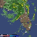
Someone please step up to correct me if I am mistaken here. I probably don't know what I'm talking about. But it sure seems to me from viewing the TPC website that they just LOST IT in their 11 am report.
(1) The storm is still reported as heading due north, not NNE as is apparent in looking at the radar loops. More to the point, no mention of the greatly increased threat to Fort Myers and Port Charlotte.
(2) Dysfunctional posting on their website. Here shortly past noon, I still get the 5 a.m. Discussion by clicking on that link. Not a good show at a time when every hour is critical. And check out the latest charts they put up...the lines showing the path of the storm as it comes into Tampa aren't even there on both charts. Looks to me that they are unfinished yet were put up that way!
http://www.nhc.noaa.gov/refresh/graphic ... 0908.shtml?
(3) Didn't they fail to report the strengthening of the storm as found by recon aircraft?
I could be wrong here and if so I apologize. Could someone more knowledgeable than me comment on these points?
Last edited by Storminole on Fri Aug 13, 2004 12:07 pm, edited 1 time in total.
0 likes

-
Guest
Who is online
Users browsing this forum: No registered users and 25 guests