Actually.......
http://weather.msfc.nasa.gov/GOES/goeseastfullwv.html
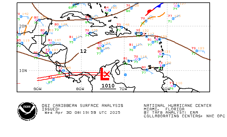
Water Vapor doesnt look half bad
Invest 97L (Model data, graphics, recon, etc.)
Moderator: S2k Moderators
Forum rules

The posts in this forum are NOT official forecasts and should not be used as such. They are just the opinion of the poster and may or may not be backed by sound meteorological data. They are NOT endorsed by any professional institution or STORM2K. For official information, please refer to products from the National Hurricane Center and National Weather Service.
-
Stormchaser16
- Category 5

- Posts: 1013
- Joined: Thu Aug 21, 2003 10:25 pm
- Location: NW Jersey
- Contact:
-
senorpepr

- Military Met/Moderator

- Posts: 12542
- Age: 43
- Joined: Fri Aug 22, 2003 9:22 pm
- Location: Mackenbach, Germany
- Contact:
Code: Select all
000
ABNT20 KNHC 200846
TWOAT
TROPICAL WEATHER OUTLOOK
NWS/TPC NATIONAL HURRICANE CENTER MIAMI FL
530 AM EDT TUE JUL 20 2004

FOR THE NORTH ATLANTIC...CARIBBEAN SEA AND THE GULF OF MEXICO...

A VIGOROUS TROPICAL WAVE IS ENTERING THE EXTREME EASTERN
CARIBBEAN SEA AND IS MOVING WESTWARD AT 20 TO 25 MPH.  SURFACE
OBSERVATIONS INDICATE THAT THIS WAVE WAS ACCOMPANIED BY SIGNIFICANT
PRESSURE FALLS OVER THE WINDWARD ISLANDS.  HOWEVER...SATELLITE
IMAGES SHOW THAT THIS SYSTEM IS LESS WELL-ORGANIZED THAN IT WAS
YESTERDAY...AND UPPER-LEVEL WINDS HAVE BECOME LESS FAVORABLE FOR
DEVELOPMENT.  SHOWERS AND GUSTY WINDS OVER PORTIONS OF THE LESSER
ANTILLES ARE EXPECTED TO GRADUALLY DIMINISH OVER THE NEXT DAY OR
SO.

ELSEWHERE...TROPICAL STORM FORMATION IS NOT EXPECTED THROUGH
WEDNESAY.

FORECASTER PASCH
$$
0 likes


-
senorpepr
- Military Met/Moderator
- Posts: 12542
- Age: 43
- Joined: Fri Aug 22, 2003 9:22 pm
- Location: Mackenbach, Germany
- Contact:
Code: Select all
293
WHXX01 KWBC 210935
CHGHUR

 DISCLAIMER...NUMERICAL MODELS ARE SUBJECT TO LARGE ERRORS.
 PLEASE REFER TO TPC/NHC OFFICIAL FORECASTS FOR TROPICAL CYCLONES.

    .....THE FOLLOWING IS A TEST MESSAGE.....

  NATIONAL HURRICANE CENTER NORTH ATLANTIC OBJECTIVE AIDS FOR

  TROPICAL DEPRESSION INVEST     (AL972004) ON 20040721  0600 UTC

          ...00 HRS...   ...12 HRS...   ...24 HRS...   ...36 HRS...
          040721  0600   040721  1800   040722  0600   040722  1800

           LAT    LON     LAT    LON     LAT    LON     LAT    LON
  BAMD    15.6N  69.6W   16.0N  71.9W   16.1N  74.2W   16.4N  76.6W
  BAMM    15.6N  69.6W   16.2N  72.4W   16.4N  75.0W   16.9N  77.2W
  A98E    15.6N  69.6W   16.8N  73.6W   17.4N  76.9W   18.0N  79.7W
  LBAR    15.6N  69.6W   16.6N  72.7W   17.4N  75.8W   18.2N  78.7W
  SHIP        25KTS          25KTS          30KTS          34KTS
  DSHP        25KTS          25KTS          30KTS          34KTS

          ...48 HRS...   ...72 HRS...   ...96 HRS...   ..120 HRS...
          040723  0600   040724  0600   040725  0600   040726  0600

           LAT    LON     LAT    LON     LAT    LON     LAT    LON
  BAMD    16.7N  78.6W   17.4N  82.0W   17.5N  85.6W   17.3N  89.4W
  BAMM    17.2N  79.0W   17.8N  82.2W   18.2N  85.8W   18.4N  89.4W
  A98E    18.2N  81.7W   18.7N  85.1W   19.0N  88.6W   19.1N  92.7W
  LBAR    19.2N  81.3W   20.9N  85.0W   22.6N  87.3W   23.8N  89.0W
  SHIP        41KTS          55KTS          72KTS          82KTS
  DSHP        41KTS          55KTS          72KTS          41KTS

               ...INITIAL CONDITIONS...
  LATCUR =  15.6N LONCUR =  69.6W DIRCUR = 290DEG SPDCUR =  22KT
  LATM12 =  13.8N LONM12 =  65.5W DIRM12 = 292DEG SPDM12 =  23KT
  LATM24 =  12.3N LONM24 =  61.5W
  WNDCUR =   25KT RMAXWD =   75NM WNDM12 =   30KT
  CENPRS = 1012MB OUTPRS = 1013MB OUTRAD =  120NM SDEPTH =   M
  RD34NE =    0NM RD34SE =    0NM RD34SW =    0NM RD34NW =   0NM

  .....THE ABOVE HAS BEEN A TEST MESSAGE.....
0 likes
-
senorpepr
- Military Met/Moderator
- Posts: 12542
- Age: 43
- Joined: Fri Aug 22, 2003 9:22 pm
- Location: Mackenbach, Germany
- Contact:
Recon's en route...
Here's the coded obs so far...
Here's the coded obs so far...
Code: Select all
97779 16204 40281 89200 58200 99005 58691 /4589
RMK AF966 01BBA INVEST OB 01

97779 16504 40261 88400 58500 99005 58658 /4590
RMK AF966 01BBA INVEST OB 02

OB 3 was a dropsonde ob.

97779 17204 40240 87200 52300 99005 53692 /4589
RMK AF966 01BBA INVEST OB 04

97779 17504 40218 86200 52100 99005 53//9 /4590
RMK AF966 01BBA INVEST OB 05

97779 18264 40201 84800 52100 10015 53//1 /4590
RMK AF966 01BBA INVEST OB 06
0 likes

-
senorpepr
- Military Met/Moderator
- Posts: 12542
- Age: 43
- Joined: Fri Aug 22, 2003 9:22 pm
- Location: Mackenbach, Germany
- Contact:
Here's the coded recon obs from yesterday's mission (although they had to turn back before the storm due to mechanical problems)
Code: Select all
97779 16204 40281 89200 58200 99005 58691 /4589
RMK AF966 01BBA INVEST OB 01

97779 16504 40261 88400 58500 99005 58658 /4590
RMK AF966 01BBA INVEST OB 02

OB 3 was a dropsonde ob.

97779 17204 40240 87200 52300 99005 53692 /4589
RMK AF966 01BBA INVEST OB 04

97779 17504 40218 86200 52100 99005 53//9 /4590
RMK AF966 01BBA INVEST OB 05

97779 18264 40201 84800 52100 10015 53//1 /4590
RMK AF966 01BBA INVEST OB 06

97779 19054 40225 86700 61300 99005 60//1 /8036
RMK AF966 01BBA INVEST OB 07

97779 19304 40245 87400 61700 16013 59//1 /8035
RMK AF966 01BBA INVEST OB 08

97779 20054 40271 88800 73900 18020 67//1 /5759
RMK AF966 01BBA INVEST OB 09

97779 20274 40290 88900 73800 20020 68//1 /5760
RMK AF966 01BBA INVEST OB 10 LAST REPORT
0 likes
-
senorpepr
- Military Met/Moderator
- Posts: 12542
- Age: 43
- Joined: Fri Aug 22, 2003 9:22 pm
- Location: Mackenbach, Germany
- Contact:
Here are the above obs, but decoded.
Code: Select all
Ob #01: Time: 1620Z; Lat: 28.1N; Long: 89.2W; Turbulence: None; Flight Level: 19,000ft; Wind: Vrb @ 06 mph; Weather: Scattered Clouds; Temp: 18°F; Dewpoint: -2°F; Remarks: None

Ob #02: Time: 1650Z; Lat: 26.1N; Long: 88.4W; Turbulence: None; Flight Level: 19,000ft; Wind: Vrb @ 06 mph; Weather: Rainshowers; Temp: 18°F; Dewpoint: 5°F; Remarks: None

Ob #03: Remarks: Dropsonde Observation.

Ob #04: Time: 1720Z; Lat: 24.0N; Long: 87.2W; Turbulence: None; Flight Level: 17,000ft; Wind: Vrb @ 06 mph; Weather: Broken Clouds; Temp: 27°F; Dewpoint: --°F; Remarks: None

Ob #05: Time: 1750Z; Lat: 21.8N; Long: 86.2W; Turbulence: None; Flight Level: 17,000ft; Wind: Vrb @ 06 mph; Weather: Thunderstorm; Temp: 27°F; Dewpoint: --°F; Remarks: None

Ob #06: Time: 1826Z; Lat: 20.1N; Long: 84.8W; Turbulence: None; Flight Level: 17,000ft; Wind: 100° @ 17 mph; Weather: Scattered Clouds; Temp: 27°F; Dewpoint: --°F; Remarks: None

Ob #07: Time: 1905Z; Lat: 22.5N; Long: 86.7W; Turbulence: None; Flight Level: 20,000ft; Wind: Vrb @ 06 mph; Weather: Scattered Clouds; Temp: 14°F; Dewpoint: --°F; Remarks: None

Ob #08: Time: 1930Z; Lat: 24.5N; Long: 87.4W; Turbulence: None; Flight Level: 20,000ft; Wind: 160° @ 15 mph; Weather: Scattered Clouds; Temp: 16°F; Dewpoint: --°F; Remarks: None

Ob #09: Time: 2005Z; Lat: 27.1N; Long: 88.8W; Turbulence: None; Flight Level: 24,000ft; Wind: 180° @ 23 mph; Weather: Scattered Clouds; Temp: 1°F; Dewpoint: --°F; Remarks: None

Ob #10: Time: 2027Z; Lat: 29.0N; Long: 88.9W; Turbulence: None; Flight Level: 24,000ft; Wind: 200° @ 23 mph; Weather: Scattered Clouds; Temp: 0°F; Dewpoint: --°F; Remarks: Last
0 likes
Who is online
Users browsing this forum: wwizard and 152 guests