EPAC Action

This is the general tropical discussion area. Anyone can take their shot at predicting a storms path.

Moderator: S2k Moderators

Forum rules

The posts in this forum are NOT official forecasts and should not be used as such. They are just the opinion of the poster and may or may not be backed by sound meteorological data. They are NOT endorsed by any professional institution or STORM2K. For official information, please refer to products from the National Hurricane Center and National Weather Service.

Help Support Storm2K
Message
Author
User avatar
Aquawind
Category 5
Category 5
Posts: 6714
Age: 62
Joined: Mon Jun 16, 2003 10:41 pm
Location: Salisbury, NC
Contact:

EPAC Action

#1 Postby Aquawind » Mon Jun 07, 2004 8:52 pm

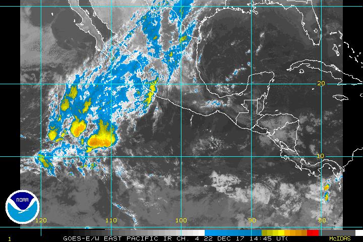
Well qscat Certainly looks interesting!

Image


Tropical Weather Outlook

--------------------------------------------------------------------------------


000
ABPZ20 KNHC 072244
TWOEP
TROPICAL WEATHER OUTLOOK
NWS TPC/NATIONAL HURRICANE CENTER MIAMI FL
4 PM PDT MON JUNE 7 2004

FOR THE EASTERN NORTH PACIFIC...EAST OF 140 DEGREES WEST LONGITUDE..

A WELL-DEFINED CIRCULATION CENTER AND AREA OF LOW PRESSURE HAS
DEVELOPED ABOUT 180 MILES SOUTHWEST OF MANZANILLO MEXICO WITHIN A
LARGE TROPICAL DISTURBANCE. HOWEVER...THE SYSTEM HAS INSUFFICIENT
ORGANIZED THUNDERSTORM ACTIVITY TO BE CONSIDERED A TROPICAL
DEPRESSION AT THIS TIME. UPPER-LEVEL WINDS ARE NOT CURRENTLY
FAVORABLE FOR DEVELOPMENT OF THIS SYSTEM. EVEN IF THE SYSTEM DOES
NOT DEVELOP INTO A TROPICAL CYCLONE...IT IS LIKELY TO PRODUCE
OCCASIONAL PERIODS OF LOCALLY HEAVY RAINFALL AND GUSTY WINDS ALONG
PORTIONS OF THE MEXICAN COAST AND INLAND AREAS BETWEEN CABO
CORRIENTES AND ACAPULCO FOR THE NEXT FEW DAYS.

ANOTHER AREA OF DISTURBED WEATHER IS CENTERED ABOUT 600 MILES
SOUTH-SOUTHWEST OF THE GULF OF TEHUANTEPEC. DEVELOPMENT...IF
ANY...IS EXPECTED TO BE SLOW TO OCCUR.

ELSEWHERE...TROPICAL STORM FORMATION IS NOT EXPECTED THROUGH
TUESDAY.

FORECASTER FRANKLIN
0 likes   

User avatar
HURAKAN
Professional-Met
Professional-Met
Posts: 46086
Age: 38
Joined: Thu May 20, 2004 4:34 pm
Location: Key West, FL
Contact:

#2 Postby HURAKAN » Mon Jun 07, 2004 8:57 pm

To develop what the system needs now is what it doesn't have, persistant thunderstorms over or near the center. Until that doesn't happen we will continue to see the same, over and over.

Sandy Delgado
0 likes   

User avatar
Aquawind
Category 5
Category 5
Posts: 6714
Age: 62
Joined: Mon Jun 16, 2003 10:41 pm
Location: Salisbury, NC
Contact:

#3 Postby Aquawind » Mon Jun 07, 2004 9:03 pm

I agree entirely.. :)
0 likes   

User avatar
USAwx1
Professional-Met
Professional-Met
Posts: 936
Joined: Mon Apr 26, 2004 5:57 pm
Location: Marineland, FL

#4 Postby USAwx1 » Mon Jun 07, 2004 9:14 pm

yep, but it is for sure a nice looking circulation.

Image
0 likes   


Return to “Talkin' Tropics”

Who is online

Users browsing this forum: No registered users and 117 guests