


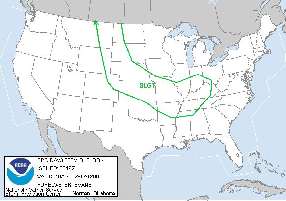
...SERN UNITED STATES...
THUNDERSTORMS SHOULD DEVELOP ACROSS THE AREA WEDNESDAY NIGHT AND
CONTINUE INTO THE DAY 3 PERIOD AS UPPER LEVEL DIFFLUENCE
STRENGTHENS. BOTH THE ETA AND GFS MODELS SHOW LITTLE CHANGE IN THE
OVERALL ENVIRONMENTAL WIND PATTERN...POSSIBLY RESULTING IN
WIDESPREAD PRECIPITATION TRAINING NEWD ACROSS THE AREA DURING THE
DAY. ALTHOUGH THIS MAY LIMIT THE AMOUNT OF INSTABILITY...THE DEEP
LAYER SHEAR WILL REMAIN FAVORABLE FOR ORGANIZED SEVERE STORMS.
SEVERE STORM COVERAGE WILL BE DEPENDENT ON AIR MASS RECOVERY...BUT
THIS CAN NOT BE DETERMINED 3 DAYS OUT. THUS...A BROAD SLIGHT RISK
AREA COVERS THE REGION WHERE THE AIR MASS SHOULD REMAIN WARM AND
MOIST.

