Questions......

Winter Weather Discussion

Moderator: S2k Moderators

Forum rules

The posts in this forum are NOT official forecast and should not be used as such. They are just the opinion of the poster and may or may not be backed by sound meteorological data. They are NOT endorsed by any professional institution or STORM2K.

Help Support Storm2K
Message
Author
Anonymous

Questions......

#1 Postby Anonymous » Sun Jan 18, 2004 10:43 pm

We are heading into a Retrogressive pattern. That is a Fact.

In a Retrogressive pattern, there is a Ridge in the East, and a deep Trough in the West.

I already know that configuration is very, very bad for winter weather here in the East,

So, I pose my question:

Does the Retrogressive Pattern mean that prospects for snow here in the Mid Atlantic is very, very poor? I do understand that we may have a chance for something in the next 2 weeks while we transition to the Western Trough/Eastern Ridge, but after that: Is it true that for the Mid Atlantic, snow may well be completely over with?

Because I have a gut feeling that that is indeed what is going to happen, and I can get used to it. That's why I have a Web Design obsession, to help with the terribly mild MA winters that I know I will have to endure in my life since it is not possible for me to move north.

But.....................I'd like to hear it from the experts here on this fine board. Hey I won't be happy...................but I'll live :) I was living well when I was head over heels in love with Nags Head in the OBX and my 77/64 jebwalks! :)

I only have to suffer through the rest of this month and through February and early March and then it will be appropriate for me to go into an obsessive overdrive about spring thunderstorms and the beach in summer and I can then call myself Nags Head JEB once again!!!!! :) :) :)


-JEB........at a climatological crossroads.........
0 likes   

User avatar
Stormsfury
Category 5
Category 5
Posts: 10549
Age: 53
Joined: Wed Feb 05, 2003 6:27 pm
Location: Summerville, SC

#2 Postby Stormsfury » Sun Jan 18, 2004 10:58 pm

I've got a discussion on my website you can read and yes, it is a retrogressive pattern and yes, we're likely heading into an RNA pattern after being in a +PNA for a little while ...

Fact of the matter is that the displaced PV which even dove into the Northeastern States literally FROZE that region with some of the coldest air in many decades, including the -44º at Mt. Washington ... ouch!

The severely displaced PV caused the storm track (especially the SBJ) to be crushed and non-existent ... the s/w across the country were all northern stream dominated and an overwhelming PJ crushed any s/w that entered into the confluent zone ...

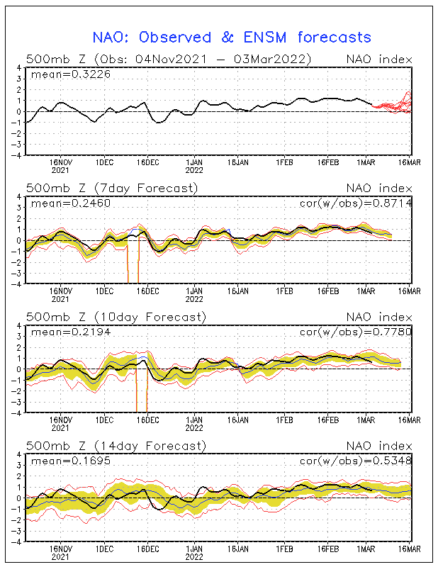
However, that's about to change with the pattern ... and it doesn't necessarily mean that we totally lose the arctic air, either... especially in regards to potential cold air damming scenarios if highs can build in from Eastern Canada ... and looking at the latest progs, indicate that the -NAO is about to wildly TANK NEG ... with opporutinities to LOCK the cold in the east, despite an RNA pattern ... there's plenty of cold air in Canada ...

SF
0 likes   

Anonymous

#3 Postby Anonymous » Sun Jan 18, 2004 11:13 pm

Stormsfury wrote:I've got a discussion on my website you can read and yes, it is a retrogressive pattern and yes, we're likely heading into an RNA pattern after being in a +PNA for a little while ...

Fact of the matter is that the displaced PV which even dove into the Northeastern States literally FROZE that region with some of the coldest air in many decades, including the -44º at Mt. Washington ... ouch!

The severely displaced PV caused the storm track (especially the SBJ) to be crushed and non-existent ... the s/w across the country were all northern stream dominated and an overwhelming PJ crushed any s/w that entered into the confluent zone ...

However, that's about to change with the pattern ... and it doesn't necessarily mean that we totally lose the arctic air, either... especially in regards to potential cold air damming scenarios if highs can build in from Eastern Canada ... and looking at the latest progs, indicate that the -NAO is about to wildly TANK NEG ... with opporutinities to LOCK the cold in the east, despite an RNA pattern ... there's plenty of cold air in Canada ...

SF


Three things I have to say concerning you SF..............


1) You are one heck of an Optimist!! :) :)

2) Dude, Your website is AWESOME!!!! :) :)

and

3) That is one heck of a Sig!!!!! :) :)


About your views..........All I can say, in all fairness, is,

We'll see.................................... :)


-JEB
0 likes   

donsutherland1
S2K Analyst
S2K Analyst
Posts: 2718
Joined: Mon Sep 15, 2003 8:49 pm
Location: New York

Re: Questions......

#4 Postby donsutherland1 » Sun Jan 18, 2004 11:14 pm

Jeb,

Retrogression refers to east-west movement of synoptic features. It does not necessarily mean a trough in the West/ridge in the East setup.
0 likes   

Anonymous

Re: Questions......

#5 Postby Anonymous » Sun Jan 18, 2004 11:17 pm

donsutherland1 wrote:Jeb,

Retrogression refers to east-west movement of synoptic features. It does not necessarily mean a trough in the West/ridge in the East setup.


Yeah Don, I had a feeling I might have had my retrogression "facts" kinda mixed up LOL........


Thanks for straightening me out. :)


-JEB
0 likes   

donsutherland1
S2K Analyst
S2K Analyst
Posts: 2718
Joined: Mon Sep 15, 2003 8:49 pm
Location: New York

Re: Questions......

#6 Postby donsutherland1 » Sun Jan 18, 2004 11:18 pm

np.
0 likes   

Steve H.
Category 5
Category 5
Posts: 2146
Joined: Sat Oct 19, 2002 9:06 am
Location: Palm Bay, Florida

#7 Postby Steve H. » Mon Jan 19, 2004 12:20 pm

I'm no expert, but with the blocking pattern pretty well established, even if retrogression does occur it may actually benefit the east coast by providing southern stream energy to come into play. The blocking continues to keep cold temps in the NE as lows dumbell around the vortex, providing a sufficiently cold air supply to be tapped if we get a phaser, and snows will occur, but the WHERE would be the question with each event, depending on track. Don't see strong ridging in the east with such a pattern. The groundhog may indeed see his shadow...if it isn't snowing! BTW, curious to see what affect this trough stuck in the east has on this coming tropical season. Waters cooling in the western Atlantic and probably warming in the Pacific :roll: Guess I better check. Still no snow in Palm Bay this year. 12:20 pm & 75F 8-)
0 likes   

Anonymous

#8 Postby Anonymous » Mon Jan 19, 2004 12:51 pm

Jeb...

wxrisk.com has a nice write-up on the Clipper that went from 4-8 inches to a few flurries for our area.

As you know, February is typically VA snowiest month, so keep the faith.

It sounds like we may a shot the 25th and again on 28th - 30th range, let's hope so.
0 likes   

User avatar
FLguy
Professional-Met
Professional-Met
Posts: 799
Joined: Mon Dec 29, 2003 5:36 pm
Location: Daytona Beach FL
Contact:

Re: Questions......

#9 Postby FLguy » Mon Jan 19, 2004 2:03 pm

EVEN in a retrogressive pattern...***IF IF IF*** the NAO is negative then the trough will not be as easy to remove from the east.

last nights ECM builds a STRONGY -NAO with huge omega style block between iceland and greenland at 240hrs. this would imply that while the amplitude of the trough in the EUS isnt as great as what it was when the PNA ridge was up...we may be looking at a broad based coast to coast trough.

http://web.wright-weather.com/wxp-model ... 40_500.gif

this is supported by the GFS ensembles through the 1st of FEB:

Image

http://web.wright-weather.com/wxp-model ... t_h168.gif

now in the case that we have several low pressure centers in the E PAC that are cutoff from the main flow...the trough WILL NOT be allowed to amplify into the western part of the country...instead the PJ is directed south-southeast over the top and into the eastern part of the country.

the SE ridge CANNOT make a comeback either w/ the NAO negative. IF the NAO is positive in a pattern like this THEN the trough would shift back into the western part of the country and a ridge will develop off the SE coast.

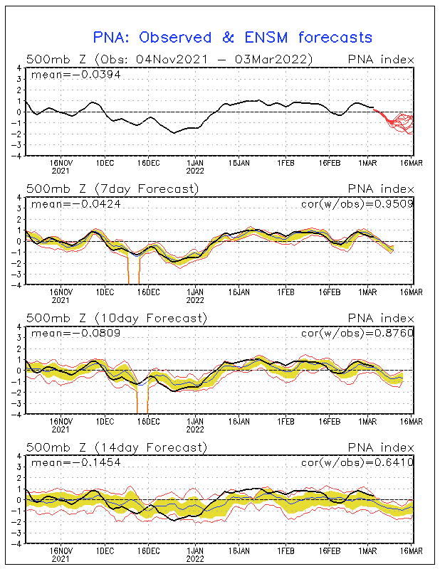
of course however with the retrogression of the pattern the trough TRYING to become re-established in the western part of the country the PNA ridge will get beaten down and we will see the re-emergence of an RNA pattern (trough in the west/ridge in the east according to climo for such a pattern) by the first of FEB:

Image

The ensembles tank the PNA by the end of the forecast period (FEB 1).
0 likes   

User avatar
FLguy
Professional-Met
Professional-Met
Posts: 799
Joined: Mon Dec 29, 2003 5:36 pm
Location: Daytona Beach FL
Contact:

Re: Questions......

#10 Postby FLguy » Mon Jan 19, 2004 2:08 pm

Jeb wrote:We are heading into a Retrogressive pattern. That is a Fact.

In a Retrogressive pattern, there is a Ridge in the East, and a deep Trough in the West.

I already know that configuration is very, very bad for winter weather here in the East,

So, I pose my question:

Does the Retrogressive Pattern mean that prospects for snow here in the Mid Atlantic is very, very poor? I do understand that we may have a chance for something in the next 2 weeks while we transition to the Western Trough/Eastern Ridge, but after that: Is it true that for the Mid Atlantic, snow may well be completely over with?

Because I have a gut feeling that that is indeed what is going to happen, and I can get used to it. That's why I have a Web Design obsession, to help with the terribly mild MA winters that I know I will have to endure in my life since it is not possible for me to move north.

But.....................I'd like to hear it from the experts here on this fine board. Hey I won't be happy...................but I'll live :) I was living well when I was head over heels in love with Nags Head in the OBX and my 77/64 jebwalks! :)

I only have to suffer through the rest of this month and through February and early March and then it will be appropriate for me to go into an obsessive overdrive about spring thunderstorms and the beach in summer and I can then call myself Nags Head JEB once again!!!!! :) :) :)


-JEB........at a climatological crossroads.........


:roll:

so does that also mean jeb that we can expect the same cry in my soup BS this summer and fall when you DONT get your once in 50 yrs tornado outbreak or a category 5 hurricane doesnt make a direct hit on woodbridge
0 likes   

Cumulonimbus
Tropical Depression
Tropical Depression
Posts: 70
Joined: Sun Jun 22, 2003 9:03 am
Location: Newcastle, WA

Retrogression

#11 Postby Cumulonimbus » Mon Jan 19, 2004 2:27 pm

One thing seems to be agreed upon by most of the models is retrogression. However the GFS is certainly NOT the model to use at least now. It has changed with almost every 6 hour forecast especially here in the far nw coast. Cold...not cold...arctic air....no arctic air...ridge on the coast....off in the Gulf of Alaska...on the coast again etc etc etc. The discussion for the medium range period even discounts the latest(06Z) run with respect to rising heights in the southeastern US. I just take what we get and check out about 72 hours in advance to see what probably will happen. Beyond that time seems to be up in the air with any kind of certainty which I know all of the forecasters tell us.
I also realize that in a transition period which we are about to go into, the prediction skill drops I think until the pattern stablizes again. I enjoy winter a lot and would really like to see Seattle get snow again but am not counting on it. The ensemble run looks promising but only time will tell. At least this has been an interesting winter with lots of variability.

Alex
0 likes   

User avatar
FLguy
Professional-Met
Professional-Met
Posts: 799
Joined: Mon Dec 29, 2003 5:36 pm
Location: Daytona Beach FL
Contact:

Re: Retrogression

#12 Postby FLguy » Mon Jan 19, 2004 2:38 pm

Cumulonimbus wrote:One thing seems to be agreed upon by most of the models is retrogression. However the GFS is certainly NOT the model to use at least now. It has changed with almost every 6 hour forecast especially here in the far nw coast. Cold...not cold...arctic air....no arctic air...ridge on the coast....off in the Gulf of Alaska...on the coast again etc etc etc. The discussion for the medium range period even discounts the latest(06Z) run with respect to rising heights in the southeastern US. I just take what we get and check out about 72 hours in advance to see what probably will happen. Beyond that time seems to be up in the air with any kind of certainty which I know all of the forecasters tell us.
I also realize that in a transition period which we are about to go into, the prediction skill drops I think until the pattern stablizes again. I enjoy winter a lot and would really like to see Seattle get snow again but am not counting on it. The ensemble run looks promising but only time will tell. At least this has been an interesting winter with lots of variability.

Alex


the GFS is also having quite a bit of trouble with the STJ s/w energy getting kicked out of the southwest next week which COULD become a MAJOR winter storm for much of the eastern part of the country.

since the PV isnt displaced too far to the southeast anymore its possible that this also effects portions of the northeast and new england.

normally the european has a big problem with holding back energy in the STJ but since it sees the upstream energy...it kicks the s/w out of the southwest into the plains.

http://web.wright-weather.com/wxp-model ... t_h168.gif

the only problem is there doesnt appear to be anything there in the PJ for it to phase with. but nonetheless it does look VERY interesting for most of the EUS as we head toward next weekend.
0 likes   

Anonymous

Re: Questions......

#13 Postby Anonymous » Mon Jan 19, 2004 3:27 pm

FLguy wrote:
Jeb wrote:We are heading into a Retrogressive pattern. That is a Fact.

In a Retrogressive pattern, there is a Ridge in the East, and a deep Trough in the West.

I already know that configuration is very, very bad for winter weather here in the East,

So, I pose my question:

Does the Retrogressive Pattern mean that prospects for snow here in the Mid Atlantic is very, very poor? I do understand that we may have a chance for something in the next 2 weeks while we transition to the Western Trough/Eastern Ridge, but after that: Is it true that for the Mid Atlantic, snow may well be completely over with?

Because I have a gut feeling that that is indeed what is going to happen, and I can get used to it. That's why I have a Web Design obsession, to help with the terribly mild MA winters that I know I will have to endure in my life since it is not possible for me to move north.

But.....................I'd like to hear it from the experts here on this fine board. Hey I won't be happy...................but I'll live :) I was living well when I was head over heels in love with Nags Head in the OBX and my 77/64 jebwalks! :)

I only have to suffer through the rest of this month and through February and early March and then it will be appropriate for me to go into an obsessive overdrive about spring thunderstorms and the beach in summer and I can then call myself Nags Head JEB once again!!!!! :) :) :)


-JEB........at a climatological crossroads.........


:roll:

so does that also mean jeb that we can expect the same cry in my soup BS this summer and fall when you DONT get your once in 50 yrs tornado outbreak or a category 5 hurricane doesnt make a direct hit on woodbridge


No it does not, because I am deathly afraid of tornadoes. I also HATE hurricanes with a vengeance after what I saw of the damage from Isabel in my precious OBX.

Everything with me is jebwalks plus emotional correlations with music. Hence my obsession with jebwalks and playing my CD headphones while walking down the beach in Nags Head and in snowstorms.

Tornadoes terrify me beyond all reason.

Furthermore, anyone that actually wants a tornado, should be immediately locked up in a padded room for life at St. Elizabeths frickin' mental hospital here in Southeast Washington DC.

You have got to be absolutely nuts to ever want a tornado in your town, Those storms kill people and destroy homes, often leaving folks with ZERO, ZILCH, NADA.

In 2002, I went to Nags Head with my Christian Singles group. We stayed at 6901 and 6903 S. Va Trl. That is right on the beach at Nags Head. We stayed there from October 10 through 14 in 2002. We really enjoyed the pool and the deck where we had some really nice times together. I conducted numerous jebwalks in October 2002 in 80/70 T/D spread conditions. I walked clear down to the Outer Banks Pier, from 6901 S. Va Trl. That was about 2 miles one way.

Now flash forward to October 10 through 14 2003. This folks is AFTER Isabel had hit Nags Head. This is the very first time I had actually, in person, confronted real hurricane damage.

It was 130am in the morning on Sunday, October 13 in 2003 when I was in the middle of a jebwalk along the beach there in Nags Head. In 2003 we stayed at 116 Sea Spray Ct, which is on the beach at Milepost 15.5. I came to 6901 S. Va Trl. and stopped short. Isabel had utterly demolished the dune, the deck, and the pool which we had enjoyed such great times in October 2002. It was 130 am, but I fell to my knees and sobbed.

The hurricane damage was way too much for me to deal with. It made me feel like it was September 11 2001 all over again. I cried like a baby. No one was out there at 130 am, it was cloudy and intermittently raining.

I did some growing up that early morning. It isn't that I don't like hurricanes.

I hate them.

I saw these houses right on the beach. They had collapsed. Sand was all over the highway. There were piles of debris all over the place. Isabel utterly altered Nags Head and it was way, way too much for me. I had to conduct some of my jebwalks on the highway away from the beach because the damage Izzy had wrought was just too much for me to handle.


No, I do not want tornadoes. No, I do not want hurricanes.

I'm crazy about snow, but even I have a little sense when it comes to tornadoes and hurricanes.

I won't have to worry about seeing too much snow, because I will never lay eyes on winter north of the mason-dixon line. My folks have literally had it with my lifelong snow obsession, as well as my community. My parents are sick to death of people calling them up to tell them that their son is overly excited about snow again. I've been like that for at least 30 years. I am a MAJOR embarrassment to my family and much of the Woodbridge/Dale City community this time of year. It's too bad I have to live in a part of the world where many folks do not appreciate snow, and I will be living here for LIFE or moving SOUTH. If I go anywhere it will NOT be north.

I will be living in the Mid Atlantic FOR LIFE. If I get to go anywhere, it will be SOUTH to south central Texas, or to Hawaii.

So you can see why I am so adamant about wanting 8 little inches of snow here in Woodbridge. Snow in VA where I live does not erode beaches, nor does it wreck homes, nor does it kill a whole lot of people like a hurricane or a massive tornado outbreak will.

So yes I will do some crying because Virginia has been, and will continue to be missed by snow this winter.

But I will never want a tornado outbreak or a major hurricane. People like those should be locked up, sooner rather than later, and the key thrown away for good.


-JEB
0 likes   


Return to “Winter Weather”

Who is online

Users browsing this forum: wxman22 and 22 guests