 The posts in this forum are NOT official forecast and should not be used as such. They are just the opinion of the poster and may or may not be backed by sound meteorological data. They are NOT endorsed by any professional institution or

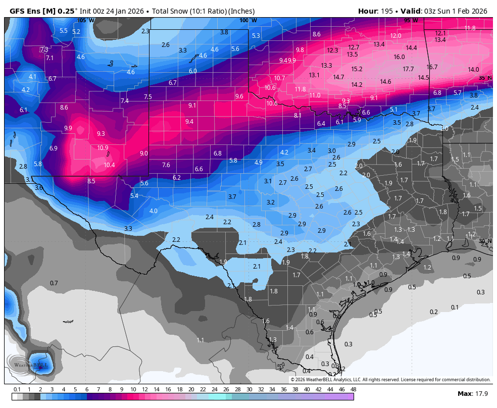
cheezyWXguy wrote:GeauxTigers wrote:cheezyWXguy wrote: With the cold air out west gradually expanding east, and the other surge of cold air coming in from Texarkana, the i35 corridor will probably be the last place to drop below freezing in the immediate metro since that’s about where they’ll ultimately meet.
Is that bad news if I’m 35 miles from I35 near Denton? Or just a delay for the frozen stuff?
Nah, no delay. The subfreezing air was modeled to flood into the area in this way, and it’s still faster that models like the nam and hrrr have been depicting. You also probably won’t see much freezing rain accumulation at ground level at 31/32 degrees, it’ll mainly be on taller things like trees or roofs at those temps. Maybe on your car?
So does that mean my area (Tioga, TX) will get less frzg rain overnight? Or is everything still on track for up here for frz rain overnight night and big sleet tomorrow afternoon with 2nd wave?


