Cerlin wrote:snownado wrote:cheezyWXguy wrote:I think he’s saying it’s an indication it could be trending in that direction, not necessarily that the verbatim output currently shows it
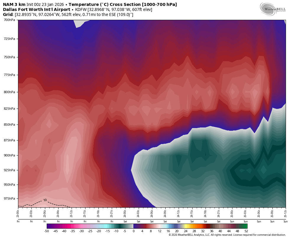
Look at the chart I shared again. There's no way a projected 5-8*C warm nose that is 5,000ft+ deep is just going to trend away in less than 48 hours away.
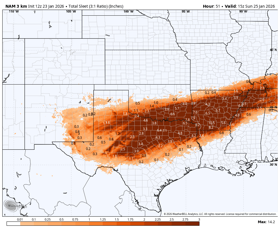
I'd give up hope of any appreciable snowfall at this point for DFW. Of course, it would be a bonus if anything does fall (and there's still a small chance we could see some light snow that leaves a coating on the tail end).
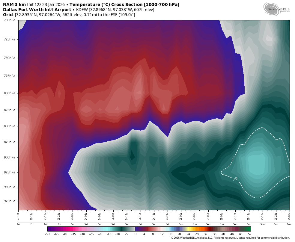
Eh, I don't blame the skepticism but the NAM is the only one that shows that strong of a warm nose. With how much hydrometeor loading is occurring based on the upper level RH patterns, it wouldn't shock me if there is enough adiabatic cooling to erode that warm nose enough to produce snow, even if that's not until Sunday. But that's almost too hard to forecast at this point and we won't know until this front has fully moved through and we get some real observations.
The temp profile throughout the entire column will eventually cool to support snow as the precip type, but it's going to be a race against time with the best forcing and mid-level moisture quickly shifting NE Sunday morning. That said, past history with these type of events would suggest the warm nose will not only take longer to completely erode than even the models project, but also that the backside of the precipitation will move in sooner than expected.
I could certainly understand the "dynamic cooling" argument during peak precipitation rates if the warm nose was a mere 1*C and maybe a few hundred feet in depth without a stiff SW wind in the mid-levels. But that's simply not the case here.
BTW, the other models also have a 5,000ft deep warm nose of at least 3-5*C. The GGEM is perhaps the least ugly-looking, but of course we all know it has its own cold bias.


 The posts in this forum are NOT official forecast and should not be used as such. They are just the opinion of the poster and may or may not be backed by sound meteorological data. They are NOT endorsed by any professional institution or


