WPAC: FENGSHEN - Tropical Storm

Moderator: S2k Moderators

Message
Author
User avatar
Hayabusa
Category 5
Category 5
Posts: 4826
Joined: Sun Sep 16, 2018 1:05 pm

Re: WPAC: INVEST 96W

#21 Postby Hayabusa » Tue Oct 14, 2025 8:55 am

06z deepmind
Image
Image
0 likes   
ヤンデレ女が寝取られるているのを見たい!!!
ECMWF ensemble NWPAC plots: https://ecmwfensnwpac.imgbb.com/
Multimodel NWPAC plots: https://multimodelnwpac.imgbb.com/
GFS Ensemble NWPAC plots (16 & 35 day forecast): https://gefsnwpac.imgbb.com/
Plots updated automatically

User avatar
mrbagyo
Category 5
Category 5
Posts: 3962
Age: 33
Joined: Thu Apr 12, 2012 9:18 am
Location: 14.13N 120.98E
Contact:

Re: WPAC: INVEST 96W

#22 Postby mrbagyo » Tue Oct 14, 2025 4:24 pm

Image
0 likes   
The posts in this forum are NOT official forecast and should not be used as such. They are just the opinion of the poster and may or may not be backed by sound meteorological data. They are NOT endorsed by any professional institution or storm2k.org. For official information, please refer to RSMC, NHC and NWS products.

User avatar
Hayabusa
Category 5
Category 5
Posts: 4826
Joined: Sun Sep 16, 2018 1:05 pm

Re: WPAC: INVEST 96W

#23 Postby Hayabusa » Wed Oct 15, 2025 4:32 am

JMA dissipated it but forecast to reform into a TD within 48 hours
0 likes   
ヤンデレ女が寝取られるているのを見たい!!!
ECMWF ensemble NWPAC plots: https://ecmwfensnwpac.imgbb.com/
Multimodel NWPAC plots: https://multimodelnwpac.imgbb.com/
GFS Ensemble NWPAC plots (16 & 35 day forecast): https://gefsnwpac.imgbb.com/
Plots updated automatically

User avatar
Hayabusa
Category 5
Category 5
Posts: 4826
Joined: Sun Sep 16, 2018 1:05 pm

Re: WPAC: INVEST 96W

#24 Postby Hayabusa » Thu Oct 16, 2025 12:09 am

Back to TD
WWJP27 RJTD 160000
WARNING AND SUMMARY 160000.
WARNING VALID 170000.
WARNING IS UPDATED EVERY 6 HOURS.
WARNING.
TROPICAL DEPRESSION 1006 HPA
AT 13.7N 136.5E SEA EAST OF PHILIPPINES MOVING WNW 10 KNOTS.
POSITION POOR.
MAX WINDS 30 KNOTS NEAR CENTER.
0 likes   
ヤンデレ女が寝取られるているのを見たい!!!
ECMWF ensemble NWPAC plots: https://ecmwfensnwpac.imgbb.com/
Multimodel NWPAC plots: https://multimodelnwpac.imgbb.com/
GFS Ensemble NWPAC plots (16 & 35 day forecast): https://gefsnwpac.imgbb.com/
Plots updated automatically

User avatar
Hayabusa
Category 5
Category 5
Posts: 4826
Joined: Sun Sep 16, 2018 1:05 pm

Re: WPAC: INVEST 96W

#25 Postby Hayabusa » Thu Oct 16, 2025 6:33 am

Latest Euro AI tracking towards Catanduanes then over Southern Luzon
0 likes   
ヤンデレ女が寝取られるているのを見たい!!!
ECMWF ensemble NWPAC plots: https://ecmwfensnwpac.imgbb.com/
Multimodel NWPAC plots: https://multimodelnwpac.imgbb.com/
GFS Ensemble NWPAC plots (16 & 35 day forecast): https://gefsnwpac.imgbb.com/
Plots updated automatically

User avatar
Hayabusa
Category 5
Category 5
Posts: 4826
Joined: Sun Sep 16, 2018 1:05 pm

Re: WPAC: INVEST 96W

#26 Postby Hayabusa » Thu Oct 16, 2025 2:09 pm

Up to medium
ABPW10 PGTW 161900
MSGID/GENADMIN/JOINT TYPHOON WRNCEN PEARL HARBOR HI//
SUBJ/SIGNIFICANT TROPICAL WEATHER ADVISORY FOR THE WESTERN AND SOUTH
PACIFIC OCEANS REISSUED/161900Z-170600ZOCT2025//
RMKS/
1. WESTERN NORTH PACIFIC AREA (180 TO MALAY PENINSULA):
A. TROPICAL CYCLONE SUMMARY: NONE.
B. TROPICAL DISTURBANCE SUMMARY:
(1) THE AREA OF CONVECTION (INVEST 96W) PREVIOUSLY LOCATED NEAR
13.7N 137.1E IS NOW LOCATED NEAR 13.9N 131.5E, APPROXIMATELY 525 NM EAST
OF LEGAZPI, PHILIPPINES. ANIMATED ENHANCED INFRARED SATELLITE IMAGERY
(EIR) DEPICTS A BROAD CONSOLIDATING LOW-LEVEL CIRCULATION EMBEDDED
WITHIN PERSISTENT CONVECTION. ENVIRONMENTAL ANALYSIS REVEALS MARGINALLY
FAVORABLE CONDITIONS FOR DEVELOPMENT WITH MODERATE POLEWARD AND
EQUATORWARD OUTFLOW AND WARM SEA SURFACE TEMPERATURES (30-31 C), AS WELL
AS LOW NORTHWESTERLY VERTICAL WIND SHEAR (10-15 KTS). GLOBAL
DETERMINISTIC AND ENSEMBLE MODELS ARE IN FAIR AGREEMENT THAT INVEST 96W
WILL STEADILY CONSOLIDATE OVER THE NEXT 24-48 HOURS WHILE TRACKING
NORTHWESTWARD. MAXIMUM SUSTAINED SURFACE WINDS ARE ESTIMATED AT 18 TO 23
KNOTS. MINIMUM SEA LEVEL PRESSURE IS ESTIMATED TO BE NEAR 1007 MB. THE
POTENTIAL FOR THE DEVELOPMENT OF A SIGNIFICANT TROPICAL CYCLONE WITHIN
THE NEXT 24 HOURS IS UPGRADED TO MEDIUM.
(2) NO OTHER SUSPECT AREAS.
C. SUBTROPICAL SYSTEM SUMMARY: NONE.
2. SOUTH PACIFIC AREA (WEST COAST OF SOUTH AMERICA TO 135 EAST):
A. TROPICAL CYCLONE SUMMARY: NONE.
B. TROPICAL DISTURBANCE SUMMARY: NONE.
C. SUBTROPICAL SYSTEM SUMMARY: NONE.
3. JUSTIFICATION FOR REISSUE: UPGRADED AREA IN PARA 1.B.(1) TO MEDIUM.//
NNNN
0 likes   
ヤンデレ女が寝取られるているのを見たい!!!
ECMWF ensemble NWPAC plots: https://ecmwfensnwpac.imgbb.com/
Multimodel NWPAC plots: https://multimodelnwpac.imgbb.com/
GFS Ensemble NWPAC plots (16 & 35 day forecast): https://gefsnwpac.imgbb.com/
Plots updated automatically

User avatar
Hayabusa
Category 5
Category 5
Posts: 4826
Joined: Sun Sep 16, 2018 1:05 pm

Re: WPAC: 96W - Tropical Depression

#27 Postby Hayabusa » Thu Oct 16, 2025 2:18 pm

TC warning
Image
TD a
Issued at 2025/10/16 19:15 UTC
Analysis at 10/16 18 UTC
Grade TD
Scale -
Intensity -
Center position N13°40′ (13.7°)
E132°35′ (132.6°)
Direction and speed of movement W 20 km/h (10 kt)
Central pressure 1004 hPa
Maximum sustained wind speed near center 15 m/s (30 kt)
Maximum wind gust speed 23 m/s (45 kt)
Forecast for 10/17 18 UTC
Grade TS
Intensity -
Center position of probability circle N13°35′ (13.6°)
E126°55′ (126.9°)
Direction and speed of movement W 25 km/h (14 kt)
Central pressure 1000 hPa
Maximum sustained wind speed near center 18 m/s (35 kt)
Maximum wind gust speed 25 m/s (50 kt)
Radius of probability circle 130 km (70 NM)
Forecast for 10/18 18 UTC
Grade TS
Intensity -
Center position of probability circle N15°10′ (15.2°)
E123°50′ (123.8°)
Direction and speed of movement WNW 15 km/h (9 kt)
Central pressure 1000 hPa
Maximum sustained wind speed near center 18 m/s (35 kt)
Maximum wind gust speed 25 m/s (50 kt)
Radius of probability circle 200 km (110 NM)
Forecast for 10/19 18 UTC
Grade TS
Intensity -
Center position of probability circle N17°25′ (17.4°)
E118°20′ (118.3°)
Direction and speed of movement WNW 25 km/h (14 kt)
Central pressure 998 hPa
Maximum sustained wind speed near center 18 m/s (35 kt)
Maximum wind gust speed 25 m/s (50 kt)
Radius of probability circle 260 km (140 NM)
Forecast for 10/20 18 UTC
Grade TS
Intensity -
Center position of probability circle N18°05′ (18.1°)
E115°55′ (115.9°)
Direction and speed of movement WNW 10 km/h (6 kt)
Central pressure 996 hPa
Maximum sustained wind speed near center 20 m/s (40 kt)
Maximum wind gust speed 30 m/s (60 kt)
Radius of probability circle 330 km (180 NM)
Forecast for 10/21 18 UTC
Grade TS
Intensity -
Center position of probability circle N17°55′ (17.9°)
E113°50′ (113.8°)
Direction and speed of movement W Slow
Central pressure 992 hPa
Maximum sustained wind speed near center 23 m/s (45 kt)
Maximum wind gust speed 35 m/s (65 kt)
Radius of probability circle 440 km (240 NM)
0 likes   
ヤンデレ女が寝取られるているのを見たい!!!
ECMWF ensemble NWPAC plots: https://ecmwfensnwpac.imgbb.com/
Multimodel NWPAC plots: https://multimodelnwpac.imgbb.com/
GFS Ensemble NWPAC plots (16 & 35 day forecast): https://gefsnwpac.imgbb.com/
Plots updated automatically

User avatar
Hayabusa
Category 5
Category 5
Posts: 4826
Joined: Sun Sep 16, 2018 1:05 pm

Re: WPAC: 96W - Tropical Depression

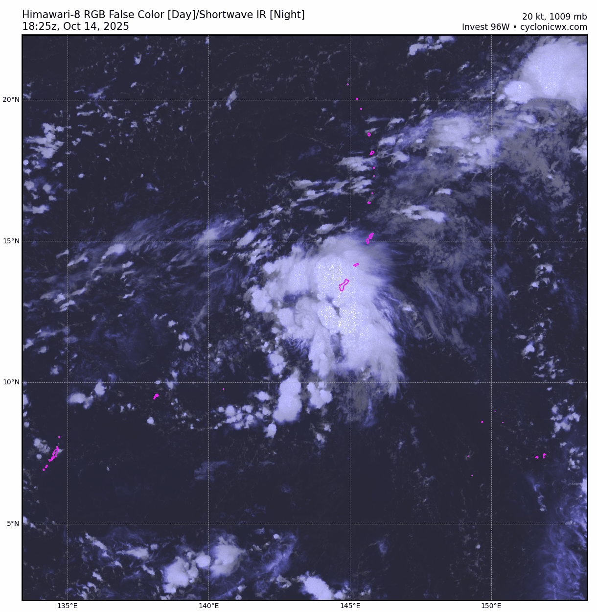
#28 Postby Hayabusa » Thu Oct 16, 2025 11:37 pm

TCFA
Image
WTPN21 PGTW 170300
MSGID/GENADMIN/JOINT TYPHOON WRNCEN PEARL HARBOR HI//
SUBJ/TROPICAL CYCLONE FORMATION ALERT (INVEST 96W)//
RMKS/
1. FORMATION OF A SIGNIFICANT TROPICAL CYCLONE IS POSSIBLE WITHIN
140 NM EITHER SIDE OF A LINE FROM 13.8N 131.2E TO 15.3N 124.1E
WITHIN THE NEXT 12 TO 24 HOURS. AVAILABLE DATA DOES NOT JUSTIFY
ISSUANCE OF NUMBERED TROPICAL CYCLONE WARNINGS AT THIS TIME.
WINDS IN THE AREA ARE ESTIMATED TO BE 18 TO 23 KNOTS. METSAT
IMAGERY AT 170000Z INDICATES THAT A CIRCULATION CENTER IS LOCATED
NEAR 13.8N 131.0E. THE SYSTEM IS MOVING WEST-SOUTHWESTWARD AT 05
KNOTS.
2. REMARKS: THE AREA OF CONVECTION (INVEST 96W) PREVIOUSLY LOCATED NEAR
13.9N 131.5E IS NOW LOCATED NEAR 13.8N 131.0E, APPROXIMATELY 489 NM EAST
OF LEGAZPI, PHILIPPINES. ANIMATED MULTISPECTRAL SATELLITE IMAGERY (MSI)
DEPICTS A CONSOLIDATING LOW-LEVEL CIRCULATION CENTER (LLCC) EMBEDDED
WITHIN PERSISTENT CONVECTION. ENVIRONMENTAL ANALYSIS REVEALS MARGINALLY
FAVORABLE CONDITIONS FOR DEVELOPMENT WITH GOOD RADIAL OUTFLOW, WARM SEA
SURFACE TEMPERATURES (30-31 C), AND LOW NORTHWESTERLY VERTICAL WIND
SHEAR (10-15 KTS). GLOBAL DETERMINISTIC AND ENSEMBLE MODELS ARE IN GOOD
AGREEMENT THAT INVEST 96W WILL STEADILY CONSOLIDATE OVER THE NEXT 24
HOURS WHILE TRACKING NORTHWESTWARD. MAXIMUM SUSTAINED SURFACE WINDS ARE
ESTIMATED AT 18 TO 23 KNOTS. MINIMUM SEA LEVEL PRESSURE IS ESTIMATED TO
BE NEAR 1005 MB. THE POTENTIAL FOR THE DEVELOPMENT OF A SIGNIFICANT
TROPICAL CYCLONE WITHIN THE NEXT 24 HOURS IS HIGH.
3. THIS ALERT WILL BE REISSUED, UPGRADED TO WARNING OR CANCELLED BY
180300Z.//
NNNN
0 likes   
ヤンデレ女が寝取られるているのを見たい!!!
ECMWF ensemble NWPAC plots: https://ecmwfensnwpac.imgbb.com/
Multimodel NWPAC plots: https://multimodelnwpac.imgbb.com/
GFS Ensemble NWPAC plots (16 & 35 day forecast): https://gefsnwpac.imgbb.com/
Plots updated automatically

User avatar
mrbagyo
Category 5
Category 5
Posts: 3962
Age: 33
Joined: Thu Apr 12, 2012 9:18 am
Location: 14.13N 120.98E
Contact:

Re: WPAC: 96W - Tropical Depression

#29 Postby mrbagyo » Fri Oct 17, 2025 12:47 am

Image

Despite the presence of high SST and OHC, good radial outflow, and favorable wind shear, the system still struggles to maintain sustained convection on its northwestern sector — likely due to the intrusion of dry air suppressing convective activity.
0 likes   
The posts in this forum are NOT official forecast and should not be used as such. They are just the opinion of the poster and may or may not be backed by sound meteorological data. They are NOT endorsed by any professional institution or storm2k.org. For official information, please refer to RSMC, NHC and NWS products.

User avatar
Hayabusa
Category 5
Category 5
Posts: 4826
Joined: Sun Sep 16, 2018 1:05 pm

Re: WPAC: 96W - Tropical Depression

#30 Postby Hayabusa » Fri Oct 17, 2025 1:39 am

mrbagyo wrote:https://s12.gifyu.com/images/b3zWO.gif

Despite the presence of high SST and OHC, good radial outflow, and favorable wind shear, the system still struggles to maintain sustained convection on its northwestern sector — likely due to the intrusion of dry air suppressing convective activity.


It really is struggling, the "Philippine sea effect" seems not that really working this year.
0 likes   
ヤンデレ女が寝取られるているのを見たい!!!
ECMWF ensemble NWPAC plots: https://ecmwfensnwpac.imgbb.com/
Multimodel NWPAC plots: https://multimodelnwpac.imgbb.com/
GFS Ensemble NWPAC plots (16 & 35 day forecast): https://gefsnwpac.imgbb.com/
Plots updated automatically

User avatar
Hayabusa
Category 5
Category 5
Posts: 4826
Joined: Sun Sep 16, 2018 1:05 pm

Re: WPAC: FENGSHEN - Tropical Storm

#31 Postby Hayabusa » Fri Oct 17, 2025 2:30 pm

Up to TS
Image
T2524(Fengshen)
Issued at 2025/10/17 19:30 UTC
Analysis at 10/17 18 UTC
Grade TS
Scale -
Intensity -
Center position N12°55′ (12.9°)
E127°25′ (127.4°)
Direction and speed of movement W 25 km/h (13 kt)
Central pressure 1000 hPa
Maximum sustained wind speed near center 18 m/s (35 kt)
Maximum wind gust speed 25 m/s (50 kt)
Radius of 30-kt wind area 220 km (120
0 likes   
ヤンデレ女が寝取られるているのを見たい!!!
ECMWF ensemble NWPAC plots: https://ecmwfensnwpac.imgbb.com/
Multimodel NWPAC plots: https://multimodelnwpac.imgbb.com/
GFS Ensemble NWPAC plots (16 & 35 day forecast): https://gefsnwpac.imgbb.com/
Plots updated automatically

User avatar
cycloneye
Admin
Admin
Posts: 148541
Age: 69
Joined: Thu Oct 10, 2002 10:54 am
Location: San Juan, Puerto Rico

Re: WPAC: FENGSHEN - Tropical Storm

#32 Postby cycloneye » Fri Oct 17, 2025 2:51 pm

0 likes   
Visit the Caribbean-Central America Weather Thread where you can find at first post web cams,radars
and observations from Caribbean basin members Click Here

User avatar
cycloneye
Admin
Admin
Posts: 148541
Age: 69
Joined: Thu Oct 10, 2002 10:54 am
Location: San Juan, Puerto Rico

Re: WPAC: FENGSHEN - Tropical Storm

#33 Postby cycloneye » Fri Oct 17, 2025 7:15 pm

0 likes   
Visit the Caribbean-Central America Weather Thread where you can find at first post web cams,radars
and observations from Caribbean basin members Click Here

User avatar
Hayabusa
Category 5
Category 5
Posts: 4826
Joined: Sun Sep 16, 2018 1:05 pm

Re: WPAC: FENGSHEN - Tropical Storm

#34 Postby Hayabusa » Sat Oct 18, 2025 4:12 am

Looks like landfall over Sorsogon at 0900z
0 likes   
ヤンデレ女が寝取られるているのを見たい!!!
ECMWF ensemble NWPAC plots: https://ecmwfensnwpac.imgbb.com/
Multimodel NWPAC plots: https://multimodelnwpac.imgbb.com/
GFS Ensemble NWPAC plots (16 & 35 day forecast): https://gefsnwpac.imgbb.com/
Plots updated automatically

User avatar
Hayabusa
Category 5
Category 5
Posts: 4826
Joined: Sun Sep 16, 2018 1:05 pm

Re: WPAC: FENGSHEN - Tropical Storm

#35 Postby Hayabusa » Sat Oct 18, 2025 11:30 am

JMA 15Z changed track again
Image
0 likes   
ヤンデレ女が寝取られるているのを見たい!!!
ECMWF ensemble NWPAC plots: https://ecmwfensnwpac.imgbb.com/
Multimodel NWPAC plots: https://multimodelnwpac.imgbb.com/
GFS Ensemble NWPAC plots (16 & 35 day forecast): https://gefsnwpac.imgbb.com/
Plots updated automatically


Return to “2025”

Who is online

Users browsing this forum: No registered users and 33 guests