Ok folks, there is a new thread for wave inside Africa and now the members can post the model runs there.
https://www.storm2k.org/phpbb2/viewtopi ... 3#p3130543
2025 Global Model Runs Discussion (Out thru day 16)
Moderator: S2k Moderators
Forum rules

The posts in this forum are NOT official forecasts and should not be used as such. They are just the opinion of the poster and may or may not be backed by sound meteorological data. They are NOT endorsed by any professional institution or STORM2K. For official information, please refer to products from the National Hurricane Center and National Weather Service.
-
cycloneye

- Admin

- Posts: 149727
- Age: 69
- Joined: Thu Oct 10, 2002 10:54 am
- Location: San Juan, Puerto Rico
Re: 2025 Global Model Runs Discussion (Out thru day 16)
4 likes
Visit the Caribbean-Central America Weather Thread where you can find at first post web cams,radars
and observations from Caribbean basin members Click Here
and observations from Caribbean basin members Click Here
-
DorkyMcDorkface

- Category 5

- Posts: 1044
- Age: 28
- Joined: Mon Sep 30, 2019 1:32 pm
- Location: Mid-Atlantic
Re: 2025 Global Model Runs Discussion (Out thru day 16)
2 likes
Please note the thoughts expressed by this account are solely those of the user and are from a hobbyist perspective. For more comprehensive analysis, consult an actual professional meteorologist or meteorological agency.
Floyd 1999 | Isabel 2003 | Hanna 2008 | Irene 2011 | Sandy 2012 | Isaias 2020
-
TomballEd
- Category 5
- Posts: 1322
- Age: 62
- Joined: Wed Aug 16, 2023 4:52 pm
- Location: Spring/Klein area, not Tomball
Re: 2025 Global Model Runs Discussion (Out thru day 16)
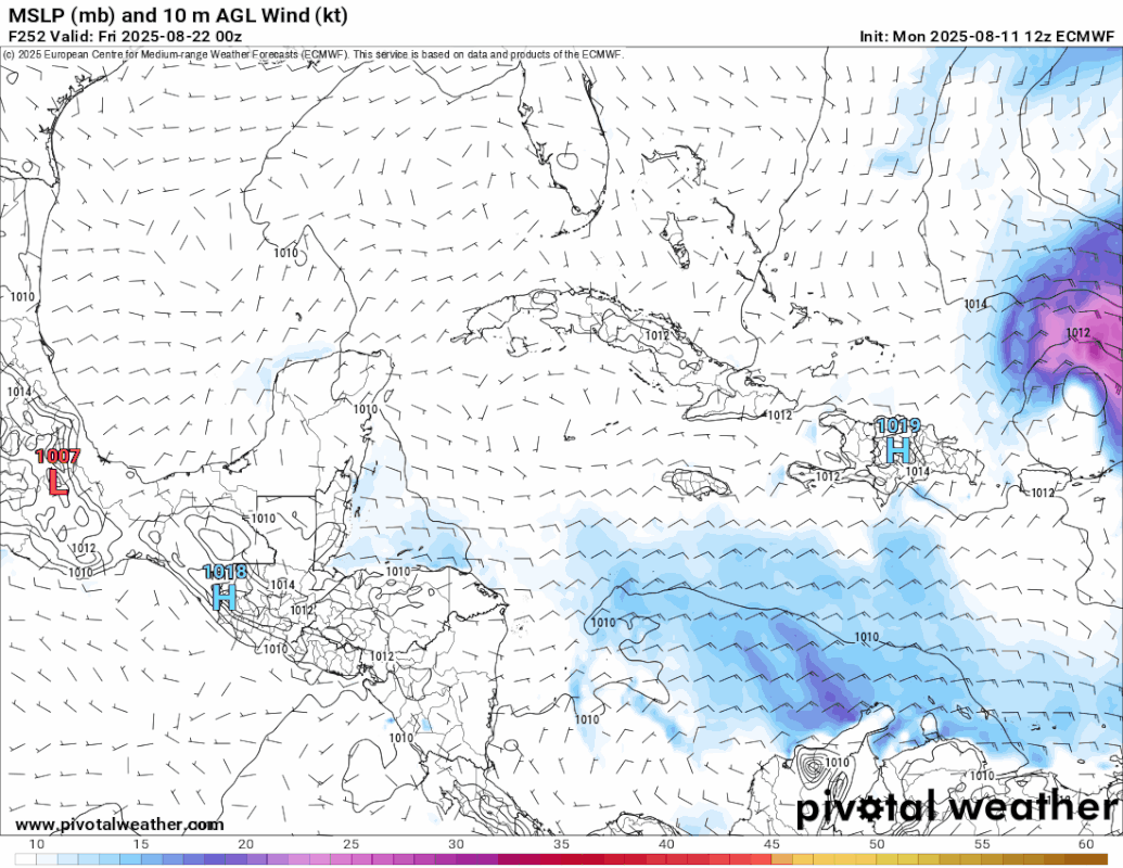
12Z GFS a little more sedate. 2 storms on the run but neither looks to threaten land except maybe Bermuda*. The wave in the Caribbean various models and ensembles saw moving in day 4/5 is still there with some vorticity and enhanced PW but other than a last minute attempt to spin up in the BoC interrupted by landfall in mainland Mexico it doesn't do much. Looks like a lone ensemble member is enthusiastic above that.
Not all the GFS ensemble members miss land on the wave over Africa with its own thread.
Not all the GFS ensemble members miss land on the wave over Africa with its own thread.
0 likes
-
Stratton23
- Category 5
- Posts: 3577
- Joined: Fri Jul 21, 2023 10:59 pm
- Location: Katy, Tx
Re: 2025 Global Model Runs Discussion (Out thru day 16)
Interesting to see the 18z GFS does develop a more consolidated vortex in the NW caribbean from our tropical wave near the leeward uslands in about a week, moves into central mexico around tampico, may still be worth watching for any surprises
2 likes
-
cycloneye
- Admin
- Posts: 149727
- Age: 69
- Joined: Thu Oct 10, 2002 10:54 am
- Location: San Juan, Puerto Rico
Re: 2025 Global Model Runs Discussion (Out thru day 16)
Great news about more improvements to some models like HAFS.
https://x.com/AndyHazelton/status/1953791273418039745
https://x.com/AndyHazelton/status/1953791273418039745
6 likes
Visit the Caribbean-Central America Weather Thread where you can find at first post web cams,radars
and observations from Caribbean basin members Click Here
and observations from Caribbean basin members Click Here
Re: 2025 Global Model Runs Discussion (Out thru day 16)
The euro and GFS have another system behind the new wave off Africa. The 0z GFS develops it into a hurricane in the Western Caribbean and goes over both Jamaica and the Cayman Islands, but the Euro takes it just north of the islands. Beyond that it looks like it gets into the Gulf.
0z euro:

0z gfs:

0z euro:
0z gfs:
1 likes
-
cycloneye
- Admin
- Posts: 149727
- Age: 69
- Joined: Thu Oct 10, 2002 10:54 am
- Location: San Juan, Puerto Rico
Re: 2025 Global Model Runs Discussion (Out thru day 16)
06z GFS did not had anything from that Caribbean one.
0 likes
Visit the Caribbean-Central America Weather Thread where you can find at first post web cams,radars
and observations from Caribbean basin members Click Here
and observations from Caribbean basin members Click Here
Re: 2025 Global Model Runs Discussion (Out thru day 16)
12z Euro has this at the end of the Run (from the system behind 97L)

1 likes
-
cycloneye
- Admin
- Posts: 149727
- Age: 69
- Joined: Thu Oct 10, 2002 10:54 am
- Location: San Juan, Puerto Rico
Re: 2025 Global Model Runs Discussion (Out thru day 16)
12z Euro develops another wave behind 97L and moves just north of the Greater Antilles but is long range and you know the drill.

1 likes
Visit the Caribbean-Central America Weather Thread where you can find at first post web cams,radars
and observations from Caribbean basin members Click Here
and observations from Caribbean basin members Click Here
-
WeatherBoy2000
- Category 1

- Posts: 463
- Joined: Mon Apr 10, 2023 9:29 am
Re: 2025 Global Model Runs Discussion (Out thru day 16)
cycloneye wrote:12z Euro develops another wave behind 97L and moves just north of the Greater Antilles but is long range and you know the drill.
https://i.imgur.com/iIYRi9g.gif
The eps is also showing more mdr development opportunities after 97l, not surprising given the favorable mjo and peak season climo.
1 likes

Re: 2025 Global Model Runs Discussion (Out thru day 16)
cycloneye wrote:12z Euro develops another wave behind 97L and moves just north of the Greater Antilles but is long range and you know the drill.
https://i.imgur.com/iIYRi9g.gif
0Z UKMET for what may be first AEW behind 97L:
NEW TROPICAL CYCLONE FORECAST TO DEVELOP AFTER 150 HOURS
FORECAST POSITION AT T+150 : 16.0N 49.7W
LEAD CENTRAL MAXIMUM WIND
VERIFYING TIME TIME POSITION PRESSURE (MB) SPEED (KNOTS)
-------------- ---- -------- ------------- -------------
1200UTC 17.08.2025 156 17.0N 51.1W 1010 27
0000UTC 18.08.2025 168 18.4N 53.9W 1011 24
2 likes
Personal Forecast Disclaimer:
The posts in this forum are NOT official forecasts and should not be used as such. They are just the opinion of the poster and may or may not be backed by sound meteorological data. They are NOT endorsed by any professional institution or storm2k.org. For official information, please refer to the NHC and NWS products.
The posts in this forum are NOT official forecasts and should not be used as such. They are just the opinion of the poster and may or may not be backed by sound meteorological data. They are NOT endorsed by any professional institution or storm2k.org. For official information, please refer to the NHC and NWS products.
Re: 2025 Global Model Runs Discussion (Out thru day 16)
12z Euro shows this after Erin: A bit too close to the 20th Anniversary of Katrina for me.
Last edited by BobHarlem on Mon Aug 11, 2025 1:25 pm, edited 1 time in total.
2 likes
-
cycloneye
- Admin
- Posts: 149727
- Age: 69
- Joined: Thu Oct 10, 2002 10:54 am
- Location: San Juan, Puerto Rico
Re: 2025 Global Model Runs Discussion (Out thru day 16)
Is long range from 12z Euro operational for wave behind Erin.

2 likes
Visit the Caribbean-Central America Weather Thread where you can find at first post web cams,radars
and observations from Caribbean basin members Click Here
and observations from Caribbean basin members Click Here

Re: 2025 Global Model Runs Discussion (Out thru day 16)
cycloneye wrote:Is long range from 12z Euro operational for wave behind Erin.
https://i.imgur.com/22fD6o1.gif
The euro has been pretty adamant on developing a wave into the Caribbean. It seems to be the only one so far though
1 likes
-
Stratton23
- Category 5
- Posts: 3577
- Joined: Fri Jul 21, 2023 10:59 pm
- Location: Katy, Tx
Re: 2025 Global Model Runs Discussion (Out thru day 16)
18z Euro has some sort of weak low, decent spin at 500, 700 and 850 mb levels moving into brownsville at hour 96, whats that from?
1 likes
-
jaguars_22
- Category 2

- Posts: 629
- Joined: Tue Jun 20, 2017 2:26 pm
- Location: Victoria TX
Re: 2025 Global Model Runs Discussion (Out thru day 16)
Stratton I been seeing that the past few runs now and the gfs has had a weak low moving into Corpus Saturday! Hope we get some clouds from it!!!
0 likes

-
cycloneye
- Admin
- Posts: 149727
- Age: 69
- Joined: Thu Oct 10, 2002 10:54 am
- Location: San Juan, Puerto Rico
Re: 2025 Global Model Runs Discussion (Out thru day 16)
12z Euro develops wave behind Erin and recurves well east in the central atlantic.

4 likes
Visit the Caribbean-Central America Weather Thread where you can find at first post web cams,radars
and observations from Caribbean basin members Click Here
and observations from Caribbean basin members Click Here
-
TomballEd
- Category 5
- Posts: 1322
- Age: 62
- Joined: Wed Aug 16, 2023 4:52 pm
- Location: Spring/Klein area, not Tomball
Re: 2025 Global Model Runs Discussion (Out thru day 16)
There be a 98L/Fernand after Erin, which will also almost immediately recurve. Might be another after that. Maybe.
After that, anything would probably be 'home brew'. I see the random systems closer to the US but ensembles usually manage to get a random storm forecast Famous last words but I think the tropics will be quiet the next two weeks
Hoping we do get major hurricane satellite imagery from Erin and any possible MDR storm that may follow in its foot steps.
1 likes
Who is online
Users browsing this forum: No registered users and 109 guests