
The third one.

Moderator: S2k Moderators


Kingarabian wrote:Going to side with the GFS here since this season has been anything but normal so far. All 3 systems the GFS shows after Flossie are there on the Euro and CMC. Just with different strengths.

Kingarabian wrote:Models lining up with the GFS. Good consensus that we'll see two solid systems over the next 10 days.
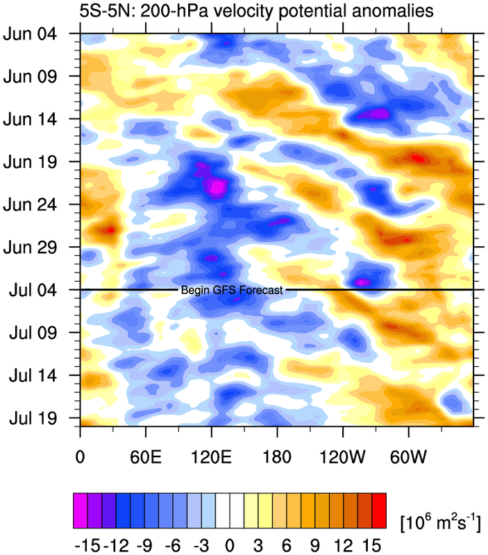
The dominant eastern EPAC -VP200 anomalies have extended west.


Users browsing this forum: No registered users and 174 guests
