EPAC: ALVIN - Remnant - Discussion
Moderator: S2k Moderators
-
Kingarabian

- S2K Supporter

- Posts: 16383
- Joined: Sat Aug 08, 2009 3:06 am
- Location: Honolulu, Hawaii
Re: EPAC: INVEST 90E - Discussion
Mid shear dropping. Was about 15kts for the past 24hrs.
1 likes
RIP Kobe Bryant
-
cycloneye

- Admin

- Posts: 149797
- Age: 69
- Joined: Thu Oct 10, 2002 10:54 am
- Location: San Juan, Puerto Rico
Re: EPAC: INVEST 90E - Discussion
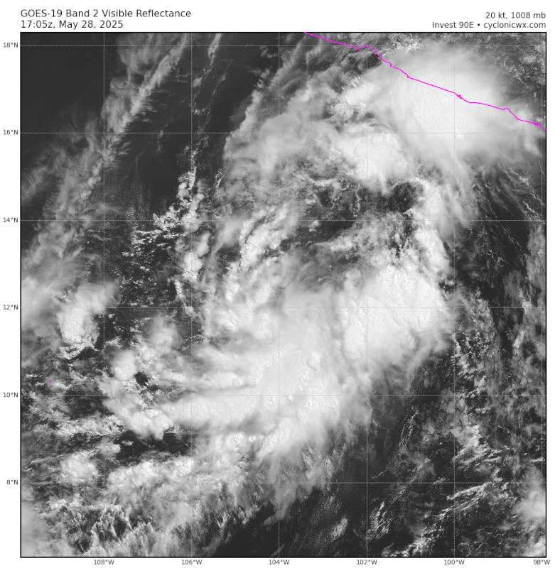
Is still looking with no convection near the circulation and time is running out with the cold waters and shear looming to the north. Looks lika a skeleton. 

0 likes
Visit the Caribbean-Central America Weather Thread where you can find at first post web cams,radars
and observations from Caribbean basin members Click Here
and observations from Caribbean basin members Click Here
-
cycloneye
- Admin
- Posts: 149797
- Age: 69
- Joined: Thu Oct 10, 2002 10:54 am
- Location: San Juan, Puerto Rico
Re: EPAC: INVEST 90E - Discussion
Tropical Weather Outlook
NWS National Hurricane Center Miami FL
500 AM PDT Wed May 28 2025
For the eastern North Pacific...east of 140 degrees west longitude:
South of the Southern Coast of Mexico (EP90):
An elongated area of low pressure located several hundred miles
south of the coast of southern Mexico continues to produce showers
and thunderstorms, but the system still lacks a well-defined
circulation. Environmental conditions remain favorable for further
development, and a tropical depression or tropical storm is expected
to form later today or tonight as the low moves generally
west-northwestward at around 10 mph. For marine forecasts, including
gale warnings, see High Seas Forecast issued by the National Weather
Service.
* Formation chance through 48 hours...high...near 100 percent.
* Formation chance through 7 days...high...near 100 percent.
High Seas Forecasts issued by the National Weather Service
can be found under AWIPS header NFDHSFEPI, WMO header FZPN02
KWBC, and on the web at ocean.weather.gov/shtml/NFDHSFEPI.php
$$
Forecaster Kelly/Mora
0 likes
Visit the Caribbean-Central America Weather Thread where you can find at first post web cams,radars
and observations from Caribbean basin members Click Here
and observations from Caribbean basin members Click Here
-
cycloneye
- Admin
- Posts: 149797
- Age: 69
- Joined: Thu Oct 10, 2002 10:54 am
- Location: San Juan, Puerto Rico
Re: EPAC: INVEST 90E - Discussion
The 12z position is much closer to that convection. EP, 90, 2025052812, , BEST, 0, 12.3N, 103.9W, 20, 1008, DB

0 likes
Visit the Caribbean-Central America Weather Thread where you can find at first post web cams,radars
and observations from Caribbean basin members Click Here
and observations from Caribbean basin members Click Here
-
TallyTracker
- Category 2

- Posts: 787
- Joined: Thu Oct 11, 2018 2:46 pm
Re: EPAC: INVEST 90E - Discussion
This is it for this invest. If it doesn’t develop in the next 12 hours, I don’t think it will develop at all. Moderate TS seems to be the top end now as well.
1 likes
Fran '96, Georges '98, Gordon '00, Gabrielle '01, Charley '04, Frances '04, Jeanne '04, Barry '07, Fay '08, Debby '12, Matthew '16, Emily '17, Irma '17, Michael ‘18, Elsa ‘21, Fred ‘21, Mindy ‘21, Nicole ‘22, Idalia ‘23, Debby ‘24, Helene ‘24
-
cycloneye
- Admin
- Posts: 149797
- Age: 69
- Joined: Thu Oct 10, 2002 10:54 am
- Location: San Juan, Puerto Rico
Re: EPAC: INVEST 90E - Discussion
0 likes
Visit the Caribbean-Central America Weather Thread where you can find at first post web cams,radars
and observations from Caribbean basin members Click Here
and observations from Caribbean basin members Click Here
-
cycloneye
- Admin
- Posts: 149797
- Age: 69
- Joined: Thu Oct 10, 2002 10:54 am
- Location: San Juan, Puerto Rico
Re: EPAC: INVEST 90E - Discussion
Tropical Weather Outlook
NWS National Hurricane Center Miami FL
1100 AM PDT Wed May 28 2025
For the eastern North Pacific...east of 140 degrees west longitude:
South of the Southern Coast of Mexico (EP90):
Satellite imagery shows showers and thunderstorms are becoming
better organized around an area of low pressure located several
hundred miles south of the coast of southern Mexico. However, the
system still appears to lack a well-defined center of circulation.
Environmental conditions remain favorable for further development,
and a tropical depression or tropical storm is expected to form
later today or tonight as the low moves generally west-northwestward
at around 10 mph. For marine forecasts, including gale warnings, see
High Seas Forecast issued by the National Weather Service.
* Formation chance through 48 hours...high...near 100 percent.
* Formation chance through 7 days...high...near 100 percent.
&&
High Seas Forecasts issued by the National Weather Service
can be found under AWIPS header NFDHSFEPI, WMO header FZPN02
KWBC, and on the web at ocean.weather.gov/shtml/NFDHSFEPI.php
$$
Forecaster Kelly/Mora
0 likes
Visit the Caribbean-Central America Weather Thread where you can find at first post web cams,radars
and observations from Caribbean basin members Click Here
and observations from Caribbean basin members Click Here
-
Sciencerocks
- Category 5

- Posts: 10194
- Age: 40
- Joined: Thu Jul 06, 2017 1:51 am
Re: EPAC: INVEST 90E - Discussion

90E is coming together nicely and now has an LLC + convection. Should be getting upgraded soon and possibly named if ascat or a sab or tafb number comes in high enough in support of such.
1 likes
-
Kingarabian
- S2K Supporter
- Posts: 16383
- Joined: Sat Aug 08, 2009 3:06 am
- Location: Honolulu, Hawaii
Re: EPAC: INVEST 90E - Discussion
Some good banding on both IR and VIS. TD on Dvorak. Would classify it already unless they want to see if it's going to fall apart again.
0 likes
RIP Kobe Bryant
-
cycloneye
- Admin
- Posts: 149797
- Age: 69
- Joined: Thu Oct 10, 2002 10:54 am
- Location: San Juan, Puerto Rico
Re: EPAC: INVEST 90E - Discussion
EP, 90, 2025052818, , BEST, 0, 115N, 1044W, 30, 1006, LO
0 likes
Visit the Caribbean-Central America Weather Thread where you can find at first post web cams,radars
and observations from Caribbean basin members Click Here
and observations from Caribbean basin members Click Here
-
Yellow Evan

- Professional-Met

- Posts: 16257
- Age: 27
- Joined: Fri Jul 15, 2011 12:48 pm
- Location: Henderson, Nevada/Honolulu, HI
- Contact:
Re: EPAC: INVEST 90E - Discussion
Latest ASCAT somewhat surprisingly has a well defined circulation. Now resembling a tropical cyclone rather than a monsoon depression.
1 likes
-
galaxy401

- Category 5
- Posts: 2446
- Age: 30
- Joined: Sat Aug 25, 2012 9:04 pm
- Location: Casa Grande, Arizona
Re: EPAC: INVEST 90E - Discussion
Anyone else not able to access the satellite view for the East Pacific on the NHC website? It's annoying me since I have to go to other sites including here to see them.
0 likes
Got my eyes on moving right into Hurricane Alley: Florida.
-
Kingarabian
- S2K Supporter
- Posts: 16383
- Joined: Sat Aug 08, 2009 3:06 am
- Location: Honolulu, Hawaii
-
AnnularCane

- S2K Supporter
- Posts: 2964
- Joined: Thu Jun 08, 2006 9:18 am
- Location: Wytheville, VA
Re: EPAC: INVEST 90E - Discussion
galaxy401 wrote:Anyone else not able to access the satellite view for the East Pacific on the NHC website? It's annoying me since I have to go to other sites including here to see them.
The satellites are there, but I don't see any floaters. Is that what you're looking for?
Tropical Tidbits is typically my go-to site.
https://www.tropicaltidbits.com/sat/
0 likes
"But it never rained rain. It never snowed snow. And it never blew just wind. It rained things like soup and juice. It snowed mashed potatoes and green peas. And sometimes the wind blew in storms of hamburgers." -- Judi Barrett, Cloudy with a Chance of Meatballs
-
cycloneye
- Admin
- Posts: 149797
- Age: 69
- Joined: Thu Oct 10, 2002 10:54 am
- Location: San Juan, Puerto Rico
Re: EPAC: ONE-E - Tropical Depression - Discussion
We have ONE-E.

Tropical Depression One-E Discussion Number 1
NWS National Hurricane Center Miami FL EP012025
300 PM CST Wed May 28 2025
Showers and thunderstorms associated with an area of low pressure
have continued to become better organized over the past 12 hours.
Some banding features have become more pronounced over the southern
semi-circle. Recent scatterometer data depicts that the system now
has a well-defined low-level center. Thus, the system is now
classified as a tropical depression, the first of the eastern
Pacific season. The initial intensity is set at 30 kt based on a
T2.0 Dvorak classification from TAFB.
The initial estimated motion is northwest at 320/8 kt, although
there is higher uncertainty in this motion given the recent
low-level center formation. Models are in fairly good agreement
that the system should continue northwest to north-northwest over
the next few days within the low-level flow. Environmental
conditions are favorable for strengthening over the next couple of
days with warm sea surface temperatures and low wind shear. After
48 h the system is likely to enter a fairly harsh environment with
drier mid-level air, cooler sea surface temperatures, and increasing
wind shear which should induce a weakening trend. The latest model
simulated IR satellite imagery shows that convection is likely to
collapse by Saturday, and the system is forecast to become a remnant
low and dissipate early next week.
FORECAST POSITIONS AND MAX WINDS
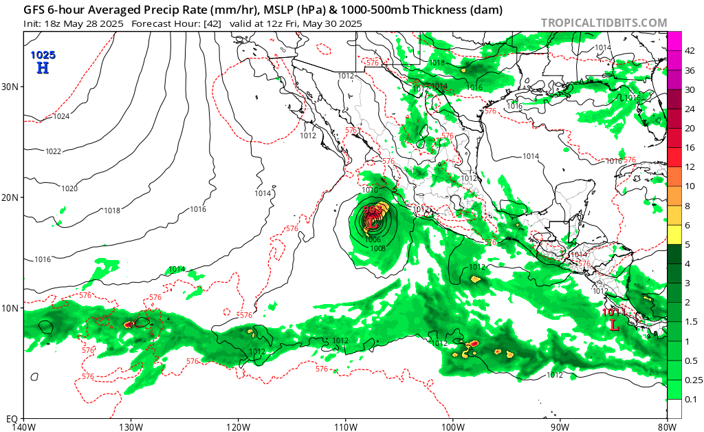
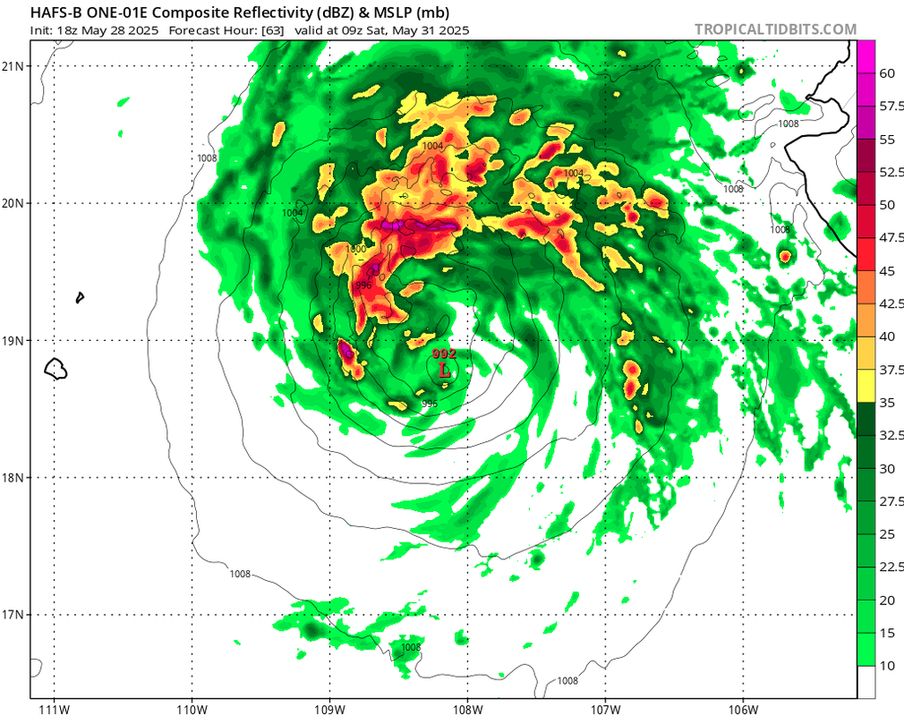
INIT 28/2100Z 11.9N 104.7W 30 KT 35 MPH
12H 29/0600Z 12.9N 105.6W 35 KT 40 MPH
24H 29/1800Z 13.9N 107.4W 45 KT 50 MPH
36H 30/0600Z 15.2N 108.6W 55 KT 65 MPH
48H 30/1800Z 16.7N 109.0W 50 KT 60 MPH
60H 31/0600Z 18.6N 109.0W 40 KT 45 MPH
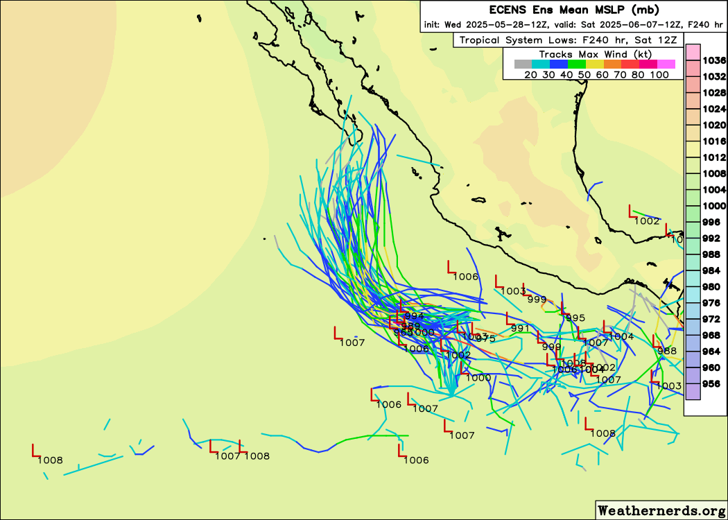
72H 31/1800Z 20.1N 109.0W 30 KT 35 MPH...POST-TROP/REMNT LOW
96H 01/1800Z 23.1N 109.2W 25 KT 30 MPH...POST-TROP/REMNT LOW
120H 02/1800Z...DISSIPATED
$$
Forecaster Kelly/Mora
NWS National Hurricane Center Miami FL EP012025
300 PM CST Wed May 28 2025
Showers and thunderstorms associated with an area of low pressure
have continued to become better organized over the past 12 hours.
Some banding features have become more pronounced over the southern
semi-circle. Recent scatterometer data depicts that the system now
has a well-defined low-level center. Thus, the system is now
classified as a tropical depression, the first of the eastern
Pacific season. The initial intensity is set at 30 kt based on a
T2.0 Dvorak classification from TAFB.
The initial estimated motion is northwest at 320/8 kt, although
there is higher uncertainty in this motion given the recent
low-level center formation. Models are in fairly good agreement
that the system should continue northwest to north-northwest over
the next few days within the low-level flow. Environmental
conditions are favorable for strengthening over the next couple of
days with warm sea surface temperatures and low wind shear. After
48 h the system is likely to enter a fairly harsh environment with
drier mid-level air, cooler sea surface temperatures, and increasing
wind shear which should induce a weakening trend. The latest model
simulated IR satellite imagery shows that convection is likely to
collapse by Saturday, and the system is forecast to become a remnant
low and dissipate early next week.
FORECAST POSITIONS AND MAX WINDS
INIT 28/2100Z 11.9N 104.7W 30 KT 35 MPH
12H 29/0600Z 12.9N 105.6W 35 KT 40 MPH
24H 29/1800Z 13.9N 107.4W 45 KT 50 MPH
36H 30/0600Z 15.2N 108.6W 55 KT 65 MPH
48H 30/1800Z 16.7N 109.0W 50 KT 60 MPH
60H 31/0600Z 18.6N 109.0W 40 KT 45 MPH
72H 31/1800Z 20.1N 109.0W 30 KT 35 MPH...POST-TROP/REMNT LOW
96H 01/1800Z 23.1N 109.2W 25 KT 30 MPH...POST-TROP/REMNT LOW
120H 02/1800Z...DISSIPATED
$$
Forecaster Kelly/Mora
2 likes
Visit the Caribbean-Central America Weather Thread where you can find at first post web cams,radars
and observations from Caribbean basin members Click Here
and observations from Caribbean basin members Click Here
-
AnnularCane
- S2K Supporter
- Posts: 2964
- Joined: Thu Jun 08, 2006 9:18 am
- Location: Wytheville, VA
Re: EPAC: ONE-E - Tropical Depression - Discussion
It finally becomes a TD and everybody clams up? 
3 likes
"But it never rained rain. It never snowed snow. And it never blew just wind. It rained things like soup and juice. It snowed mashed potatoes and green peas. And sometimes the wind blew in storms of hamburgers." -- Judi Barrett, Cloudy with a Chance of Meatballs

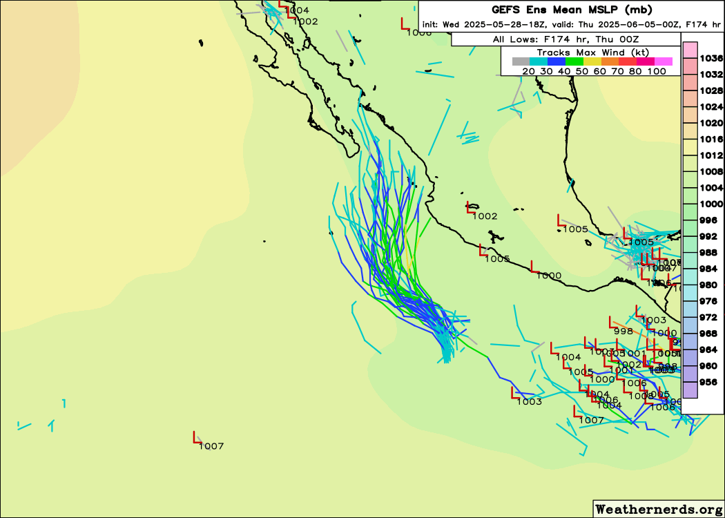
Re: EPAC: ONE-E - Tropical Depression - Discussion
AnnularCane wrote:It finally becomes a TD and everybody clams up?
In fairness, compared to the expectations days earlier, it's harder to get excited when all high-end scenarios are virtually gone:
1 likes
TC naming lists: retirements and intensity
Most aggressive Advisory #1's in North Atlantic (cr. kevin for starting the list)
Most aggressive Advisory #1's in North Atlantic (cr. kevin for starting the list)
-
cycloneye
- Admin
- Posts: 149797
- Age: 69
- Joined: Thu Oct 10, 2002 10:54 am
- Location: San Juan, Puerto Rico
Re: EPAC: ONE-E - Tropical Depression - Discussion
No Alvin yet. It has a small window of 24 to 36 hours to intensify.


EP, 01, 2025052900, , BEST, 0, 124N, 1046W, 30, 1006, TD
0 likes
Visit the Caribbean-Central America Weather Thread where you can find at first post web cams,radars
and observations from Caribbean basin members Click Here
and observations from Caribbean basin members Click Here
-
Kingarabian
- S2K Supporter
- Posts: 16383
- Joined: Sat Aug 08, 2009 3:06 am
- Location: Honolulu, Hawaii
Re: EPAC: ONE-E - Tropical Depression - Discussion
BD imagery supports a TS even though no CDO feature yet. Up to T2.5. Banding very nicely now.
0 likes
RIP Kobe Bryant
Who is online
Users browsing this forum: No registered users and 139 guests