
Is the forecast "bust" by most models on high temps today (at least so far in SE Texas), mainly due to cloud cover that the models did not anticipate, or under estimating the strength of the cold air?
Sorry - just now seeing this was addressed in the previous page...
Texas Winter 2024-2025
Moderator: S2k Moderators
Forum rules
 The posts in this forum are NOT official forecast and should not be used as such. They are just the opinion of the poster and may or may not be backed by sound meteorological data. They are NOT endorsed by any professional institution or STORM2K.

The posts in this forum are NOT official forecast and should not be used as such. They are just the opinion of the poster and may or may not be backed by sound meteorological data. They are NOT endorsed by any professional institution or STORM2K.
Re: Texas Winter 2024-2025
0 likes
Any forecast I make is based on my opinion only. Please refer to the NWS or NHC for official forecasts.
-
txtwister78

- Category 5

- Posts: 2236
- Joined: Wed Jan 30, 2019 12:56 pm
- Location: San Antonio
Re: Texas Winter 2024-2025
Portastorm wrote:txtwister78 wrote:utpmg wrote:Generally not one to fault NWS performance, but only two days ago they were forecasting 28/40 for last night today. Just now EWX lowered high for to day to 29.
Cloud cover has made the difference mostly for the adjustment in temps downward. Models had more clearing than what verified so temps have remained colder across a good portion of the state.
https://cdn.star.nesdis.noaa.gov/GOES16/ABI/SECTOR/sp/GEOCOLOR/20250501851_GOES16-ABI-sp-GEOCOLOR-1200x1200.jpg
There’s been a number of surprises, really. Real temps ended up much colder than most modeling showed. Snow flurries occurred and that wasn’t shown. And now today a significant lowering of forecasted high temps.
It’s been a challenging period for the forecasters.
Agreed. Globals were definitely too warm across the board in the short range. Snow flurries were a nice surprise but then again models/even our high-resolution guidance can struggle to pick up on those ripple disturbances, but to your point forecasters really didn't either as most had us clearing out with no mention of what ended up verifying this morning. The challenge may continue Friday morning down our way if short range guidance continues to trend with precipitation. Always a few surprises with these events no doubt.
0 likes


Re: Texas Winter 2024-2025
Also helps that we still have CAA even up in Kansas. Air is still surging southward, being fought against by the insolation. 1053mb high now in SD/NE border, it's largely held strength so no issues providing height rises for CAA. The only thing keeping tonight's temps from bottoming out is the wind mixing.

5 likes
The above post and any post by Ntxw is NOT an official forecast and should not be used as such. It is just the opinion of the poster and may or may not be backed by sound meteorological data. It is NOT endorsed by any professional institution including Storm2k. For official information, please refer to NWS products.
Help support Storm2K!
-
orangeblood
- S2K Supporter

- Posts: 3895
- Joined: Tue Dec 15, 2009 6:14 pm
- Location: Fort Worth, TX
Re: Texas Winter 2024-2025
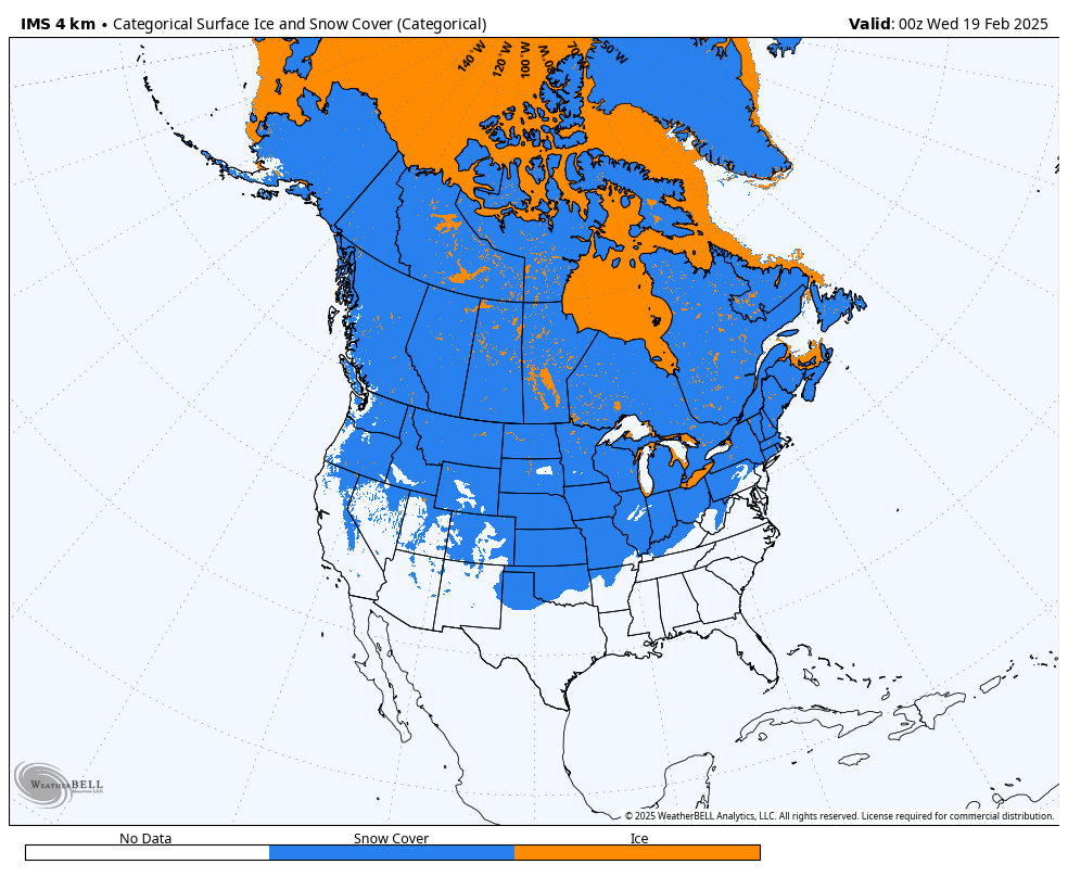
Great North America snowpack and the coldest temperatures on the planet relative to normal, by a longshot, currently in our backyards!!!

7 likes
-
TropicalTundra

- S2K Supporter
- Posts: 738
- Joined: Wed Oct 16, 2019 12:56 pm
- Location: Temple, Texas
Re: Texas Winter 2024-2025
No more snow falling & any that was on the side of the road or on concrete melted away. Shucks, oh well.
2 likes
Snow in Texas? What’s that?
Don't use my posts as forecast; I'm not a certified meteorologist! I just endorse cold weather, alright?
All observations I note are for Temple, Texas unless otherwise stated.
-
orangeblood
- S2K Supporter
- Posts: 3895
- Joined: Tue Dec 15, 2009 6:14 pm
- Location: Fort Worth, TX
Re: Texas Winter 2024-2025
Important to document the performance of these models in these extreme events....here were the temps at 1pm
Actual temps

Compared to the short range forecasts.... (the NAM3k even in real time is out to lunch. CMC ICON RGEM did decent. What's most interesting is the Euro AI did really well even from longer range)
CMC

Euro AI

ICON

Euro Op

GFS

NAM3k

Actual temps
Compared to the short range forecasts.... (the NAM3k even in real time is out to lunch. CMC ICON RGEM did decent. What's most interesting is the Euro AI did really well even from longer range)
CMC
Euro AI
ICON
Euro Op
GFS
NAM3k
4 likes
Re: Texas Winter 2024-2025
Kudos to the FW office for catching on to the LES/enhanced yesterday. Not everyone won that department, usually narrow and not every lake overperformed. It made the lucky few the bitter cold not as boring. That's a few times now we have been able to see it in action the past few years and good experience what to look for in the future.
Wxman57 can build all the walls he wants to, we're building lakes! Build 'em and it will come!
Wxman57 can build all the walls he wants to, we're building lakes! Build 'em and it will come!
10 likes
The above post and any post by Ntxw is NOT an official forecast and should not be used as such. It is just the opinion of the poster and may or may not be backed by sound meteorological data. It is NOT endorsed by any professional institution including Storm2k. For official information, please refer to NWS products.
Help support Storm2K!
Help support Storm2K!
-
HockeyTx82
- S2K Supporter
- Posts: 2809
- Joined: Tue Oct 27, 2009 11:17 am
- Location: Ponder, TX
Re: Texas Winter 2024-2025
Ntxw wrote:Kudos to the FW office for catching on to the LES/enhanced yesterday. Not everyone won that department, usually narrow and not every lake overperformed. It made the lucky few the bitter cold not as boring. That's a few times now we have been able to see it in action the past few years and good experience what to look for in the future.
Wxman57 can build all the walls he wants to, we're building lakes! Build 'em and it will come!
So what I need to find is a house South of a large lake and on the Hospital power grid so I am 100% ready for Winter!
Seems like a selling point if you ask me.
4 likes
Don't hold me accountable for anything I post on this forum. Leave the real forecasting up to the professionals.
Location: Ponder, TX (all observation posts are this location unless otherwise noted)
Location: Ponder, TX (all observation posts are this location unless otherwise noted)
-
Brent
- S2K Supporter
- Posts: 38769
- Age: 37
- Joined: Sun May 16, 2004 10:30 pm
- Location: Tulsa Oklahoma
- Contact:
Re: Texas Winter 2024-2025
Tulsa finished with 3.5 inches somehow and it looks like everyone underperformed up here(I struggled to measure 2 here) Highest total I've seen is about 8 inches in Kansas and they had forecasts of 10-14. I think it's pretty clear the dry air really hurt our potential. There were times yesterday that it was snowing but the rates were so weak there was no real accumulation
It was still a decent storm but the cold is way more the story here like every arctic outbreak since 2021. The wind chill is still -6 at mid afternoon 10 days before March. This is about as insane as it gets this late here


I can only find two instances of Tulsa going below zero after this date and we're gonna be close tonight
It was still a decent storm but the cold is way more the story here like every arctic outbreak since 2021. The wind chill is still -6 at mid afternoon 10 days before March. This is about as insane as it gets this late here
I can only find two instances of Tulsa going below zero after this date and we're gonna be close tonight
1 likes
#neversummer
-
Tireman4

- S2K Supporter
- Posts: 5904
- Age: 60
- Joined: Fri Jun 30, 2006 1:08 pm
- Location: Humble, Texas
- Contact:
Re: Texas Winter 2024-2025
Portastorm wrote:txtwister78 wrote:utpmg wrote:Generally not one to fault NWS performance, but only two days ago they were forecasting 28/40 for last night today. Just now EWX lowered high for to day to 29.
Cloud cover has made the difference mostly for the adjustment in temps downward. Models had more clearing than what verified so temps have remained colder across a good portion of the state.
https://cdn.star.nesdis.noaa.gov/GOES16/ABI/SECTOR/sp/GEOCOLOR/20250501851_GOES16-ABI-sp-GEOCOLOR-1200x1200.jpg
There’s been a number of surprises, really. Real temps ended up much colder than most modeling showed. Snow flurries occurred and that wasn’t shown. And now today a significant lowering of forecasted high temps.
It’s been a challenging period for the forecasters.
This is giving forecasters fits. I do not think NE Harris County gets above freezing today, Porta.
0 likes
-
TeamPlayersBlue

- Category 5
- Posts: 3531
- Joined: Tue Feb 02, 2010 1:44 am
- Location: Denver/Applewood, CO
Re: Texas Winter 2024-2025
Happy to see so many of you getting some snow! Cold looks brutal with the wind down there. We have been in the freezer here for a few days. Not enough snow for this kind of cold!
Also, what are the analogs looking like for this year? If 2013 is one of them, I think we have another arctic blast coming. Not done yet.
Also, what are the analogs looking like for this year? If 2013 is one of them, I think we have another arctic blast coming. Not done yet.
2 likes
Personal Forecast Disclaimer:
The posts in this forum are NOT official forecast and should not be used as such. They are just the opinion of the poster and may or may not be backed by sound meteorological data. They are NOT endorsed by any professional institution or storm2k.org. For official information, please refer to the NHC and NWS products.
The posts in this forum are NOT official forecast and should not be used as such. They are just the opinion of the poster and may or may not be backed by sound meteorological data. They are NOT endorsed by any professional institution or storm2k.org. For official information, please refer to the NHC and NWS products.
-
txtwister78
- Category 5
- Posts: 2236
- Joined: Wed Jan 30, 2019 12:56 pm
- Location: San Antonio
Re: Texas Winter 2024-2025
Sun has made into parts of SA late this afternoon points sw/west and temps have climbed into the mid and upper 30's compared to Austin/Houston stuck in the low 30's and upper 20's where overcast conditions still remain. Models did not have a good handle on the cloud cover today and that's been pretty clear.

0 likes
-
orangeblood
- S2K Supporter
- Posts: 3895
- Joined: Tue Dec 15, 2009 6:14 pm
- Location: Fort Worth, TX
Re: Texas Winter 2024-2025
Brent wrote:Tulsa finished with 3.5 inches somehow and it looks like everyone underperformed up here(I struggled to measure 2 here) Highest total I've seen is about 8 inches in Kansas and they had forecasts of 10-14. I think it's pretty clear the dry air really hurt our potential. There were times yesterday that it was snowing but the rates were so weak there was no real accumulation
It was still a decent storm but the cold is way more the story here like every arctic outbreak since 2021. The wind chill is still -6 at mid afternoon 10 days before March. This is about as insane as it gets this late here
I can only find two instances of Tulsa going below zero after this date and we're gonna be close tonight
It really is, you can see it in the record books over the years...once you get to mid-February, it takes a lot of punch to get it this cold!!!
wxman57 has gone MIA, maybe he's busy filing an insurance claim on that wall of his!! His neck of the woods looks like it going to easily set the record low max of the day in Houston Hobby (39F set in 1939) and the record low for tomorrow morning (31F set in 2021). And maybe even another record low max tomorrow (45F set in 1955). This is a record breaking Arctic Outbreak across a lot of Texas - So much for "just another February cold front".....
6 likes
Re: Texas Winter 2024-2025
This is the coldest air mass of the season. Bismarck, ND peaked at -26F below average in January and is now at least -41F below normal in this event. One can make the argument normals are higher now, but raw temps it beats that also. It's the coldest for most north of the I-20 corridor in the US. It was along the gulf coast during the snow that it was lower down that way but not due to raw cold itself.
6 likes
The above post and any post by Ntxw is NOT an official forecast and should not be used as such. It is just the opinion of the poster and may or may not be backed by sound meteorological data. It is NOT endorsed by any professional institution including Storm2k. For official information, please refer to NWS products.
Help support Storm2K!
Help support Storm2K!
-
orangeblood
- S2K Supporter
- Posts: 3895
- Joined: Tue Dec 15, 2009 6:14 pm
- Location: Fort Worth, TX
Re: Texas Winter 2024-2025
Ntxw wrote:This is the coldest air mass of the season. Bismarck, ND peaked at -26F below average in January and is now at least -41F below normal in this event. One can make the argument normal are higher now, but raw temps it beats that also. It's the coldest for most north of the I-20 corridor in the US. It was along the gulf coast during the snow that it was lower down that way but not due to raw cold itself.
Coldest airmass of All-Time for these specific dates, compounded by overcoming a lot more urban induced heat (higher population density)and no snow cover…this one is pretty phenomenal!
Also of note: after tomorrow, you’ll likely have 9 of 28 Feb low max record highs set just in the past 10 years. 3 in 2015, 4 in 2021 and 2 in 2025. Pretty significant climate trend for late winter seasons
Last edited by orangeblood on Wed Feb 19, 2025 5:46 pm, edited 1 time in total.
4 likes
-
Tireman4
- S2K Supporter
- Posts: 5904
- Age: 60
- Joined: Fri Jun 30, 2006 1:08 pm
- Location: Humble, Texas
- Contact:
Re: Texas Winter 2024-2025
486
FXUS64 KHGX 192213
AFDHGX
Area Forecast Discussion
National Weather Service Houston/Galveston TX
413 PM CST Wed Feb 19 2025
...New SHORT TERM, LONG TERM, MARINE...
.SHORT TERM...
(This evening through Thursday Night)
Issued at 409 PM CST Wed Feb 19 2025
The Arctic airmass is upon us and is leaving us a very cold day with
afternoon temperatures struggling to reach the upper 30s under
mostly cloudy skies. Northwest winds are generally gusting from 20
to 30 mph, even higher along the islands. Windy and very cold
conditions are leading to wind chills in the teens and 20s areawide.
The coldest temperatures with dangerous wind chills is yet to come
with the worst expected tonight. In fact, based on current
observations, we`ve decided to start earlier the Extreme Cold
Warning and Cold Weather Advisory. While winds will weaken a bit
this evening, strong cold air advection will remain in place,
dropping temperatures mainly in the 20s. Areas around the Brazos
Valley could see lows in the upper teens. Clouds and breezy
conditions may play a big role in temperatures tonight. If clouds
clear or thin out through the night, colder conditions can be
expected. The Brazos Valley has a 80 percent chance of temperatures
at or below 20F tonight. While the remainder of SE TX has a 90 -
100% chance of temperatures below freezing. An Extreme Cold Warning
remains in effect for portions of southeast TX where dangerous wind
chills falling in the single digits to low teens are expected. Cold
Weather Advisory also remains in effect for our eastern counties
with very cold wind chills from 15 to 20 degF expected. Cold weather
safety practices should continue whether you are in an Extreme Cold
Warning or Cold Advisory... it is COLD out there. Stay warm, stay
safe and wear appropriate clothing, especially if spending time
outdoors.
If you are not a fan of cold weather, unfortunately, cold conditions
will continue through the end of the week. Surface high pressure
remains in control over the central CONUS, resulting in north winds
in our region. While temperatures will warm up above freezing on
Thursday, it will struggle to reach the upper 40s. Pressure gradient
relaxes more during the day, so winds, at least, will be weaker
compared to today. Winds will begin to veer on Thursday evening as
the main high shifts to the east. However, cold conditions will
remain with us with overnight lows from the low 20s to low 30s. Cold
weather products will likely be issued again during this period, at
least across our northern counties.
JM
&&
.LONG TERM...
(Friday through next Tuesday)
Issued at 409 PM CST Wed Feb 19 2025
The weekend will start with a continuation of cloudy and cool
weather with a chance of rain during the day Saturday as a shortwave
trough moves across the region. An associated weak surface low will
develop over the Gulf over the nw Gulf and bring breezy conditions
as well. Rain chances look to peak after dark Saturday over much of
the region, with highest chances near the Gulf. This rain does not
appear to be too heavy, with generally .25-.5" of rain Saturday and
Saturday night. This system and associated weather will pull east of
the area by Sunday, with improving weather and a return to spring-
like conditions by the middle of next week. Saturday will be the
coolest day with temps likely remaining in the 40s along with cloudy
skies, some rain showers and breezy easterly winds. However, the
warming trend will start on Sunday with highs about 10-15 degrees
warmer than Saturday, and currently expect near 80f max temps by
Tue/Wed!
Evans
&&
.AVIATION...
(18Z TAF Issuance)
Issued at 1156 AM CST Wed Feb 19 2025
Widespread MVFR with scattered IFR conditions due to low clouds
are expected to continue this afternoon, with clouds slowly
scattering out or lifting this evening. Strong northwest to north
winds will prevail through at least early Thursday with gusts
around 20 to 30 knots. Higher gusts around GLS terminal.
Conditions will gradually improve to VFR later tonight.
JM
&&
.MARINE...
Issued at 409 PM CST Wed Feb 19 2025
Gusts to gale are still frequent enough across the southern bays and
Gulf waters to maintain the Gale Warning for the remainder of the
afternoon. Plan is to transition them to Small Craft Advisories at
6pm for the rest of the night and probably well into Thurs. Seas are
currently running 5ft nearshore and 11ft offshore. Will also
maintain the low water advisory for the bays. This is primarily for
the northern parts of the bays where levels around -1 MLLW will be
common...especially around low tide times.
Winds/seas will somewhat diminish Friday nearshore, but suspect
we`ll still need a combination of caution/advisory flags in the Gulf
going into the weekend as a coastal trof develops to our south and
the pressure gradient re-tightens. Expect a surface low pressure
area to eventually develop near the Coastal Bend and transition ENE
across the Upper Texas coastal waters Saturday and Sunday. As this
occurs, look for periods of unsettled wx with rain/isolated storms
and elevated winds/seas into the first half of Sunday as it passes
through. Conditions should improve Monday and expect onshore winds
to eventually resume Monday night. 47
&&
.PRELIMINARY POINT TEMPS/POPS...
College Station (CLL) 20 39 27 39 / 0 0 0 0
Houston (IAH) 26 44 30 42 / 0 0 0 0
Galveston (GLS) 31 44 37 49 / 0 0 0 0
&&
.HGX WATCHES/WARNINGS/ADVISORIES...
TX...Extreme Cold Warning from midnight tonight to 10 AM CST Thursday
for TXZ163-176-177-195>199-210>213-226-227-235.
Cold Weather Advisory from midnight tonight to 10 AM CST
Thursday for TXZ164-178-179-200-214-236>238-300-313-335>338-
436>439.
GM...Gale Warning until 6 PM CST this evening for GMZ330-335-350-355-
370-375.
Low Water Advisory until noon CST Thursday for GMZ330-335.
Small Craft Advisory until 6 AM CST Thursday for GMZ330-335.
Small Craft Advisory until 9 AM CST Thursday for GMZ350-355.
Small Craft Advisory until 3 PM CST Thursday for GMZ370-375.
&&
$$
SHORT TERM...JM
LONG TERM....Evans
AVIATION...JM
MARINE...47
0 likes

Re: Texas Winter 2024-2025
orangeblood wrote:Ntxw wrote:13 wind chill -7.
Now 12F with light snow and 2.0 visibility
ICON had the best handle on this airmass, CMC close second.
To reiterate and document just how terrible the GFS is with low level arctic outbreaks of this magnitude (due to its low resolution and physical limitations), this is the past 10 GFS Op runs from yesterday for DFW....it never got below 20F for its forecasted Wednesday morning low at DFW (ranged from 20-24F), the unofficial low at DFW appears to be 12F! An 8-12F temp bust from 24-72 hours out. It's much better with qpf and upper levels, but do not trust it's temperature depictions in these setups! Once you recognize the setup, it's best to discount the GFS temp forecast substantially. Hopefully pro mets and weather apps will pay attention to this flaw more in the future because it's becoming a pattern, we've seen it way too many times over the years on this forum to ignore.
https://images.weatherbell.com/meteogram/gfs-deterministic/KDFW/tmin_multirun/1739880000/1739880000-0Jnd96330so.png
This was just a "normal cold front", especially for Houston (ha-ha), right?!
2 likes
-
Brent
- S2K Supporter
- Posts: 38769
- Age: 37
- Joined: Sun May 16, 2004 10:30 pm
- Location: Tulsa Oklahoma
- Contact:
Re: Texas Winter 2024-2025
We had way more snow in January and it melted way faster than this 
0 likes
#neversummer
-
jasons2k

- Storm2k Executive

- Posts: 8290
- Age: 52
- Joined: Wed Jul 06, 2005 12:32 pm
- Location: The Woodlands, TX
Texas Winter 2024-2025
At my location, today’s official forecast afternoon high was 48 (and sunny).
My afternoon high was 29 under cloudy skies. That’s 19 degrees difference. Probably one of the biggest busts I’ve ever seen. Honestly, I can’t think of a bigger bust than that.
Someone tell WxMan57 his walls have failed. The reinforcements quickly fled the scene. The breach was quick and brutal this morning.
7 likes
Re: Texas Winter 2024-2025
jasons2k wrote:At my location, today’s official forecast afternoon high was 48 (and sunny).
My afternoon high was 29 under cloudy skies. That’s 19 degrees difference. Probably one of the biggest busts I’ve ever seen. Honestly, I can’t think of a bigger bust than that.
Someone tell WxMan57 his walls have failed. The reinforcements quickly fled the scene. The breach was quick and brutal this morning.
WxMan57 is soon to ask, "did today's high make my bust look big?".
Shallow. Dense. Cold. Hurry up AI and teach today's models how to predict.
2 likes
Who is online
Users browsing this forum: No registered users and 241 guests