toad strangler wrote:Looks like if this tries to get anywhere close to the CONUS it will be ripped to shreds. If you believe shear forecasts out that far. Would fit with climo though.
I'm not so sure
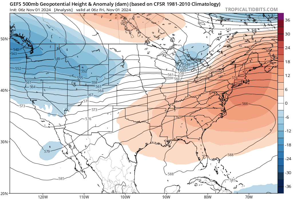
 You're spot on in terms of the projected 200-850 wind shear forecast but I then took a look at both the 200mb & 250mb forecasts and beginning around 126 hr's, there's a building anticyclone over the NW Caribbean, southeast GOM, W. Cuba and S. Florida. In fact, I could see the potential for an extremely well-ventilated TC if aligned under that set-up. It looks to me like the GFS 6Z 180 hr. forecast has a storm north of the NW tip of Yucatan and this in concert with an upper high further east is a significant reason for that net upper-level shear. The 12Z is running now and of course I don't expect any run-to-run consistency as to where the TC will be forecast but i'd be wary of another significant South/Central Fla impact if a TC were anywhere near the W tip of Cuba around 130-180 hr's.