


Moderator: S2k Moderators


tolakram wrote:12Z Euro
https://i.imgur.com/vNkhbef.gif


chris_fit wrote:tolakram wrote:12Z Euro
https://i.imgur.com/vNkhbef.gif
Soooo many wobbles on the approach, and it's not just the EURO showing this....


Stormlover70 wrote:Fml in new port richey

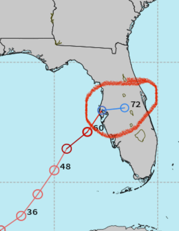
BIFF_THE_UNRULY wrote:the hard cut right is the frontal boundary i assume
Could that boundary save Tampa just in time?
CycloysisNegative wrote:BIFF_THE_UNRULY wrote:the hard cut right is the frontal boundary i assume
Could that boundary save Tampa just in time?
That’s what I’ve been thinking the past 6hrs. Could that be the Charley like right hook? Not saying Port Charolette, but if that turn happens earlier, might save TB from the surge.

BIFF_THE_UNRULY wrote:
i cant see tampa bay underneath all those plots.

HurricaneBelle wrote:BIFF_THE_UNRULY wrote:
i cant see tampa bay underneath all those plots.
most of them are just south, over Bradenton/Sarasota
fsucory08 wrote:skillz305 wrote:The direct cut east is kinda worrisome for the treasure coast here
Especially because it's really a timing thing. If Milton slows down on approach, would not have a lot of warning of an abrupt right turn. Just another thing to watch for. Wonder if the NHC shifts the track after landfall.
MEANINGLESS_NUMBERS wrote:HurricaneBelle wrote:BIFF_THE_UNRULY wrote:
i cant see tampa bay underneath all those plots.
most of them are just south, over Bradenton/Sarasota
So... right into the mouth of the bay? In terms of surge that might actually be worse.
MEANINGLESS_NUMBERS wrote:HurricaneBelle wrote:BIFF_THE_UNRULY wrote:
i cant see tampa bay underneath all those plots.
most of them are just south, over Bradenton/Sarasota
So... right into the mouth of the bay? In terms of surge that might actually be worse.

Zarniwoop wrote:It appears that it will weaken significantly before landfall. Would that be a correct prediction at the moment?
chaser1 wrote:fsucory08 wrote:skillz305 wrote:The direct cut east is kinda worrisome for the treasure coast here
Especially because it's really a timing thing. If Milton slows down on approach, would not have a lot of warning of an abrupt right turn. Just another thing to watch for. Wonder if the NHC shifts the track after landfall.
I believe any eastward motion would be the result of its forward motion being steered by the lower levels as a result of dry air entrainment (rather then caused by land itself). I think that will be better predicted as we get a little closer in. I could even see the storm potentially getting shunted southeast if the dropping trough were particularly flat (east/west oriented)
Users browsing this forum: No registered users and 44 guests

