I’ve been watching this since the beginning and I don’t think there has been an overall vibe among the forum members that this was gonna be a big one. Regardless of what the models were showing. Mainly because they’re just isn’t a system yet.Woofde wrote:toad strangler wrote:Kazmit wrote:2024 post-Beryl:
1. Models show a strong hurricane impacting the U.S. “This will be the big one!” everyone thinks.
2. Models become increasingly unenthusiastic and the system either fails to form or is sloppier than expected.
Not saying this is a guaranteed outcome with this one, but I’m leaning towards it.
I don’t think there’s been a pervasive mindset that this was gonna be a big one. There’s been evidence since the beginning that this might not come together being CAG origin
It's been waning recently, but not long ago there was very solid ensemble support and strong operation runs, just like Francine really. Ironically enough we are approaching that preinvest thread's number of posts.
Low pressure developing over the western Caribbean Sea (Is Invest 97L)
Moderator: S2k Moderators
Forum rules

The posts in this forum are NOT official forecasts and should not be used as such. They are just the opinion of the poster and may or may not be backed by sound meteorological data. They are NOT endorsed by any professional institution or STORM2K. For official information, please refer to products from the National Hurricane Center and National Weather Service.
-
toad strangler

- S2K Supporter

- Posts: 4546
- Joined: Sun Jul 28, 2013 3:09 pm
- Location: Earth
- Contact:
Re: RE: Re: Area of low pressure to develop over the western Caribbean sea (0/60)
2 likes
My Weather Station
https://www.wunderground.com/dashboard/pws/KFLPORTS603
https://www.wunderground.com/dashboard/pws/KFLPORTS603

Re: RE: Re: Area of low pressure to develop over the western Caribbean sea (0/60)
toad strangler wrote:I’ve been watching this since the beginning and I don’t think there has been an overall vibe among the forum members that this was gonna be a big one. Regardless of what the models were showing. Mainly because they’re just isn’t a system yet.Woofde wrote:toad strangler wrote:
I don’t think there’s been a pervasive mindset that this was gonna be a big one. There’s been evidence since the beginning that this might not come together being CAG origin
It's been waning recently, but not long ago there was very solid ensemble support and strong operation runs, just like Francine really. Ironically enough we are approaching that preinvest thread's number of posts.
It’s always been an unknown right? CAG storms are notoriously fickle in what you get. This is late September and not usually when we’re looking at it for genesis though we do look to the Caribbean in general. Clues were mid week when models were all over the place from each other and most of themselves from run to run. We had depictions of giant storms, small storms, strong storms and strung out ones. I wouldn’t be surprised to see further, if minor, deviation the next day or two. but as we are getting closer to development and landfall range of possibilities will narrow.
4 likes
-
Stratton23
- Category 5

- Posts: 3577
- Joined: Fri Jul 21, 2023 10:59 pm
- Location: Katy, Tx
Re: Area of low pressure to develop over the western Caribbean sea (0/60)
EURO AND CMC agree that the system will become trapped in land by stronge ridging once it makes landfall, IMO the GFS is too progressive with weakening the ridge over the NE US, im leaning towards a trap and almost loop like motion with what the euro and cmc show
1 likes
-
Category5Kaiju

- Category 5
- Posts: 4347
- Joined: Thu Dec 24, 2020 12:45 pm
- Location: Seattle during the summer, Phoenix during the winter
Re: Area of low pressure to develop over the western Caribbean sea (0/60)
I wasn't on Storm2k back then, but for people who tracked Michael here, what was the general vibe before the storm formed? Were there indications that it was going to blow up? Were the models all over the place with it?
0 likes
Unless explicitly stated, all information in my posts is based on my own opinions and observations. Tropical storms and hurricanes can be extremely dangerous. Refer to an accredited weather research agency or meteorologist if you need to make serious decisions regarding an approaching storm.

Re: Area of low pressure to develop over the western Caribbean sea (0/60)
I still think it’s premature to be assuming this isn’t going to be much of anything now. Maybe it won’t be, hopefully not, but we don’t even have a PTC designation yet. The Gulf can do some crazy things. Time will tell.
3 likes
-
Stormcenter
- S2K Supporter
- Posts: 6689
- Joined: Wed Sep 03, 2003 11:27 am
- Location: Houston, TX
Re: Area of low pressure to develop over the western Caribbean sea (0/60)
As always timing is everything, does the trough influence the system or not and if yes how much? I still think
all of the models continue to struggle with that.
all of the models continue to struggle with that.
1 likes

Re: Area of low pressure to develop over the western Caribbean sea (0/60)
toad strangler wrote:I’ve been watching this since the beginning and I don’t think there has been an overall vibe among the forum members that this was gonna be a big one. Regardless of what the models were showing. Mainly because they’re just isn’t a system yet.Woofde wrote:toad strangler wrote:
I don’t think there’s been a pervasive mindset that this was gonna be a big one. There’s been evidence since the beginning that this might not come together being CAG origin
It's been waning recently, but not long ago there was very solid ensemble support and strong operation runs, just like Francine really. Ironically enough we are approaching that preinvest thread's number of posts.
I definitely have the context, I've been following since the beginning as well(first post was #13). I've read just about every post on this 800+ preinvest thread haha. I just gauged the earlier conversation differently. There was lots of hype around the time the GFS runs were cranking. Though there has always rightfully been doubts as you say because it hasn't formed and we were/are still a ways away.
Last edited by Woofde on Sat Sep 21, 2024 2:02 pm, edited 2 times in total.
1 likes
-
Spacecoast

- Category 2

- Posts: 773
- Joined: Thu Aug 31, 2017 2:03 pm
Re: Area of low pressure to develop over the western Caribbean sea (0/60)
TomballEd wrote:I looked 6 hour by 56 hour on TT. I didn't say there were a lot, I said there were enough. I am the last person screaming 'the Gulf is boiling, this is a Cat 5 for sure'. In fact, I am now on enemies lists when pointing out a poster when the 'weenie' every posts More ensemble members are TS and Cat 1 than anything else, I'm not going back two pages, but I think I said I expected a Cat 1 or a Cat 2.
No problem. I wasn't inferring anything wrong with your interpretation. It's is certainly within the range of possibilities.
I prefer to use the ensemble mean values, rather than focus on any individual, or small group of members. With a high spread ensemble run, 90% of the members will verify to be very wrong.
It is only when the ensemble members agree with each other, and the mean that the forecast can be considered high confidence.
Eventually, they will.
They always do.
I also wanted to point out the difference between TT, and WN/Pivotal wrt pressure levels. It has long been a mystery why there are different measurements for exactly same member at exactly the same time. I though they both pulled data from the same source.
0 likes
-
DunedinDave
- Category 1

- Posts: 269
- Joined: Fri Aug 25, 2023 10:31 am
Re: Area of low pressure to develop over the western Caribbean sea (0/60)
Category5Kaiju wrote:I wasn't on Storm2k back then, but for people who tracked Michael here, what was the general vibe before the storm formed? Were there indications that it was going to blow up? Were the models all over the place with it?
Looking at the models archive, it looked like the initial tracks were it hitting the Panhandle as a cat 1 or 2 storm. That was around 120-144 hours out. Pressure in the 970s or 980s. So it looked like there was more optimism that it had potential to be a big storm compared to this…as of now.
1 likes
-
Blown Away

- S2K Supporter
- Posts: 10253
- Joined: Wed May 26, 2004 6:17 am
Re: Area of low pressure to develop over the western Caribbean sea (0/60)
Euro trending E…
1 likes
Hurricane Eye Experience: David 79, Irene 99, Frances 04, Jeanne 04, Wilma 05… Hurricane Brush Experience: Andrew 92, Erin 95, Floyd 99, Matthew 16, Irma 17, Ian 22, Nicole 22…
-
TomballEd
- Category 5
- Posts: 1322
- Age: 62
- Joined: Wed Aug 16, 2023 4:52 pm
- Location: Spring/Klein area, not Tomball
Re: Area of low pressure to develop over the western Caribbean sea (0/60)
Spacecoast wrote:TomballEd wrote:I looked 6 hour by 56 hour on TT. I didn't say there were a lot, I said there were enough. I am the last person screaming 'the Gulf is boiling, this is a Cat 5 for sure'. In fact, I am now on enemies lists when pointing out a poster when the 'weenie' every posts More ensemble members are TS and Cat 1 than anything else, I'm not going back two pages, but I think I said I expected a Cat 1 or a Cat 2.
No problem. I wasn't inferring anything wrong with your interpretation. It's is certainly within the range of possibilities.
I prefer to use the ensemble mean values, rather than focus on any individual, or small group of members. With a high spread ensemble run, 90% of the members will verify to be very wrong.
It is only when the ensemble members agree with each other, and the mean that the forecast can be considered high confidence.
Eventually, they will.
They always do.
I also wanted to point out the difference between TT, and WN/Pivotal wrt pressure levels. It has long been a mystery why there are different measurements for exactly same member at exactly the same time. I though they both pulled data from the same source.
We don't get access to mean forecasts of a system until it gets an invest tag, as far as I can tell. I use 'eyeball' means, but that isn't perfect. Even TT/WN means can be wrong, as some members dissipate a member, perhaps from landfalls, and only take the mean of the remaining members.
0 likes
-
Ivanhater

- Storm2k Moderator

- Posts: 11222
- Age: 39
- Joined: Fri Jul 01, 2005 8:25 am
- Location: Pensacola
Re: Area of low pressure to develop over the western Caribbean sea (0/60)
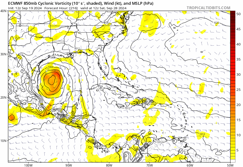
Blown Away wrote:[url]https://i.postimg.cc/x8RWmDyw/ec-fast-uv850-vort-watl-fh168-trend.gif [/url]
Euro trending E…
It went west from 00z. 00z had big bend area...12z looks like Alabama gulf coast
0 likes
Michael
Re: Area of low pressure to develop over the western Caribbean sea (0/60)
Slowly getting there

0 likes
-
TomballEd
- Category 5
- Posts: 1322
- Age: 62
- Joined: Wed Aug 16, 2023 4:52 pm
- Location: Spring/Klein area, not Tomball
Re: Area of low pressure to develop over the western Caribbean sea (0/60)
Shape of NHC's orange shifting E on new TWO.
0 likes
-
StPeteMike

- Category 2
- Posts: 657
- Joined: Thu Jun 07, 2018 11:26 pm
Re: Area of low pressure to develop over the western Caribbean sea (0/60)
DunedinDave wrote:Category5Kaiju wrote:I wasn't on Storm2k back then, but for people who tracked Michael here, what was the general vibe before the storm formed? Were there indications that it was going to blow up? Were the models all over the place with it?
Looking at the models archive, it looked like the initial tracks were it hitting the Panhandle as a cat 1 or 2 storm. That was around 120-144 hours out. Pressure in the 970s or 980s. So it looked like there was more optimism that it had potential to be a big storm compared to this…as of now.
Models and discussion this far out was that it was going to be a sheared Cat 1 to weak Cat 2 Hurricane into the Panhandle. Some of the models had him crashing into Belize and not becoming of much. Don’t think it was until a day before being classified that the upper level environment was looking more favorable and models begun to start showing a strong major.
3 likes
The above post is not official and should not be used as such. It is the opinion of the poster and may or may not be backed by sound meteorological data. It is not endorsed by any professional institution or storm2k.org. For official information, please refer to the NHC and NWS products.
Re: Area of low pressure to develop over the western Caribbean sea (0/60)
TomballEd wrote:Shape of NHC's orange shifting E on new TWO.
What's that new orange area just west of the islands off of Africa?
0 likes
-
HurricaneBelle

- S2K Supporter
- Posts: 1209
- Joined: Sun Aug 27, 2006 6:12 pm
- Location: Clearwater, FL
Re: Area of low pressure to develop over the western Caribbean sea (0/60)
HurricaneBelle wrote:Josh Morgerman tweeted this after Debby (and Idalia the year before). Based on model trends the Weather Gods don't appear to be listening to him.
https://x.com/iCyclone/status/1820441484165845219
And today he added this, LOL
https://x.com/iCyclone/status/1837558145700278455
1 likes
-
Emmett_Brown

- Category 5
- Posts: 1433
- Joined: Wed Aug 24, 2005 9:10 pm
- Location: Sarasota FL
Re: Area of low pressure to develop over the western Caribbean sea (0/60)
Well, this storm probably wont even form for days, so plenty of time for models to show all kinds of crazy stuff. If you get bored with a certain run, there's always another run in a few hours
0 likes

Re: Area of low pressure to develop over the western Caribbean sea (0/60)
Off topic, but the chatter yesterday about the longest pre-invest thread made me look. It's not pre-Francine contrary to the popular belief. Pre-Nicole in 2010 had 1,461 posts/74 pages (!) before being designated as invest 96L. It was a SFL model storm which ended up peaking as a 40kt tropical storm dissipating after crossing Cuba. We've got a ways to go with this one.
3 likes
Kendall -> SLO -> PBC
Memorable Storms: Katrina (for its Florida landfall...) Wilma Matthew Irma
Memorable Storms: Katrina (for its Florida landfall...) Wilma Matthew Irma
Re: Area of low pressure to develop over the western Caribbean sea (0/60)
Ubuntwo wrote:Off topic, but the chatter yesterday about the longest pre-invest thread made me look. It's not pre-Francine contrary to the popular belief. Pre-Nicole in 2010 had 1,461 posts/74 pages (!) before being designated as invest 96L. It was a SFL model storm which ended up peaking as a 40kt tropical storm dissipating after crossing Cuba. We've got a ways to go with this one.
I’ll raise you one visible satellite of the area featuring a nice outflow boundary.
https://www.tropicaltidbits.com/sat/sat ... t=vis_swir
2 likes
Who is online
Users browsing this forum: No registered users and 125 guests