

3090 wrote:What reliable models are showing the low CAT3 hurricane? I have not seen one. Thanks!TomballEd wrote:MarioProtVI wrote:Looks like this unmarked disturbance in EPac will be why this ends up being nothing more then a sloppy system - it interacts with the CAG enough to keep the AOI very broad and weak. Models seem to be shifting towards this now with a notable downtrend in intensity among ensemble members. Seems like September could go with a single major (I do not have expectations for the MDR storm given GFS is the only one showing anything remotely strong there and it tends to be overzealous there). Good for GoM people as it’ll likely be nothing more then a typical June tropical storm setup (thinking Cindy 2017-like). The curse of 2024 continues…
https://media.discordapp.net/attachments/783987504071573517/1287101254358536192/msfc.gif?ex=66f051f4&is=66ef0074&hm=8a24f8ca188552094922d67c786eaa62b910c676d53e6753467744e43f2d5a69&
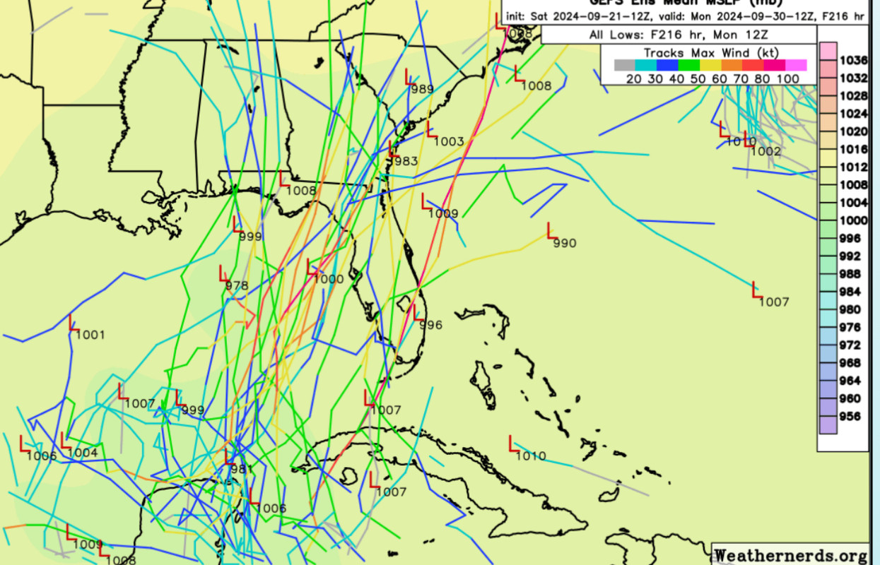
Too soon for that call, I see a member in the 930s, likely an outlier. But I see enough systems in the 950's and 960's, a system as strong as a Cat 3 is possible. I expect a Cat 1 or Cat 2, which probably gets somewhat maintained as it approaches the strong shear by the strong W-lies and SW-lies that will aid the evacuation of air and create extra lift before the shear can push dry air into the system.
See the use of the word 'ensembles', which are a better guide than the operational when the operational is 'guessing' where the low forms. See a few posts back, I linked the GFS ensembles
Edit- I used the actual word 'ensembles' a few posts back. I'm not the kind of guy that gets excited about the Korean or NAVGEM model.
Second edit to add There is a 930s ensemble member, a solid Cat 4, but one of 30 ensembles doesn't a decent amateur forecast make. I was focusing on the 950s's and 960's mb ensemble members.


