

NAM 12km - Landfall @ 980mb +/- 5pm tomorrow St. Mary Parish (or so)
NAM 3km - Landfall @ 966mb +/- 6pm tomorrow St. Mary Parish (or so)
FV3 Hi-res - Landfall @ 975mb +/- 3pm tomorrow St. Mary Parish (or so)
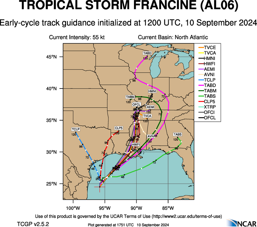
Early Cycle 12z
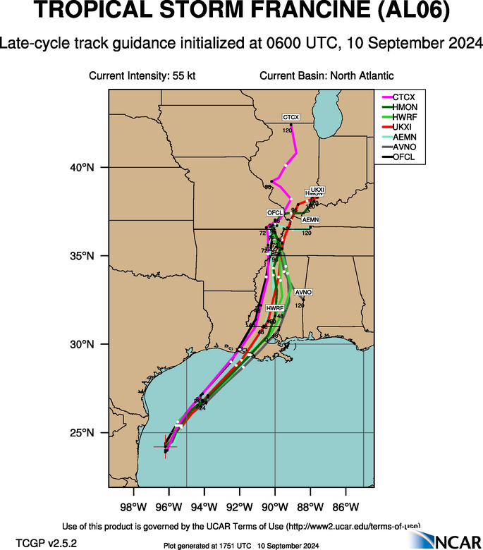
Late Cycle 06z
Moderator: S2k Moderators


tolakram wrote:ICON also shows marked weakening before landfall. Let's see just how good it is.
https://i.imgur.com/HPslldz.gif

Stormlover70 wrote:TABS ìs interesting

Hammy wrote:Stormlover70 wrote:TABS ìs interesting
Wondering if that particular model has a stronger system and pulls it further east due to the upper level flow
LARanger wrote:It seems to me most 18Z runs (GFS, the various H's, Euro) had this thing trying to go fishing in Lake Maurepas or Pontchartrain. I'll be very interested to see the 00Z runs.


Users browsing this forum: No registered users and 41 guests


