ATL: FRANCINE - Remnants - Discussion
Moderator: S2k Moderators
-
cheezyWXguy

- Category 5

- Posts: 6282
- Joined: Mon Feb 13, 2006 12:29 am
- Location: Dallas, TX
Re: ATL: FRANCINE - Tropical Storm - Discussion
Core is starting to moisten again, higher radar returns starting to show up gradually. If this gets one big burst this evening the naysayers won’t have much to go on.
3 likes

Re: ATL: FRANCINE - Tropical Storm - Discussion
Blinhart wrote:WiscoWx02 wrote:The dry air entrainment struggle has begun and will likely continue to plague the system until landfall. Category 1 is the likely ceiling thanks to entrainment. Models have been seeing this more and more today, with the dry air struggle being clearly show on the Euro’s 700-300 hPa Relative Humidity scheme…GFS shows it as well.
Where are you getting all this??? all models are saying Cat 2 is most likely and Cat 3 isn't still out of realm of possibility.
I can't post the model runs for some reason, but both the GFS and ECMWF show a clear bought of dry air entrainment from the WSW of Francine getting into the core, which keeps the strongest precip on the NNE side, which doesn't allow Francine to intensify past roughly 970mb, which is about category 1 intensity typically.
0 likes
-
cheezyWXguy
- Category 5
- Posts: 6282
- Joined: Mon Feb 13, 2006 12:29 am
- Location: Dallas, TX
Re: ATL: FRANCINE - Tropical Storm - Discussion
WiscoWx02 wrote:Blinhart wrote:WiscoWx02 wrote:The dry air entrainment struggle has begun and will likely continue to plague the system until landfall. Category 1 is the likely ceiling thanks to entrainment. Models have been seeing this more and more today, with the dry air struggle being clearly show on the Euro’s 700-300 hPa Relative Humidity scheme…GFS shows it as well.
Where are you getting all this??? all models are saying Cat 2 is most likely and Cat 3 isn't still out of realm of possibility.
I can't post the model runs for some reason, but both the GFS and ECMWF show a clear bought of dry air entrainment from the WSW of Francine getting into the core, which keeps the strongest precip on the NNE side, which doesn't allow Francine to intensify past roughly 970mb, which is about category 1 intensity typically.
970 is easily cat2, especially for a storm with smaller core
6 likes
-
FLpanhandle91

- Category 5
- Posts: 1039
- Age: 35
- Joined: Mon Sep 13, 2010 3:50 pm
- Location: Fort Walton Beach, FL
Re: ATL: FRANCINE - Tropical Storm - Discussion
She has PLENTY of time over the jet fuel Gulf. After Michael, I know nothing is out of the realm of possible.
1 likes

Re: ATL: FRANCINE - Tropical Storm - Discussion
WiscoWx02 wrote:Blinhart wrote:WiscoWx02 wrote:The dry air entrainment struggle has begun and will likely continue to plague the system until landfall. Category 1 is the likely ceiling thanks to entrainment. Models have been seeing this more and more today, with the dry air struggle being clearly show on the Euro’s 700-300 hPa Relative Humidity scheme…GFS shows it as well.
Where are you getting all this??? all models are saying Cat 2 is most likely and Cat 3 isn't still out of realm of possibility.
I can't post the model runs for some reason, but both the GFS and ECMWF show a clear bought of dry air entrainment from the WSW of Francine getting into the core, which keeps the strongest precip on the NNE side, which doesn't allow Francine to intensify past roughly 970mb, which is about category 1 intensity typically.
Currently dry air is not an issue as shown on the dropsondes dropped by the NOAA recon sampling the atmosphere.
Down the road right before making landfall that's another story and you can't go by the global models' forecasted winds, that's where hurricane models come in thus the NHC calling for Francine to become at least a Cat 2.
2 likes
-
tolakram
- Admin

- Posts: 20186
- Age: 62
- Joined: Sun Aug 27, 2006 8:23 pm
- Location: Florence, KY (name is Mark)
Re: ATL: FRANCINE - Tropical Storm - Discussion
WiscoWx02 wrote:Blinhart wrote:WiscoWx02 wrote:The dry air entrainment struggle has begun and will likely continue to plague the system until landfall. Category 1 is the likely ceiling thanks to entrainment. Models have been seeing this more and more today, with the dry air struggle being clearly show on the Euro’s 700-300 hPa Relative Humidity scheme…GFS shows it as well.
Where are you getting all this??? all models are saying Cat 2 is most likely and Cat 3 isn't still out of realm of possibility.
I can't post the model runs for some reason, but both the GFS and ECMWF show a clear bought of dry air entrainment from the WSW of Francine getting into the core, which keeps the strongest precip on the NNE side, which doesn't allow Francine to intensify past roughly 970mb, which is about category 1 intensity typically.
While a storm is heading toward the coast do not start amateur forecasting something less than the NHC. You are entitled to your opinion but if you're looking at model runs then stick it in the model thread, not in the discussion thread. The Euro and GFS are NOT to be used for intensity.
9 likes
M a r k
- - - - -
Join us in chat: Storm2K Chatroom Invite. Android and IOS apps also available.
The posts in this forum are NOT official forecasts and should not be used as such. Posts are NOT endorsed by any professional institution or STORM2K.org. For official information and forecasts, please refer to NHC and NWS products.
-
MGC

- S2K Supporter

- Posts: 5941
- Joined: Sun Mar 23, 2003 9:05 pm
- Location: Pass Christian MS, or what is left.
Re: ATL: FRANCINE - Tropical Storm - Discussion
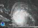
Brownsville radar appears to be indicating Francine is moving north now with intact western eyewall......MGC
2 likes
Re: ATL: FRANCINE - Tropical Storm - Discussion
As far as dry air goes:
-NHC stated Francine is in an environment of 'ample moisture'
-GFS and ECMWF are showing dry air intrusion after the shear sets in, not currently
-NHC stated Francine is in an environment of 'ample moisture'
-GFS and ECMWF are showing dry air intrusion after the shear sets in, not currently
3 likes
-
cheezyWXguy
- Category 5
- Posts: 6282
- Joined: Mon Feb 13, 2006 12:29 am
- Location: Dallas, TX
Re: ATL: FRANCINE - Tropical Storm - Discussion
cheezyWXguy wrote:Core is starting to moisten again, higher radar returns starting to show up gradually. If this gets one big burst this evening the naysayers won’t have much to go on.
Ope, here it goes. New burst in the SW eyewall
1 likes
Re: ATL: FRANCINE - Tropical Storm - Discussion
WiscoWx02 wrote:Blinhart wrote:WiscoWx02 wrote:The dry air entrainment struggle has begun and will likely continue to plague the system until landfall. Category 1 is the likely ceiling thanks to entrainment. Models have been seeing this more and more today, with the dry air struggle being clearly show on the Euro’s 700-300 hPa Relative Humidity scheme…GFS shows it as well.
Where are you getting all this??? all models are saying Cat 2 is most likely and Cat 3 isn't still out of realm of possibility.
I can't post the model runs for some reason, but both the GFS and ECMWF show a clear bought of dry air entrainment from the WSW of Francine getting into the core, which keeps the strongest precip on the NNE side, which doesn't allow Francine to intensify past roughly 970mb, which is about category 1 intensity typically.
Huh?...thats not what the NHC tells in their 4 pm update....not to be argumentative....I do not understand models...but the NHC clearly says Category 2 hurricane....people do not need to underprepare....just sayin...
4 likes
-
ScottNAtlanta

- Category 5
- Posts: 2535
- Joined: Sat May 25, 2013 3:11 pm
- Location: Atlanta, GA
Re: ATL: FRANCINE - Tropical Storm - Discussion
Pressure is down to 997 and they have not reached the center yet
0 likes
The posts in this forum are NOT official forecast and should not be used as such. They are just the opinion of the poster and may or may not be backed by sound meteorological data. They are NOT endorsed by any professional institution or storm2k.org. For official information, please refer to the NHC and NWS products.

-
Sciencerocks
- Category 5
- Posts: 10193
- Age: 40
- Joined: Thu Jul 06, 2017 1:51 am

-
weeniepatrol

- Category 5
- Posts: 1345
- Joined: Sat Aug 22, 2020 5:30 pm
- Location: WA State


Re: ATL: FRANCINE - Tropical Storm - Discussion
Owasso wrote:991mb
Moving much slower too, still south of 24N.
0 likes
-
Category5Kaiju

- Category 5
- Posts: 4347
- Joined: Thu Dec 24, 2020 12:45 pm
- Location: Seattle during the summer, Phoenix during the winter
Re: ATL: FRANCINE - Tropical Storm - Discussion
I do wonder if Opal from 1995 might be a decent analog for what Francine may become. I don't know about the strength, but the idea of an intense hurricane in the Gulf of Mexico that slowly moves northeastward and starts near the Bay of Campeche while being ventilated by a trough.
Last edited by Category5Kaiju on Mon Sep 09, 2024 7:02 pm, edited 1 time in total.
3 likes
Unless explicitly stated, all information in my posts is based on my own opinions and observations. Tropical storms and hurricanes can be extremely dangerous. Refer to an accredited weather research agency or meteorologist if you need to make serious decisions regarding an approaching storm.

Re: ATL: FRANCINE - Tropical Storm - Discussion
tolakram wrote:WiscoWx02 wrote:Blinhart wrote:
Where are you getting all this??? all models are saying Cat 2 is most likely and Cat 3 isn't still out of realm of possibility.
I can't post the model runs for some reason, but both the GFS and ECMWF show a clear bought of dry air entrainment from the WSW of Francine getting into the core, which keeps the strongest precip on the NNE side, which doesn't allow Francine to intensify past roughly 970mb, which is about category 1 intensity typically.
While a storm is heading toward the coast do not start amateur forecasting something less than the NHC. You are entitled to your opinion but if you're looking at model runs then stick it in the model thread, not in the discussion thread. The Euro and GFS are NOT to be used for intensity.
Levi noted in his video today where dry air gets in just before landfall (used gfs EC and a hurricane model). It disrupts the inflow or at least the convection on the south side of the system and weights it heavily north. Zeta was a different setup but also didn’t have a back side to it. Just clouds and reverse wind rushing in and that was it. It’s the opposite of Isaac in 2012 which didn’t have a north side to speak of. So maybe leveling off and decaying 6ish hours before landfall Wednesday.
Slightly breezy, cool feel to the air, low cloud cover and occasional very light droplet drizzle in New Orleans today.
3 likes
Re: ATL: FRANCINE - Tropical Storm - Discussion
This is a well organized storm traversing water similar to what Otis took advantage of last fall. While we can hope for dry air or sheer...we should also not discount the potential of rapid intensification which yields a storm stronger than forecast.
5 likes
-
johngaltfla

- Category 5
- Posts: 2073
- Joined: Sun Jul 10, 2005 9:17 pm
- Location: Sarasota County, FL
- Contact:
Re: ATL: FRANCINE - Tropical Storm - Discussion
She's getting healthy quick. Hopefully they nail this and the NNE turn happens faster and it picks up forward speed. I do not like this set up for Louisiana at all. Let's see what the early morning runs and recon brings us.
2 likes
Re: ATL: FRANCINE - Tropical Storm - Discussion
WiscoWx02 wrote:Blinhart wrote:WiscoWx02 wrote:The dry air entrainment struggle has begun and will likely continue to plague the system until landfall. Category 1 is the likely ceiling thanks to entrainment. Models have been seeing this more and more today, with the dry air struggle being clearly show on the Euro’s 700-300 hPa Relative Humidity scheme…GFS shows it as well.
Where are you getting all this??? all models are saying Cat 2 is most likely and Cat 3 isn't still out of realm of possibility.
I can't post the model runs for some reason, but both the GFS and ECMWF show a clear bought of dry air entrainment from the WSW of Francine getting into the core, which keeps the strongest precip on the NNE side, which doesn't allow Francine to intensify past roughly 970mb, which is about category 1 intensity typically.
Last I checked models are notoriously not good at strength yet you come on here repeatedly downcasting. Do you have some type of crystal ball where you can forecast what will happen? In so far as i can tell the storm has been outperforming. Your posts clearly are ones that need a disclaimer.
3 likes
Who is online
Users browsing this forum: No registered users and 43 guests