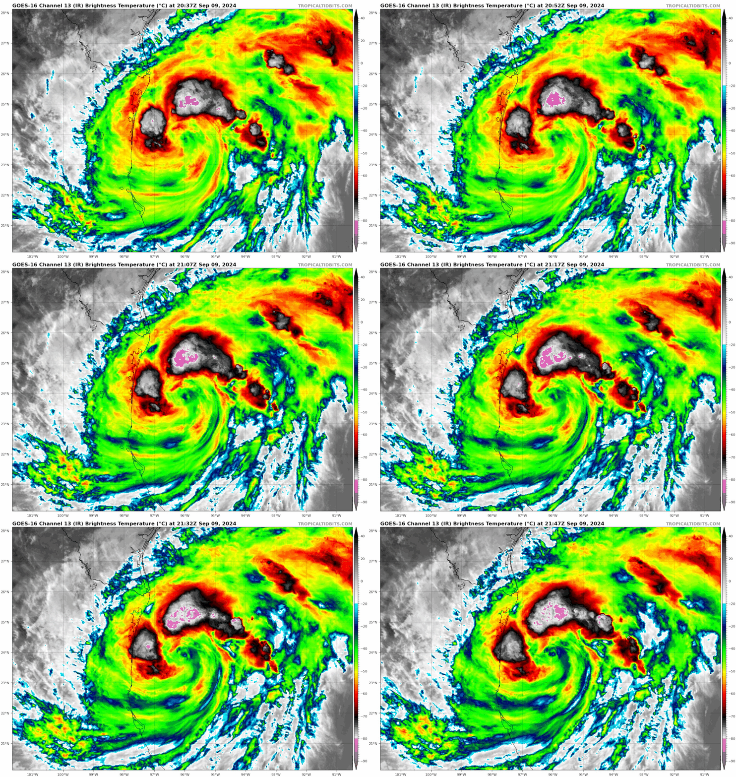
Hurrilurker wrote:Organization looks great and coming together rapidly but there's still a huge slot of dry air in there it needs to mix out.
I'm sure the time of the day may have a lot to do with it.
Moderator: S2k Moderators
Hurrilurker wrote:Organization looks great and coming together rapidly but there's still a huge slot of dry air in there it needs to mix out.
cheezyWXguy wrote:Dry air entrainment during this phase is common, and microwave/radar show that everything under the hood is organizing. Pressure is probably the same or a little lower than the recon pass earlier, guess we’ll see when it gets there. Unless new convection doesn’t form in the eyewall overnight, I don’t think anything we are seeing suggests this to be a weakening storm.

Ubuntwo wrote:cheezyWXguy wrote:Dry air entrainment during this phase is common, and microwave/radar show that everything under the hood is organizing. Pressure is probably the same or a little lower than the recon pass earlier, guess we’ll see when it gets there. Unless new convection doesn’t form in the eyewall overnight, I don’t think anything we are seeing suggests this to be a weakening storm.
I agree, though it wouldn’t surprise me to see winds the same or even slightly lower in the very short term. This is usually a period of axisymmetrization, where the storm develops a more balanced wind structure - usually a prerequisite to RI.


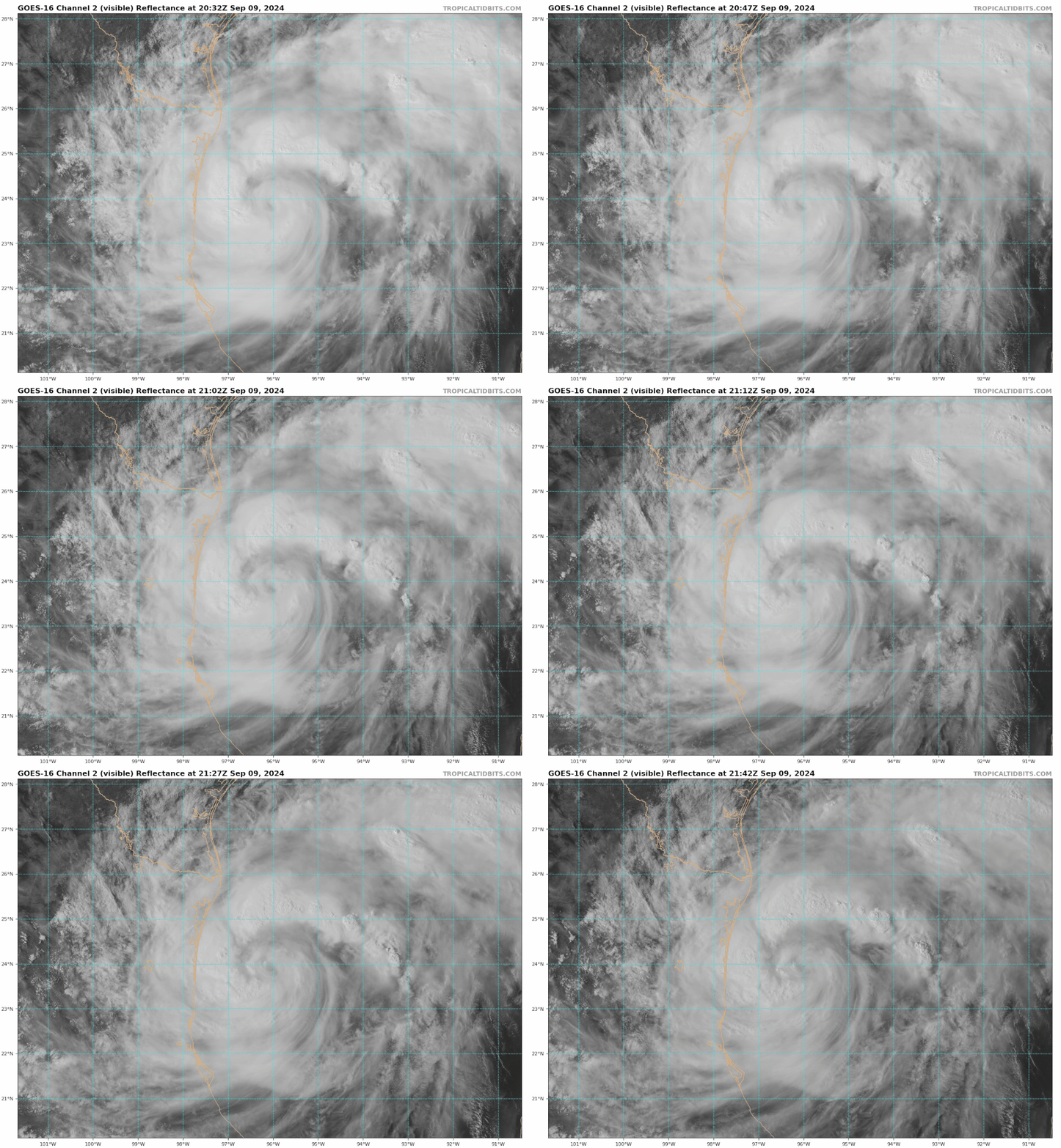
Teban54 wrote:Even though the SE quad is obviously less convectively active at the moment, it gives some gorgeous visible imagery.
Ubuntwo wrote:cheezyWXguy wrote:Dry air entrainment during this phase is common, and microwave/radar show that everything under the hood is organizing. Pressure is probably the same or a little lower than the recon pass earlier, guess we’ll see when it gets there. Unless new convection doesn’t form in the eyewall overnight, I don’t think anything we are seeing suggests this to be a weakening storm.
I agree, though it wouldn’t surprise me to see winds the same or even slightly lower in the very short term. This is usually a period of axisymmetrization, where the storm develops a more balanced wind structure - usually a prerequisite to RI.

Teban54 wrote:Ubuntwo wrote:cheezyWXguy wrote:Dry air entrainment during this phase is common, and microwave/radar show that everything under the hood is organizing. Pressure is probably the same or a little lower than the recon pass earlier, guess we’ll see when it gets there. Unless new convection doesn’t form in the eyewall overnight, I don’t think anything we are seeing suggests this to be a weakening storm.
I agree, though it wouldn’t surprise me to see winds the same or even slightly lower in the very short term. This is usually a period of axisymmetrization, where the storm develops a more balanced wind structure - usually a prerequisite to RI.
This was also well-anticipated by the hurricane models. HAFS-A and B, the only two models that correctly showed the 995 mb pressure around 17z, had slow or negligible deepening in the following 12-18 hours before starting RI.
sphelps8681 wrote:Is it possible for another eyewall reformation? Or is it done. Thanks.

sphelps8681 wrote:Is it possible for another eyewall reformation? Or is it done. Thanks.

WiscoWx02 wrote:The dry air entrainment struggle has begun and will likely continue to plague the system until landfall. Category 1 is the likely ceiling thanks to entrainment. Models have been seeing this more and more today, with the dry air struggle being clearly show on the Euro’s 700-300 hPa Relative Humidity scheme…GFS shows it as well.
WiscoWx02 wrote:The dry air entrainment struggle has begun and will likely continue to plague the system until landfall. Category 1 is the likely ceiling thanks to entrainment. Models have been seeing this more and more today, with the dry air struggle being clearly show on the Euro’s 700-300 hPa Relative Humidity scheme…GFS shows it as well.

WiscoWx02 wrote:The dry air entrainment struggle has begun and will likely continue to plague the system until landfall. Category 1 is the likely ceiling thanks to entrainment. Models have been seeing this more and more today, with the dry air struggle being clearly show on the Euro’s 700-300 hPa Relative Humidity scheme…GFS shows it as well.

WiscoWx02 wrote:The dry air entrainment struggle has begun and will likely continue to plague the system until landfall. Category 1 is the likely ceiling thanks to entrainment. Models have been seeing this more and more today, with the dry air struggle being clearly show on the Euro’s 700-300 hPa Relative Humidity scheme…GFS shows it as well.

WiscoWx02 wrote:The dry air entrainment struggle has begun and will likely continue to plague the system until landfall. Category 1 is the likely ceiling thanks to entrainment. Models have been seeing this more and more today, with the dry air struggle being clearly show on the Euro’s 700-300 hPa Relative Humidity scheme…GFS shows it as well.
WiscoWx02 wrote:The dry air entrainment struggle has begun and will likely continue to plague the system until landfall. Category 1 is the likely ceiling thanks to entrainment. Models have been seeing this more and more today, with the dry air struggle being clearly show on the Euro’s 700-300 hPa Relative Humidity scheme…GFS shows it as well.


Users browsing this forum: No registered users and 78 guests