Area of low pressure in Central Atlantic (Is Invest 92L)

This is the general tropical discussion area. Anyone can take their shot at predicting a storms path.

Moderator: S2k Moderators

Forum rules

The posts in this forum are NOT official forecasts and should not be used as such. They are just the opinion of the poster and may or may not be backed by sound meteorological data. They are NOT endorsed by any professional institution or STORM2K. For official information, please refer to products from the National Hurricane Center and National Weather Service.

Help Support Storm2K
Message
Author
User avatar
cycloneye
Admin
Admin
Posts: 145256
Age: 68
Joined: Thu Oct 10, 2002 10:54 am
Location: San Juan, Puerto Rico

Area of low pressure in Central Atlantic (Is Invest 92L)

#1 Postby cycloneye » Sun Sep 01, 2024 4:35 am

Eastern Tropical Atlantic Ocean:
A tropical wave over western Africa is forecast to move offshore on
Monday. Thereafter, environmental conditions could support some
slow development throughout the week while the system moves slowly
westward or west-northwestward over the eastern tropical Atlantic
Ocean.
* Formation chance through 48 hours...low...near 0 percent.
* Formation chance through 7 days...low...20 percent.


Image

Image
0 likes   
Visit the Caribbean-Central America Weather Thread where you can find at first post web cams,radars
and observations from Caribbean basin members Click Here

User avatar
Teban54
Category 5
Category 5
Posts: 3204
Joined: Sat May 19, 2018 1:19 pm

Re: Tropical Wave to emerge West Africa on monday (0/20)

#2 Postby Teban54 » Sun Sep 01, 2024 11:43 am

I didn't know that at a time when everyone is grasping the straws for a named storm to form, the thread for a brand new AOI named by the NHC can get zero replies in 7 hours :lol:

Anyway, I'm reposting a comment I made in the global models thread last night about the system. Of course, just after the post and NHC's mention, 12z GFS drops it. (So does 12z CMC, but it was already the least consistent global model and the outlier for this system to begin with.)

Teban54 wrote:If the disappearance of the Eastern Atlantic 0/10 AOI earlier made you think nothing in that region will spin up in the foreseeable future (or that no named storms will develop by September 15), there's a good chance you would be wrong.

Models seem very enthusiastic on the development of a tropical storm in the Eastern Atlantic, from a wave that leaves Africa over this long weekend (which is immediately behind the former 0/10 AOI). While earlier models from a few days ago couldn't decide which of the two Eastern Atlantic waves to develop, it looks like they've finally made up their mind. GFS, ECMWF, CMC, ICON, as well as the GEFS and EPS ensembles have all been showing the 9/1 wave spinning up. In fact, I'm surprised it hasn't gotten a mention from the NHC yet (some models show development within 7 days now), and even more surprised with the total lack of discussions about it here!

The catch is that they expected the system to stay weak, as even ensembles are showing fewer and fewer strong members, if any. Current consensus is that the system will recurve north near 40W while suffering from shear and dry air. It may then be pushed back to W/NW briefly due to ridge building back to the NE.

... Until now.

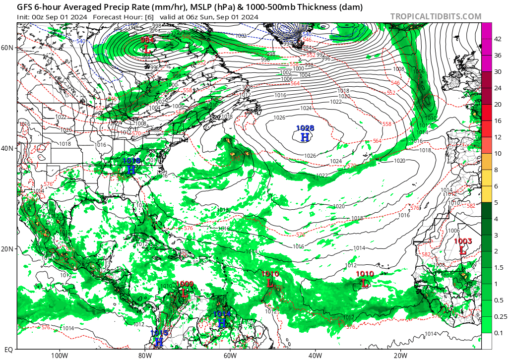
On tonight's 0z GFS, the ridge seems stronger, and the system doesn't move as far north as most runs indicated. Then it somehow gets on the dreaded WSW track. Thankfully, not all WSW dives are created equal, and it stays weak throughout (though it did get to 999 mb at one point). The dive ends just north of the Lesser Antilles, at which point it resembles more of a classic Western Atlantic track, becoming a 968 mb hurricane en route to Bermuda as the run ends.

To be clear, this is an outlier from all previous model runs -- even ensembles almost never got the system so far SW. It's probably just a fluke, but I think it should at least get a mention lol.

https://i.postimg.cc/J0dBvWMH/gfs-mslp-pcpn-atl-fh6-384.gif
0 likes   

mantis83
Tropical Storm
Tropical Storm
Posts: 198
Joined: Fri Dec 05, 2003 4:47 pm

Re: Tropical Wave to emerge West Africa on monday (0/20)

#3 Postby mantis83 » Sun Sep 01, 2024 11:46 am

looks like an early recurve candidate, if anything forms.....
0 likes   

User avatar
Hurricane2022
Category 5
Category 5
Posts: 1540
Joined: Tue Aug 23, 2022 11:38 pm
Location: Araçatuba, Brazil

Re: Tropical Wave to emerge West Africa on monday (0/20)

#4 Postby Hurricane2022 » Sun Sep 01, 2024 12:04 pm

mantis83 wrote:looks like an early recurve candidate, if anything forms.....

This system is a candidate for going OTS. But only one candidate wins, and we don't know for sure where in the world this tropical wave is headed. So I ask (again?) to you...please be patient. And, starting today...please, for God sake, always wait some more before making these statements about storms that don't even exist yet. Period!! :sun:
3 likes   
Sorry for the bad English sometimes...!
For reliable and detailed information for any meteorological phenomenon, please consult the National Hurricane Center, Joint Typhoon Warning Center , or your local Meteo Center.

--------

Una cvm Christo, pro Christo, et in Christo. Sit nomen Domini benedictvm.

User avatar
cycloneye
Admin
Admin
Posts: 145256
Age: 68
Joined: Thu Oct 10, 2002 10:54 am
Location: San Juan, Puerto Rico

Re: Tropical Wave to emerge West Africa on monday (0/20)

#5 Postby cycloneye » Sun Sep 01, 2024 12:42 pm

Eastern Tropical Atlantic Ocean:
A tropical wave over western Africa is forecast to move offshore by
Monday. Thereafter, environmental conditions could support some
slow development of this system throughout the week while it moves
slowly westward or west-northwestward over the eastern tropical
Atlantic Ocean.
* Formation chance through 48 hours...low...near 0 percent.
* Formation chance through 7 days...low...20 percent.
0 likes   
Visit the Caribbean-Central America Weather Thread where you can find at first post web cams,radars
and observations from Caribbean basin members Click Here

User avatar
cycloneye
Admin
Admin
Posts: 145256
Age: 68
Joined: Thu Oct 10, 2002 10:54 am
Location: San Juan, Puerto Rico

Re: Tropical Wave to emerge West Africa on monday (0/30)

#6 Postby cycloneye » Sun Sep 01, 2024 6:30 pm

Eastern Tropical Atlantic Ocean:
A tropical wave is forecast to move offshore of the west coast of
Africa by Monday. Thereafter, environmental conditions could
support some slow development of this system throughout the week
while it moves slowly westward or west-northwestward over the
eastern tropical Atlantic Ocean.
* Formation chance through 48 hours...low...near 0 percent.
* Formation chance through 7 days...low...30 percent
3 likes   
Visit the Caribbean-Central America Weather Thread where you can find at first post web cams,radars
and observations from Caribbean basin members Click Here

User avatar
cycloneye
Admin
Admin
Posts: 145256
Age: 68
Joined: Thu Oct 10, 2002 10:54 am
Location: San Juan, Puerto Rico

Re: Tropical Wave in Eastern Atlantic (0/30)

#7 Postby cycloneye » Sun Sep 01, 2024 10:17 pm

Tropical wave has emerged from west africa.

Image

Image
0 likes   
Visit the Caribbean-Central America Weather Thread where you can find at first post web cams,radars
and observations from Caribbean basin members Click Here

User avatar
Teban54
Category 5
Category 5
Posts: 3204
Joined: Sat May 19, 2018 1:19 pm

Re: Tropical Wave in Eastern Atlantic (0/30)

#8 Postby Teban54 » Mon Sep 02, 2024 1:27 am

Up to 10/40.
3. Eastern Tropical Atlantic Ocean:
A tropical wave along the west coast of Africa is producing a large
area of showers and thunderstorms. Environmental conditions are
forecast to gradually become more favorable for development, and a
tropical depression could form in a few days while the disturbance
moves slowly west-northwestward or northwestward over the eastern
tropical Atlantic Ocean.
* Formation chance through 48 hours...low...10 percent.
* Formation chance through 7 days...medium...40 percent.


Never thought I'd use this meme for anything other than EPAC this season, but here we are.
Image
8 likes   

User avatar
cycloneye
Admin
Admin
Posts: 145256
Age: 68
Joined: Thu Oct 10, 2002 10:54 am
Location: San Juan, Puerto Rico

Re: Tropical Wave in Eastern Atlantic (10/40)

#9 Postby cycloneye » Mon Sep 02, 2024 4:28 am

Annularcane, looks like this wave will be tagged soon with the infamous number 99L. :D

Image
2 likes   
Visit the Caribbean-Central America Weather Thread where you can find at first post web cams,radars
and observations from Caribbean basin members Click Here

User avatar
cycloneye
Admin
Admin
Posts: 145256
Age: 68
Joined: Thu Oct 10, 2002 10:54 am
Location: San Juan, Puerto Rico

Re: Tropical Wave in Eastern Atlantic (10/40)

#10 Postby cycloneye » Mon Sep 02, 2024 7:06 am

Eastern Tropical Atlantic Ocean:
A tropical wave just offshore of the west coast of Africa is
producing disorganized showers and thunderstorms. Environmental
conditions are forecast to gradually become more conducive for
development, and a tropical depression could form in a few days
while the disturbance moves slowly west-northwestward or
northwestward over the eastern tropical Atlantic Ocean. This system
could produce areas of heavy rain and gusty winds across portions of
the Cabo Verde Islands in a day or two.
* Formation chance through 48 hours...low...10 percent.
* Formation chance through 7 days...medium...40 percent.
0 likes   
Visit the Caribbean-Central America Weather Thread where you can find at first post web cams,radars
and observations from Caribbean basin members Click Here

User avatar
AnnularCane
S2K Supporter
S2K Supporter
Posts: 2860
Joined: Thu Jun 08, 2006 9:18 am
Location: Wytheville, VA

Re: Tropical Wave in Eastern Atlantic (10/40)

#11 Postby AnnularCane » Mon Sep 02, 2024 9:31 am

cycloneye wrote:Annularcane, looks like this wave will be tagged soon with the infamous number 99L. :D

https://i.imgur.com/RiXqpbX.gif


Well, I guess they can't control whatever designation gets slapped on them. :lol: But whatever they get called, so far the Antilles wave seems like 99L at heart.
1 likes   
"But it never rained rain. It never snowed snow. And it never blew just wind. It rained things like soup and juice. It snowed mashed potatoes and green peas. And sometimes the wind blew in storms of hamburgers." -- Judi Barrett, Cloudy with a Chance of Meatballs

User avatar
Teban54
Category 5
Category 5
Posts: 3204
Joined: Sat May 19, 2018 1:19 pm

Re: Tropical Wave in Eastern Atlantic (10/40)

#12 Postby Teban54 » Mon Sep 02, 2024 4:45 pm

Ensemble support for TS winds dropped, if not plummeted, on the 12z runs. On Weathernerds, GEFS still has some members showing tracks with 30+ kt winds, but much fewer than 6z. EPS shows a less drastic reduction of 30+ kts tracks, but the proportion of such members was lower to begin with.

One reason could be that 12z models were trending towards less of a northward movement (stronger ridge?). It may be that lack of visible tracks is just visual, and that some of the members remain stationary in the MDR while intensifying to a TS, but don't leave an easily recognizable trace on the map. But it could also be an issue with the actual strength of the system.

Regardless, GEFS and EPS have different solutions on where else to focus the energy on. GEFS has now increased support for the Central Atlantic wave that NHC had written off 2 days ago, with a few hurricanes on both 0z and 12z runs. EPS has minimal -- but not zero -- members developing it. On the other hand, EPS really loves the next wave that splashes down on September 10, with two-thirds of members showing a low or TS near Cabo Verde. GEFS support for this wave is inconsistent, possibly because the GFS suite keeps the vorticity of several waves tangled much longer (and in a messier fashion) than the Euro suite.
0 likes   

TomballEd
Category 2
Category 2
Posts: 685
Age: 61
Joined: Wed Aug 16, 2023 4:52 pm
Location: Spring/Klein area, not Tomball

Re: Tropical Wave in Eastern Atlantic (10/40)

#13 Postby TomballEd » Mon Sep 02, 2024 6:27 pm

This is SW of NHC's Orange X, but looking good at the moment.

Image
2 likes   

User avatar
cycloneye
Admin
Admin
Posts: 145256
Age: 68
Joined: Thu Oct 10, 2002 10:54 am
Location: San Juan, Puerto Rico

Re: Tropical Wave in Eastern Atlantic (10/40)

#14 Postby cycloneye » Mon Sep 02, 2024 6:49 pm

Eastern Tropical Atlantic Ocean:
A tropical wave over the far eastern Atlantic is producing
disorganized showers and thunderstorms. Environmental conditions
are forecast to become a little more conducive for development, and
a tropical depression could form in a few days while the disturbance
moves slowly west-northwestward or northwestward over the eastern
tropical Atlantic Ocean. This system could produce locally heavy
rains and gusty winds across portions of the Cabo Verde Islands in
a day or two.
* Formation chance through 48 hours...low...10 percent.
* Formation chance through 7 days...medium...40 percent.
0 likes   
Visit the Caribbean-Central America Weather Thread where you can find at first post web cams,radars
and observations from Caribbean basin members Click Here

User avatar
cycloneye
Admin
Admin
Posts: 145256
Age: 68
Joined: Thu Oct 10, 2002 10:54 am
Location: San Juan, Puerto Rico

Re: Tropical Wave in Eastern Atlantic (10/40)

#15 Postby cycloneye » Tue Sep 03, 2024 12:57 pm

Eastern Tropical Atlantic Ocean:
A tropical wave over the far eastern Atlantic is producing
disorganized shower activity. Some slow development of this system
is possible during the next few days as it moves west-northwestward
or northwestward over the eastern tropical Atlantic Ocean.
Environmental conditions are expected to become less conducive by
the end of the week. This system could produce locally heavy rains
and gusty winds across portions of the Cabo Verde Islands in a day
or two.
* Formation chance through 48 hours...low...20 percent.
* Formation chance through 7 days...low...30 percent.
0 likes   
Visit the Caribbean-Central America Weather Thread where you can find at first post web cams,radars
and observations from Caribbean basin members Click Here

User avatar
cycloneye
Admin
Admin
Posts: 145256
Age: 68
Joined: Thu Oct 10, 2002 10:54 am
Location: San Juan, Puerto Rico

Re: Tropical Wave in Eastern Atlantic (20/30)

#16 Postby cycloneye » Tue Sep 03, 2024 6:46 pm

Eastern Tropical Atlantic Ocean:
A third tropical wave over the far eastern Atlantic is also
producing disorganized shower activity. Some slow development of
this system is possible during the next few days while it moves
slowly northwestward at 5 to 10 mph over the eastern tropical
Atlantic Ocean. Environmental conditions are expected to become
less conducive for development by the end of the week. This system
could produce locally heavy rains across portions of the Cabo Verde
Islands overnight and on Wednesday.
* Formation chance through 48 hours...low...20 percent.
* Formation chance through 7 days...low...30 percent.
0 likes   
Visit the Caribbean-Central America Weather Thread where you can find at first post web cams,radars
and observations from Caribbean basin members Click Here

User avatar
cycloneye
Admin
Admin
Posts: 145256
Age: 68
Joined: Thu Oct 10, 2002 10:54 am
Location: San Juan, Puerto Rico

Re: Tropical Wave in Eastern Atlantic (10/20)

#17 Postby cycloneye » Wed Sep 04, 2024 6:54 am

Down to 10/20.

Eastern Tropical Atlantic Ocean:
A third tropical wave over the far eastern Atlantic is also
producing disorganized shower activity. Some slow development of
this system is possible during the next few days while it moves
slowly northwestward at 5 to 10 mph over the eastern tropical
Atlantic Ocean. This system could produce locally heavy rains
across portions of the Cabo Verde Islands today.
* Formation chance through 48 hours...low...10 percent.
* Formation chance through 7 days...low...20 percent.
0 likes   
Visit the Caribbean-Central America Weather Thread where you can find at first post web cams,radars
and observations from Caribbean basin members Click Here

User avatar
Teban54
Category 5
Category 5
Posts: 3204
Joined: Sat May 19, 2018 1:19 pm

Re: Tropical Wave in Eastern Atlantic (10/20)

#18 Postby Teban54 » Wed Sep 04, 2024 2:41 pm

Wording changed to a trough rather than a wave, perhaps also including the possible monsoon trough breakdown solution.

4. Eastern Tropical Atlantic Ocean:
An elongated trough of low pressure over the eastern tropical
Atlantic is producing disorganized showers and thunderstorms. Some
slow development of this system is possible during the next few days
while it drifts northwestward.
* Formation chance through 48 hours...low...10 percent.
* Formation chance through 7 days...low...20 percent.
0 likes   

User avatar
Teban54
Category 5
Category 5
Posts: 3204
Joined: Sat May 19, 2018 1:19 pm

Re: Tropical Wave in Eastern Atlantic (10/20)

#19 Postby Teban54 » Wed Sep 04, 2024 8:47 pm

Euro has been trending stronger with this throughout the day, though still not much.
0 likes   

User avatar
cycloneye
Admin
Admin
Posts: 145256
Age: 68
Joined: Thu Oct 10, 2002 10:54 am
Location: San Juan, Puerto Rico

Re: Tropical Wave in Eastern Atlantic (0/10)

#20 Postby cycloneye » Thu Sep 05, 2024 7:00 pm

Northwestern Caribbean Sea and Southwestern Gulf of Mexico:
A tropical wave located over the western Caribbean Sea is producing
a large area of disorganized shower and thunderstorm activity.
Development is not expected before the system reaches Belize and the
Yucatan Peninsula by early Friday. Some slow development is possible
later this weekend after the system emerges over the southwestern
Gulf of Mexico.
* Formation chance through 48 hours...low...near 0 percent.
* Formation chance through 7 days...low...20 percent.
0 likes   
Visit the Caribbean-Central America Weather Thread where you can find at first post web cams,radars
and observations from Caribbean basin members Click Here


Return to “Talkin' Tropics”

Who is online

Users browsing this forum: No registered users and 29 guests