

chaser1 wrote:By the way, Larry or Austin Man? The GFS long range forecast does beg the question:
What is the historical records on earliest Atlantic season date having two simultaneous Tropical storms churning?
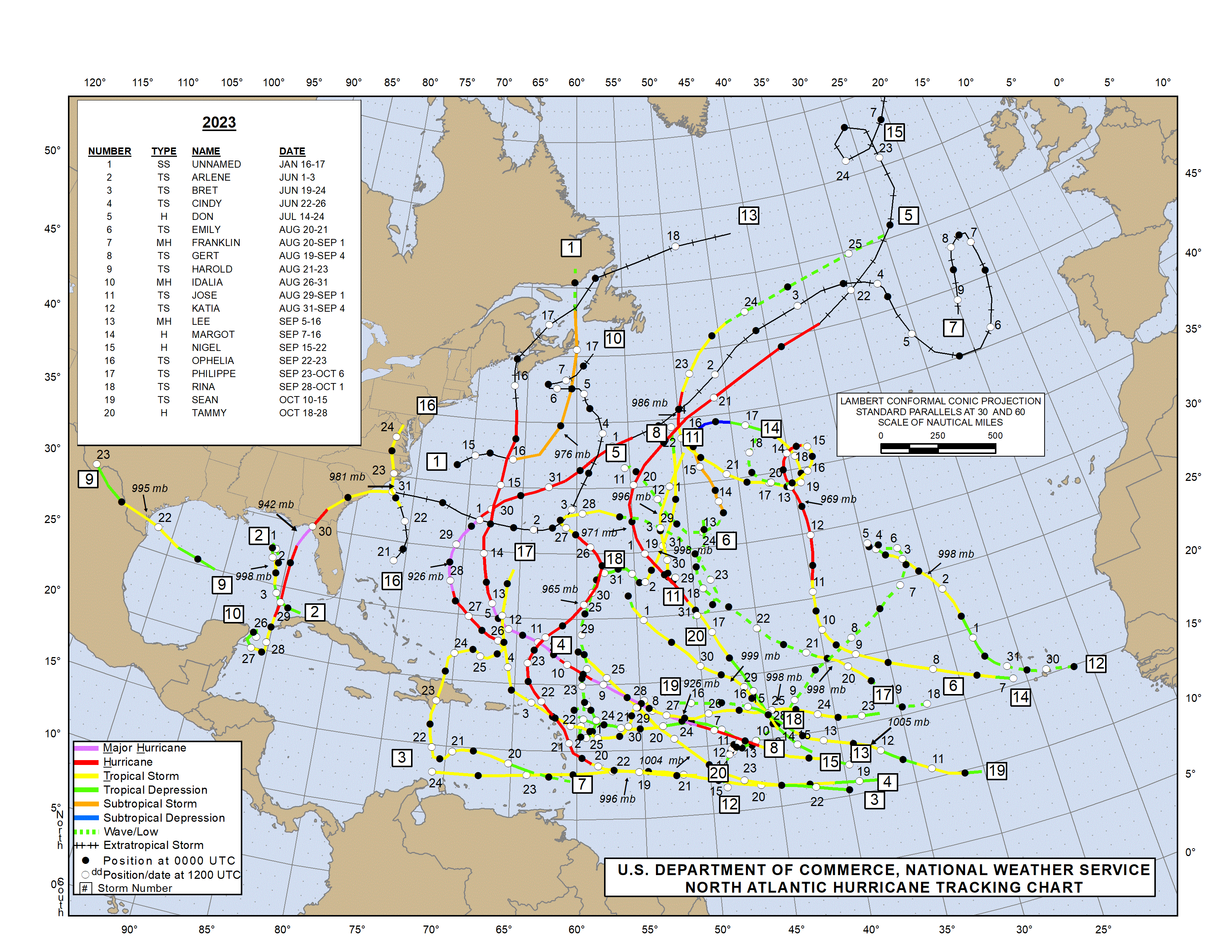
2023 had two TS simultaneously starting on June 22: Bret and Cindy (both while in the E MDR):
https://www.nhc.noaa.gov/data/tracks/tracks-at-2023.png
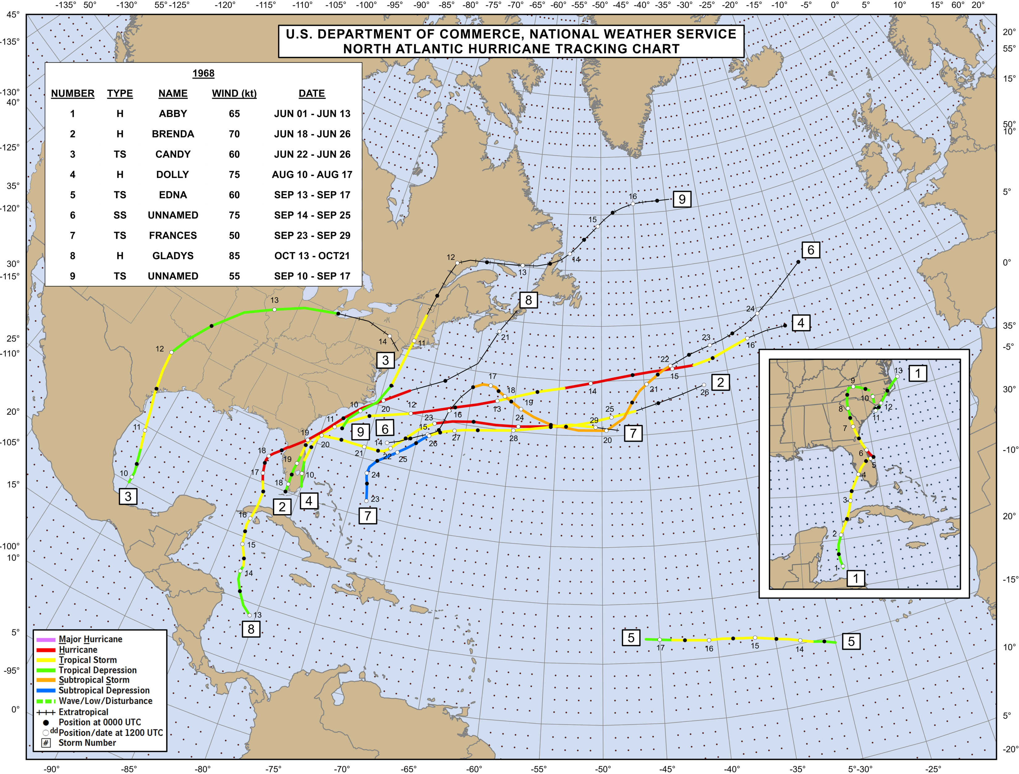
1968 also had two at same time starting on June 22, Brenda and Candy. Unlike 2023, neither was in or even near the MDR:
https://www.nhc.noaa.gov/data/tracks/tracks-at-1968.png
Before 1968, I don’t currently know if there have been two at same time that early.


