gpsnowman wrote:Portastorm wrote:One impact that looks to be fairly likely will be rip currents along the Texas coastline. Over the Memorial Day weekend, a person died and dozens needed to be rescued in Galveston due to rip currents. With a holiday week on us and hundreds of thousands enjoying Texas beaches, this is going to be a real concern.
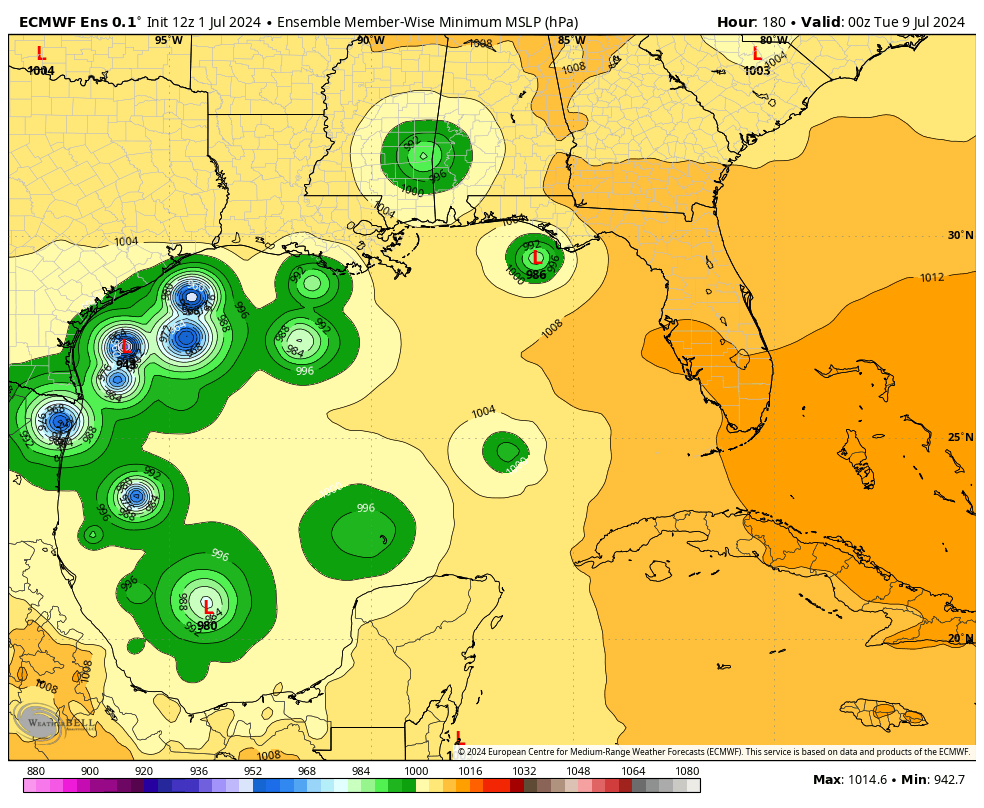
Also noticed the 12z tropical models and GFS are a bit further north on the storm's trajectory in the western Gulf. We are far from being considered out of the woods.
Someone remind me, wasn't there a tropical system headed towards Texas years ago that ended up being shredded by a strong high pressure dome?
Typically, domes of HP act as track barriers depending on where they're located. Troughs can sometimes create shear and as a result tear systems apart or prevent strengthening. What we're going to be watching in this scenario is how fast does the HP break down as the trough moves across the Midwest.
A deeper trough over the Midwest may help to breakdown the ridge and shift it more eastward and perhaps allow Beryl to gain some latitude over the southern gulf possibly toward Texas. The other question is how strong Beryl is once it moves over the high terrain of the Yucatan Peninsula.
Stronger systems typically feel the influence of the trough more whereas weaker systems may miss it entirely and therefore continue to drive it west into Mexico. This is why we see some the spread in the ensemble tracks where the stronger solutions take a more northwesterly/northerly path late in the forecast period.
To your point though, HP can create a ton of dry air and weaken systems dramatically once they make landfall. Bret was an example of this I believe. Also helped that it made landfall in a sparsely populated region of south Texas. Major hurricane but collapsed quickly. Smaller system/localized impacts.