


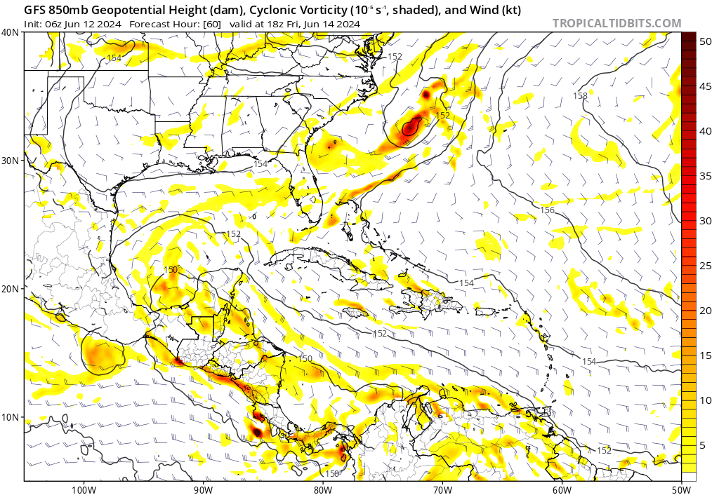
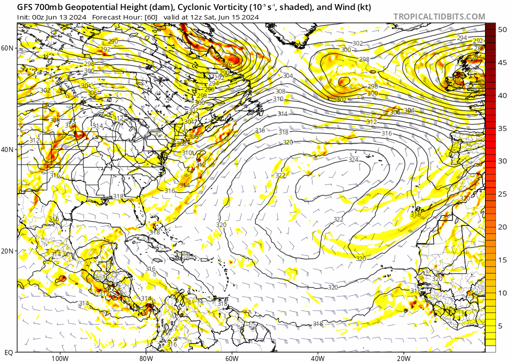
REDHurricane wrote:Looking ahead past the potential BoC system everyone's talking about for next week, I noticed that the GFS has consistently (6 out the last 8 runs) forecast a system trying to form somewhere in the Gulf/NW Caribbean around 10-11 days out -- still a ways to go before anyone should be seriously concerned, but given the environment I think it's certainly worth monitoring over the next several days in addition to the BoC system:
https://media2.giphy.com/media/v1.Y2lkPTc5MGI3NjExMXY0NHQxNjJmbzQ1dm1jN3NrY2pnMnQ1ZDF4ZDdhMXYzNW1hajdreiZlcD12MV9pbnRlcm5hbF9naWZfYnlfaWQmY3Q9Zw/3BF0hTGJEcrq4ZerAI/giphy.gif
Problem with that is the origin, you can see it on the GFS that it just randomly spins that system up out of nowhere in a region where the GFS is known to have a ton of false alarms. You can even see it do the same for another system before it but it fizzles out. Until other models show development for that system I am going to be taking it with a huge grain of salt.


