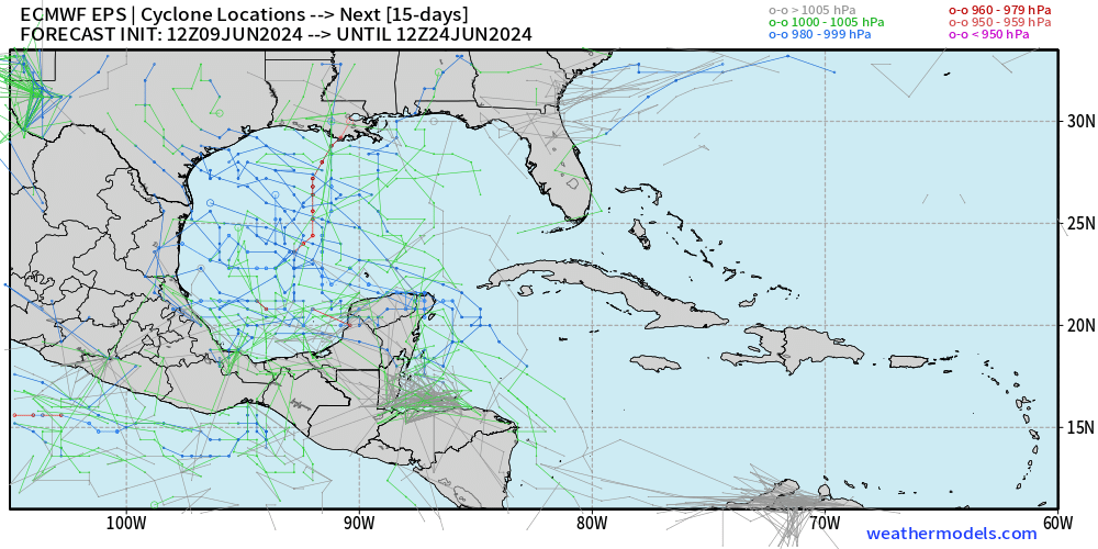
LarryWx wrote: I believe that’s the 5th UKMET run in a row showing that weak offshore the SE US TC. The others had it moving safely OTS to the NE though this 0Z run of today has it turning back N south of the NC OB.
And now the 6th UKMET run in a row with the TCG off the SE coast with this one stronger (TS) but back to moving NE safely off the E coast:
NEW TROPICAL CYCLONE FORECAST TO DEVELOP AFTER 48 HOURS
FORECAST POSITION AT T+ 48 : 28.6N 78.9W
LEAD CENTRAL MAXIMUM WIND
VERIFYING TIME TIME POSITION PRESSURE (MB) SPEED (KNOTS)
-------------- ---- -------- ------------- -------------
1200UTC 12.06.2024 48 28.6N 78.9W 1007 35
0000UTC 13.06.2024 60 29.0N 78.3W 1009 33
1200UTC 13.06.2024 72 30.8N 75.2W 1007 44
0000UTC 14.06.2024 84 31.7N 74.5W 1008 36
1200UTC 14.06.2024 96 31.6N 73.3W 1009 33
0000UTC 15.06.2024 108 33.6N 71.4W 1008 31
1200UTC 15.06.2024 120 CEASED TRACKING


