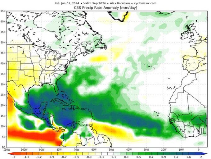
Interesting...... well, "models be damned" but this little tidbit suggests to me that we'll see a named small sloppy T.S. somewhere in the GOM between this Friday and Sunday

The two remaining options are:
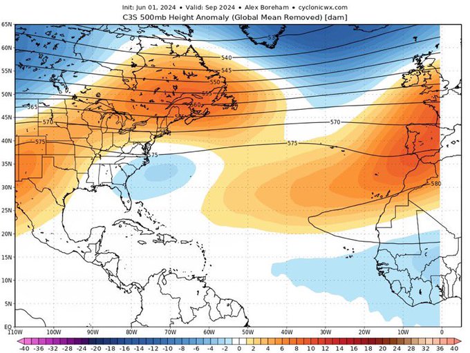
2) we are presently in the midst of the most radical tropical Atlantic seasonal transition witnessed over the last half century, or
3) this upcoming Atlantic hurricane season will turn into perhaps the very biggest seasonal forecast bust since the creation of NOAA.
If I were in Vegas I'd be placing about 65% of my money on Option 1, with the remaining 35% of my money on option 2.