

Moderator: S2k Moderators


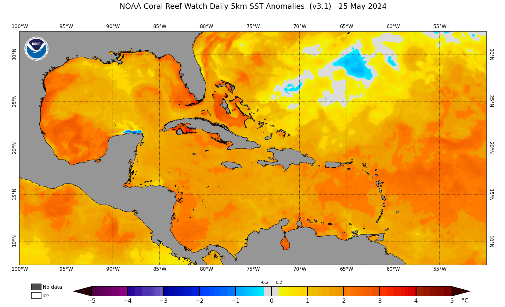
DorkyMcDorkface wrote:Interesting to see the Atlantic Niño (and much of the South Atlantic north of 20S in general) cool off quite a bit as of late. Wondering if this could be heralding a more +AMM configuration once again. Remember last month much of the seasonal guidance adjusted to show a prominent Atlantic Niño/warmer SATL but for this month they've backed off on that idea slightly.
https://i.ibb.co/bQqVPyD/bda2f579-bbee-46d2-b13e-6e1d6654b395.gif
https://i.ibb.co/6sGfz58/crw-ssta-change-satl.png


MarioProtVI wrote:DorkyMcDorkface wrote:Interesting to see the Atlantic Niño (and much of the South Atlantic north of 20S in general) cool off quite a bit as of late. Wondering if this could be heralding a more +AMM configuration once again. Remember last month much of the seasonal guidance adjusted to show a prominent Atlantic Niño/warmer SATL but for this month they've backed off on that idea slightly.
https://i.ibb.co/bQqVPyD/bda2f579-bbee-46d2-b13e-6e1d6654b395.gif
https://i.ibb.co/6sGfz58/crw-ssta-change-satl.png
Didn’t 2020 have an Atlantic Niña? I think that was one of the reasons that the MDR did poorly sans Teddy to everyone’s expectations - since the Nina forced the ITCZ further north leading to waves coming off further north and developing into weaker TCs because of cooler waters and drier air. Versus 2021 where the suppressed ITCZ due to the Atlantic Nino resulted in a very active MDR with several hurricanes and a few majors because the waves were able to come off further south and insulated from the cool SSTs and dry air.
If 2024 is developing an Atlantic Niña as it seems it might be from that loop, I think expectations will have to be tempered down a bit due to a more stable MDR (which as of right now seems to be where most predictions think the bulk of the high activity and numbers will originate from).

DorkyMcDorkface wrote:MarioProtVI wrote:DorkyMcDorkface wrote:Interesting to see the Atlantic Niño (and much of the South Atlantic north of 20S in general) cool off quite a bit as of late. Wondering if this could be heralding a more +AMM configuration once again. Remember last month much of the seasonal guidance adjusted to show a prominent Atlantic Niño/warmer SATL but for this month they've backed off on that idea slightly.
https://i.ibb.co/bQqVPyD/bda2f579-bbee-46d2-b13e-6e1d6654b395.gif
https://i.ibb.co/6sGfz58/crw-ssta-change-satl.png
Didn’t 2020 have an Atlantic Niña? I think that was one of the reasons that the MDR did poorly sans Teddy to everyone’s expectations - since the Nina forced the ITCZ further north leading to waves coming off further north and developing into weaker TCs because of cooler waters and drier air. Versus 2021 where the suppressed ITCZ due to the Atlantic Nino resulted in a very active MDR with several hurricanes and a few majors because the waves were able to come off further south and insulated from the cool SSTs and dry air.
If 2024 is developing an Atlantic Niña as it seems it might be from that loop, I think expectations will have to be tempered down a bit due to a more stable MDR (which as of right now seems to be where most predictions think the bulk of the high activity and numbers will originate from).
2020 didn't have a record warm MDR/+AMO. That alone will help focus instability in the MDR for the most part, as long as the subtropics don't warm up considerably as well (which is what happened as 2020 progressed that lead to some of the stability issues we saw).

MarioProtVI wrote:DorkyMcDorkface wrote:Interesting to see the Atlantic Niño (and much of the South Atlantic north of 20S in general) cool off quite a bit as of late. Wondering if this could be heralding a more +AMM configuration once again. Remember last month much of the seasonal guidance adjusted to show a prominent Atlantic Niño/warmer SATL but for this month they've backed off on that idea slightly.
https://i.ibb.co/bQqVPyD/bda2f579-bbee-46d2-b13e-6e1d6654b395.gif
https://i.ibb.co/6sGfz58/crw-ssta-change-satl.png
Didn’t 2020 have an Atlantic Niña? I think that was one of the reasons that the MDR did poorly sans Teddy to everyone’s expectations - since the Nina forced the ITCZ further north leading to waves coming off further north and developing into weaker TCs because of cooler waters and drier air. Versus 2021 where the suppressed ITCZ due to the Atlantic Nino resulted in a very active MDR with several hurricanes and a few majors because the waves were able to come off further south and insulated from the cool SSTs and dry air.
If 2024 is developing an Atlantic Niña as it seems it might be from that loop, I think expectations will have to be tempered down a bit due to a more stable MDR (which as of right now seems to be where most predictions think the bulk of the high activity and numbers will originate from).
Category5Kaiju wrote:MarioProtVI wrote:DorkyMcDorkface wrote:Interesting to see the Atlantic Niño (and much of the South Atlantic north of 20S in general) cool off quite a bit as of late. Wondering if this could be heralding a more +AMM configuration once again. Remember last month much of the seasonal guidance adjusted to show a prominent Atlantic Niño/warmer SATL but for this month they've backed off on that idea slightly.
https://i.ibb.co/bQqVPyD/bda2f579-bbee-46d2-b13e-6e1d6654b395.gif
https://i.ibb.co/6sGfz58/crw-ssta-change-satl.png
Didn’t 2020 have an Atlantic Niña? I think that was one of the reasons that the MDR did poorly sans Teddy to everyone’s expectations - since the Nina forced the ITCZ further north leading to waves coming off further north and developing into weaker TCs because of cooler waters and drier air. Versus 2021 where the suppressed ITCZ due to the Atlantic Nino resulted in a very active MDR with several hurricanes and a few majors because the waves were able to come off further south and insulated from the cool SSTs and dry air.
If 2024 is developing an Atlantic Niña as it seems it might be from that loop, I think expectations will have to be tempered down a bit due to a more stable MDR (which as of right now seems to be where most predictions think the bulk of the high activity and numbers will originate from).
Also important to keep in mind that a strong Atlantic Nino, as we saw back in 2021, can be a negative factor for late season activity as it drags instability southward.
Aside from that, I'm not entirely convinced by the argument that Atlantic Nino alone is necessary for heightened MDR activity, especially with an extremely potent +AMO already in place. I mean yeah sure it might very well indeed play a beneficial role in increasing MDR activity like we saw 3 years ago, but we've seen years (2010 and 2017 as examples) that lacked a defined Atlantic Nino during peak season, yet saw many powerful MDR systems.


skyline385 wrote:Category5Kaiju wrote:MarioProtVI wrote:Didn’t 2020 have an Atlantic Niña? I think that was one of the reasons that the MDR did poorly sans Teddy to everyone’s expectations - since the Nina forced the ITCZ further north leading to waves coming off further north and developing into weaker TCs because of cooler waters and drier air. Versus 2021 where the suppressed ITCZ due to the Atlantic Nino resulted in a very active MDR with several hurricanes and a few majors because the waves were able to come off further south and insulated from the cool SSTs and dry air.
If 2024 is developing an Atlantic Niña as it seems it might be from that loop, I think expectations will have to be tempered down a bit due to a more stable MDR (which as of right now seems to be where most predictions think the bulk of the high activity and numbers will originate from).
Also important to keep in mind that a strong Atlantic Nino, as we saw back in 2021, can be a negative factor for late season activity as it drags instability southward.
Aside from that, I'm not entirely convinced by the argument that Atlantic Nino alone is necessary for heightened MDR activity, especially with an extremely potent +AMO already in place. I mean yeah sure it might very well indeed play a beneficial role in increasing MDR activity like we saw 3 years ago, but we've seen years (2010 and 2017 as examples) that lacked a defined Atlantic Nino during peak season, yet saw many powerful MDR systems.
On that topic, the effects of the Atlantic Nina/Nino are still being researched and there just aren't that many studies on it from what I have seen. Also, several active years had an Atlantic Nina in June/July which started decaying as we got into August/September. Here are 2004 & 2005 for example:
[url]https://i.ibb.co/yPt24c0/image.png [/url]
[url]https://i.ibb.co/tDcs6V4/image.png [/url]


Blown Away wrote:[url]https://i.postimg.cc/Ss8xVtDQ/42fd2c4b-7b14-42c1-b334-2ae733c6d03d.gif [/url]
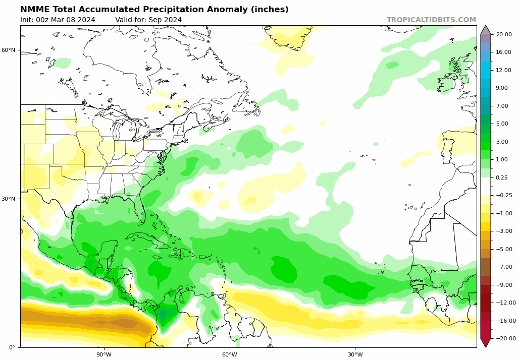
September NMME Trend...
[url]https://i.postimg.cc/6q5FT82s/nmme-apcpna-month-nmme-atl-fh3-trend-1.gif [/url]
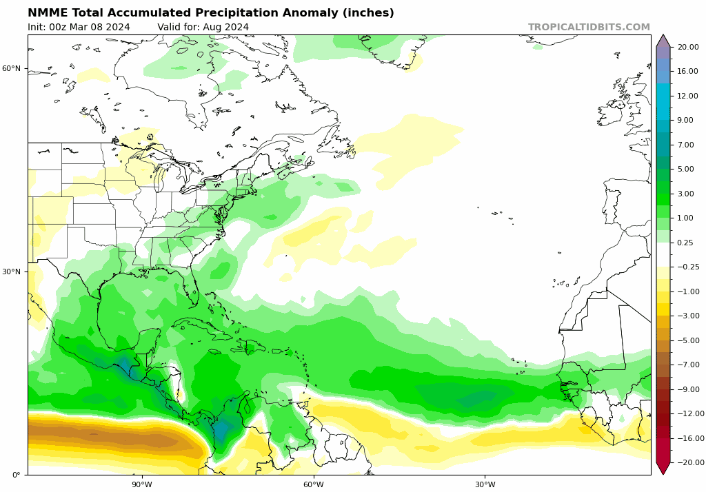
August NMME Trend...
Both Aug/Sept trending drier along the NE CONUS, would that indicate the modeling seeing stronger HP and weaker East Coast Troughing?
skyline385 wrote:Blown Away wrote:[url]https://i.postimg.cc/Ss8xVtDQ/42fd2c4b-7b14-42c1-b334-2ae733c6d03d.gif [/url]
September NMME Trend...
[url]https://i.postimg.cc/6q5FT82s/nmme-apcpna-month-nmme-atl-fh3-trend-1.gif [/url]
August NMME Trend...
Both Aug/Sept trending drier along the NE CONUS, would that indicate the modeling seeing stronger HP and weaker East Coast Troughing?
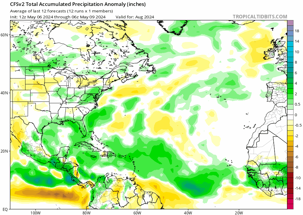
Funny thing is, I was just looking at 20 run trends of CFS yesterday and it has been doing kinda the opposite (atleast for August). You can see the GoM trending slightly drier and the MDR anomalies lifting north very slowly.
[url]https://i.postimg.cc/Qx8Y6YYB/2e90b800-d4ea-493b-9711-27d66a2aa843.gif [/url]

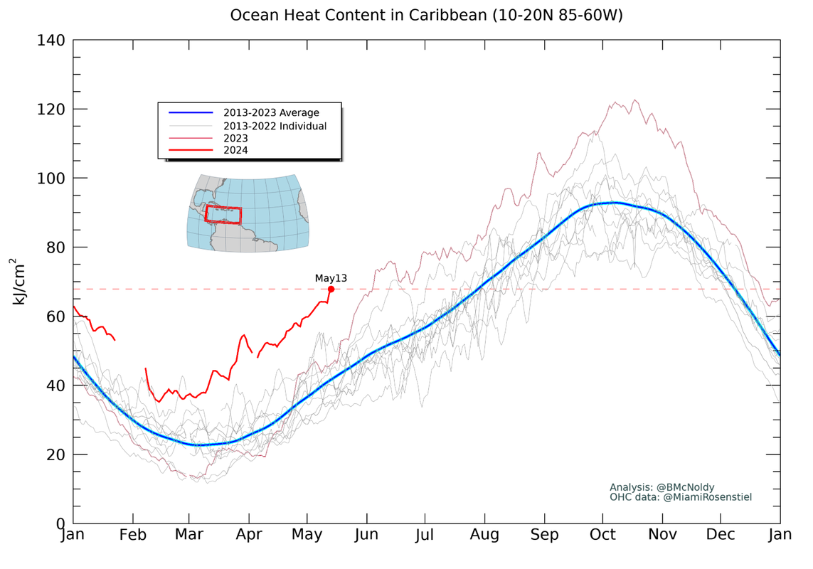
zzzh wrote:https://twitter.com/DrKimWood/status/1790393146440036499
https://i.imgur.com/RFSEcyu.png
Insane. Caribbean SST is nearly 4 month ahead of climo, and just need 0.1°C warmer to reach climo max of 29.1°C. I think it's safe to say that 2024 will break 2023's old record of 30.5°C by September.
Cpv17 wrote:zzzh wrote:https://twitter.com/DrKimWood/status/1790393146440036499
https://i.imgur.com/RFSEcyu.png
Insane. Caribbean SST is nearly 4 month ahead of climo
Maybe not if there’s a lot of upwelling.
Users browsing this forum: No registered users and 113 guests


