2023 Global Model Runs Discussion (Out thru day 16)
Moderator: S2k Moderators
Forum rules

The posts in this forum are NOT official forecasts and should not be used as such. They are just the opinion of the poster and may or may not be backed by sound meteorological data. They are NOT endorsed by any professional institution or STORM2K. For official information, please refer to products from the National Hurricane Center and National Weather Service.
Re: 2023 Global Model Runs Discussion (Out thru day 16)
00z gfs then tries to send a second epac crossover further south but gets sheared. Gfs ensembles aroubd 320 hours is getting some stronger members near the yucatan moving northeast as well. Looks like from a crossover. Seems too comical to me though. Usual gfs stuff
1 likes
-
WalterWhite

- Category 1

- Posts: 342
- Joined: Fri Mar 17, 2023 5:53 pm
Re: 2023 Global Model Runs Discussion (Out thru day 16)
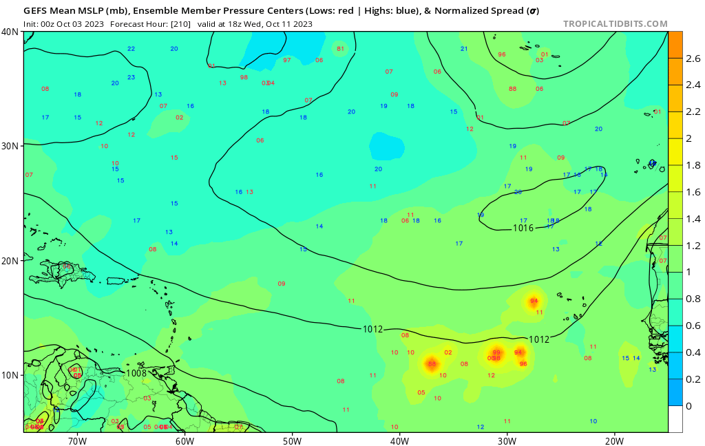
The GEFS is indicating the possibility of another Cape Verde storm around October 11.
0 likes
-
Blown Away

- S2K Supporter

- Posts: 10253
- Joined: Wed May 26, 2004 6:17 am
Re: 2023 Global Model Runs Discussion (Out thru day 16)
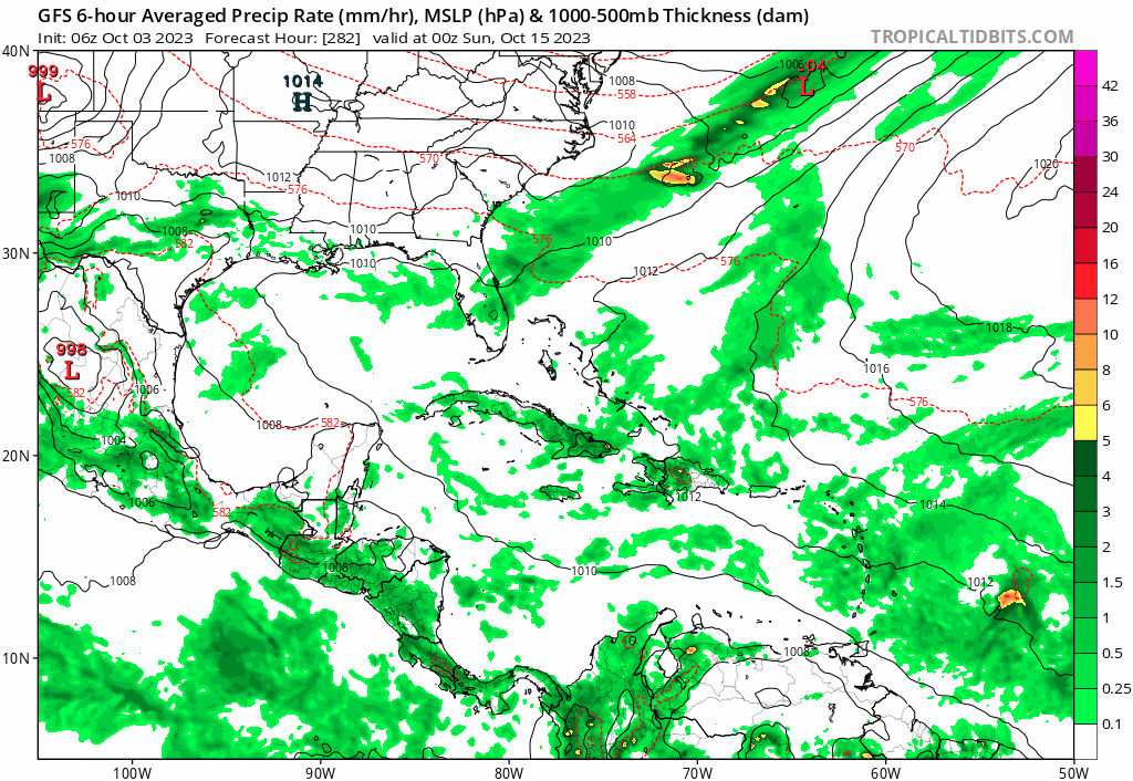
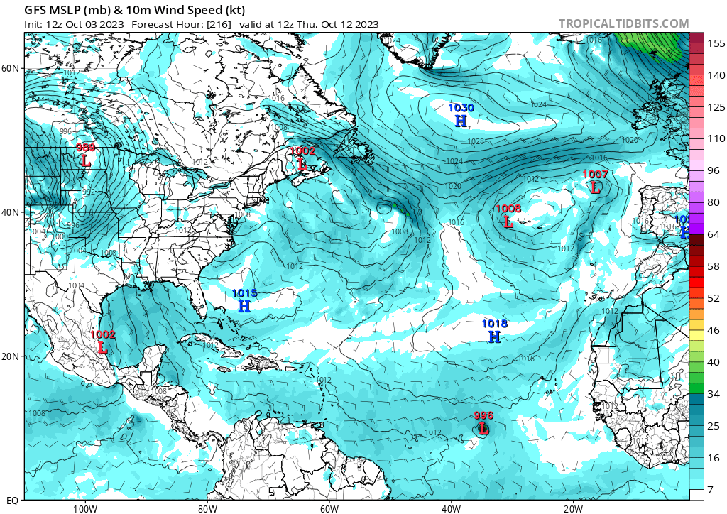
06 GFS has a TS moving through the NE Caribbean in the long range...
1 likes
Hurricane Eye Experience: David 79, Irene 99, Frances 04, Jeanne 04, Wilma 05… Hurricane Brush Experience: Andrew 92, Erin 95, Floyd 99, Matthew 16, Irma 17, Ian 22, Nicole 22…
-
DunedinDave
- Category 1
- Posts: 269
- Joined: Fri Aug 25, 2023 10:31 am
Re: 2023 Global Model Runs Discussion (Out thru day 16)
Looks like the first cold front coming through this weekend in central Fla. I always said when that first front comes through, it’s the beginning of the end for hurricane season. Going to enjoy these cooler temperatures next week.
0 likes
-
IsabelaWeather
- Category 1
- Posts: 316
- Age: 36
- Joined: Tue Jul 07, 2020 7:29 am
- Location: Isabela, Puerto Rico
Re: 2023 Global Model Runs Discussion (Out thru day 16)
Blown Away wrote:[url=https://postimages.org/]
https://i.postimg.cc/28hkjWMG/45b4c359- ... fdb535.gif
06 GFS has a TS moving through the NE Caribbean in the long range...
I'm rooting for this exact outcome, desperately need the rain here.
0 likes
-
ThunderForce

- Tropical Storm

- Posts: 208
- Age: 26
- Joined: Tue Sep 27, 2022 6:20 pm
- Location: Calhoun County, Florida
Re: 2023 Global Model Runs Discussion (Out thru day 16)
The major hurricane member that GEFS shows going into southwest FL first appears at like Forecast Hour 222 (12z Thursday, October 12th) and doesn't become sub-990 mbs until 264 (06z Saturday, October 14th). The landfall itself doesn't happen until 354 (00z Wednesday, October 18th). These are all pretty much in the "fantasy land" range, so the chances of this verifying exactly as shown this far out (e.g. formation area, path, strength, landfall location, etc.) are really low.
Definitely something to keep an eye on in any case.
Definitely something to keep an eye on in any case.
Last edited by ThunderForce on Tue Oct 03, 2023 8:29 am, edited 1 time in total.
0 likes
Please refer to the NWS, NHC, SPC or a professional meteorologist for information and decision making during storms.
-
SFLcane

- S2K Supporter
- Posts: 10281
- Age: 48
- Joined: Sat Jun 05, 2010 1:44 pm
- Location: Lake Worth Florida
Re: 2023 Global Model Runs Discussion (Out thru day 16)
DunedinDave wrote:Looks like the first cold front coming through this weekend in central Fla. I always said when that first front comes through, it’s the beginning of the end for hurricane season. Going to enjoy these cooler temperatures next week.
For the Conus maybe but the caribbean could be open into November.
0 likes
Re: 2023 Global Model Runs Discussion (Out thru day 16)
Watching it too. Could be an unusual ene track too. Further south the warmer the water. The gfs ensembles seem to think on some of the members it will be favorable the further south it is i wonder if the sub tropical jet is cranking but it's moving with the shear which shears it less
0 likes

Re: 2023 Global Model Runs Discussion (Out thru day 16)
Ianswfl wrote:
Watching it too. Could be an unusual ene track too. Further south the warmer the water. The gfs ensembles seem to think on some of the members it will be favorable the further south it is i wonder if the sub tropical jet is cranking but it's moving with the shear which shears it less
I’ve got a trip planned in the Abacos 10/13 - 10/21. Really hoping these long range models don’t materialize. Can someone please provide the best links for me to keep an eye on it? Thanks in advance!
0 likes

Re: 2023 Global Model Runs Discussion (Out thru day 16)

12z GFS
Sent from my iPad using Tapatalk
0 likes
-
WeatherBoy2000
- Category 1
- Posts: 454
- Joined: Mon Apr 10, 2023 9:29 am
Re: 2023 Global Model Runs Discussion (Out thru day 16)
https://twitter.com/MikeFischerWx/status/1709230187781521875
The gfs/cmc/icon all show mdr activity picking up again around the 10th.
The gfs/cmc/icon all show mdr activity picking up again around the 10th.
0 likes
Re: 2023 Global Model Runs Discussion (Out thru day 16)


12z GFS fantasyland
Sent from my iPad using Tapatalk
0 likes
Re: 2023 Global Model Runs Discussion (Out thru day 16)

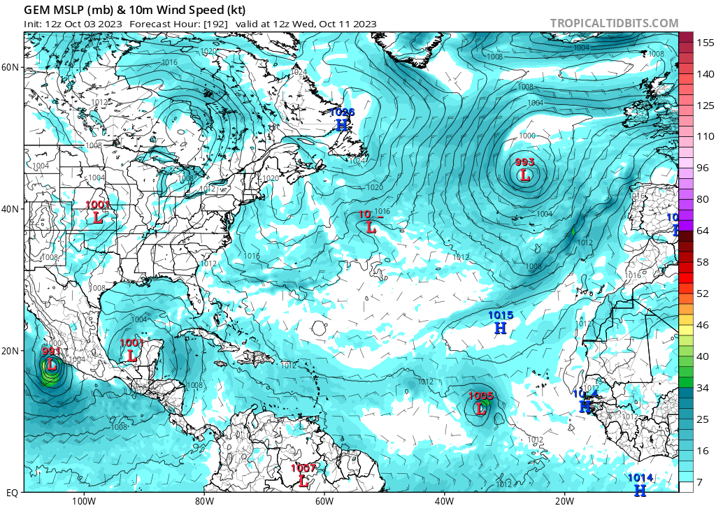
12z Canadian
Sent from my iPad using Tapatalk
0 likes
-
WalterWhite
- Category 1
- Posts: 342
- Joined: Fri Mar 17, 2023 5:53 pm
Re: 2023 Global Model Runs Discussion (Out thru day 16)
The GFS, CMC, ICON, and NAVGEM global models; and the GEFS and GEPS ensembles all point to development in near Cape Verde in about 8-9 days.
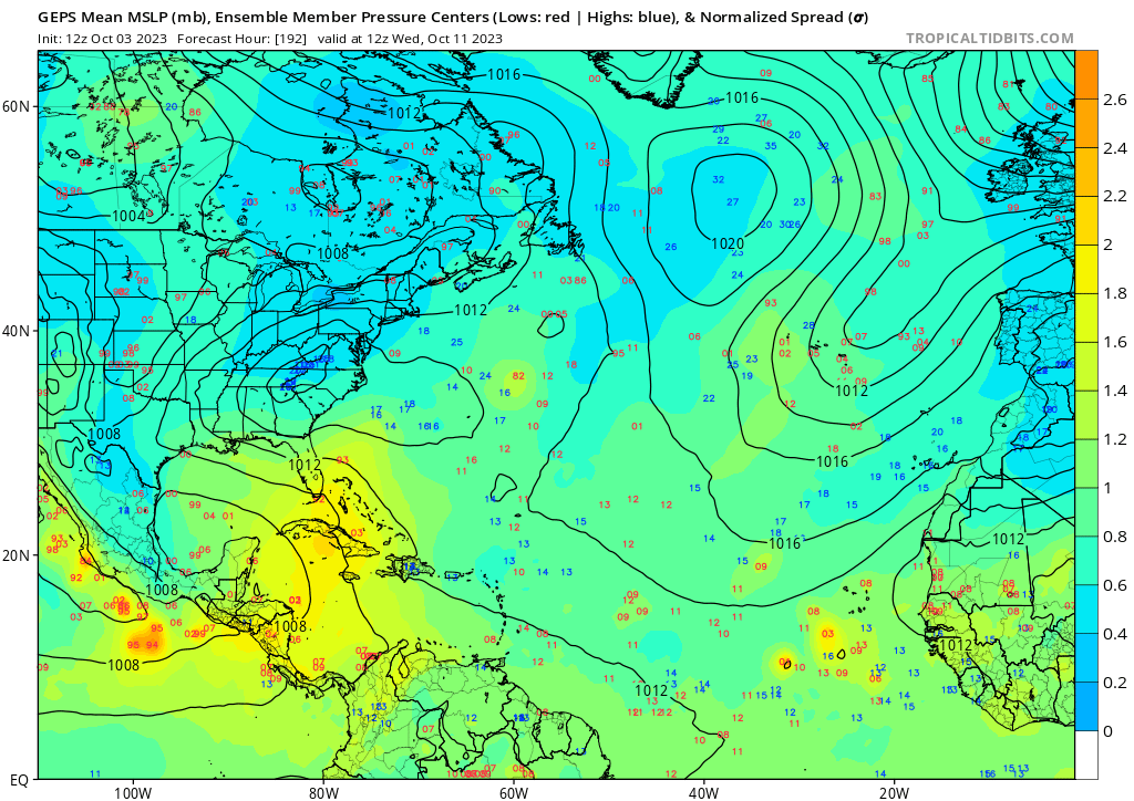
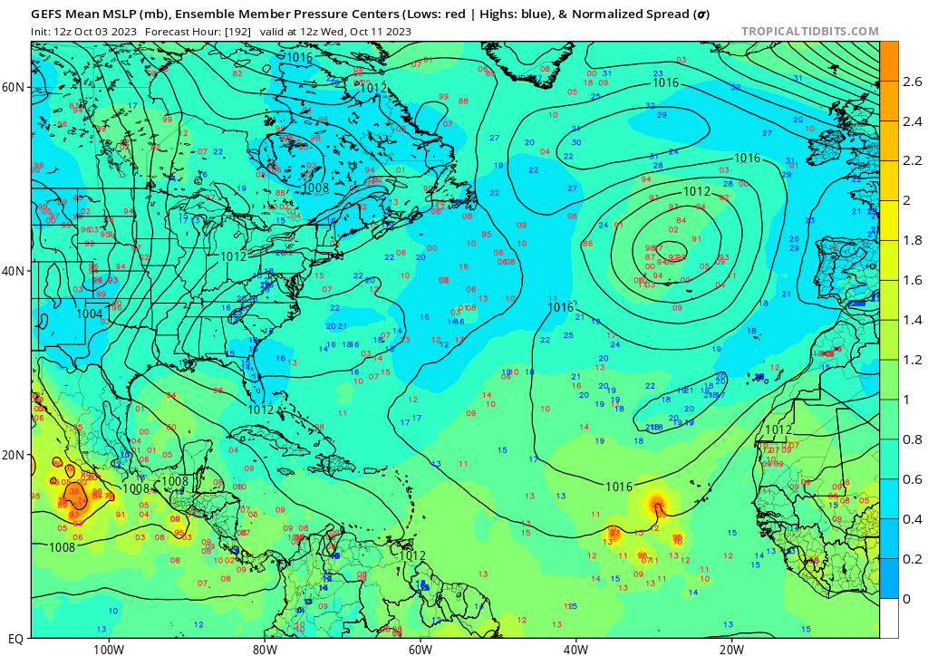
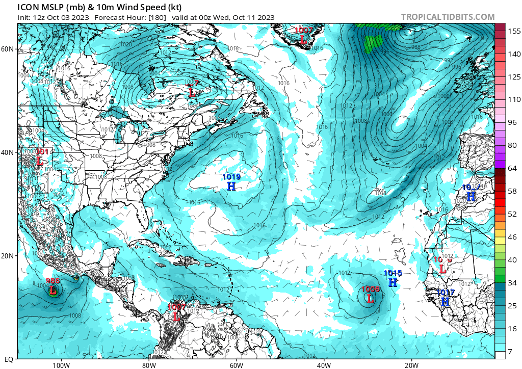
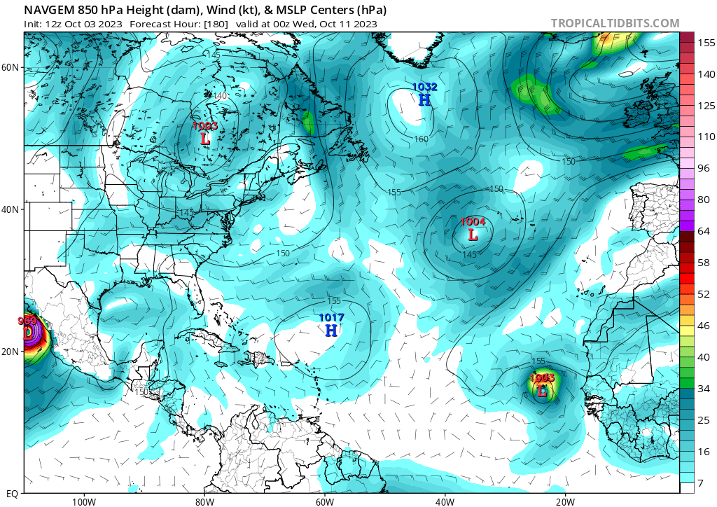
The only model that has yet to support development is the ECMWF. The 00Z ECENS ensembles show the possibility of development in this area, however.
The only model that has yet to support development is the ECMWF. The 00Z ECENS ensembles show the possibility of development in this area, however.
1 likes
Re: 2023 Global Model Runs Discussion (Out thru day 16)
Euro on board with the cross over. Both operational and ensembles!! Gfs cmc and euro on board. Anywhere from ms to south fl.
0 likes
-
tolakram
- Admin

- Posts: 20168
- Age: 62
- Joined: Sun Aug 27, 2006 8:23 pm
- Location: Florence, KY (name is Mark)
Re: 2023 Global Model Runs Discussion (Out thru day 16)
Just a bit of shear.

0 likes
M a r k
- - - - -
Join us in chat: Storm2K Chatroom Invite. Android and IOS apps also available.
The posts in this forum are NOT official forecasts and should not be used as such. Posts are NOT endorsed by any professional institution or STORM2K.org. For official information and forecasts, please refer to NHC and NWS products.

Re: 2023 Global Model Runs Discussion (Out thru day 16)
DunedinDave wrote:Looks like the first cold front coming through this weekend in central Fla. I always said when that first front comes through, it’s the beginning of the end for hurricane season. Going to enjoy these cooler temperatures next week.
It’s often the green light though for storms to come up. 2005 had some early fronts as did 2004 and what followed was long periods of activity and US landfalls. Obviously we are in October not mid-August, so it’s not the same thing as in those years. But any time a front gets through and a ridge settles in behind it, you gotta look south.
4 likes
Re: 2023 Global Model Runs Discussion (Out thru day 16)
Steve wrote:DunedinDave wrote:Looks like the first cold front coming through this weekend in central Fla. I always said when that first front comes through, it’s the beginning of the end for hurricane season. Going to enjoy these cooler temperatures next week.
It’s often the green light though for storms to come up. 2005 had some early fronts as did 2004 and what followed was long periods of activity and US landfalls. Obviously we are in October not mid-August, so it’s not the same thing as in those years. But any time a front gets through and a ridge settles in behind it, you gotta look south.
Yep. While Fl thru Oct 25th Tampa on South gets hits from the Gulf, they're usually not cat4 or cat5s. They seem to be a lot of cat3s and cat2 hits. The waters are still warm enough for major hurricanes but not the heavy hitters like Ian. Wilma is a good example of the typical intensity if you get a well develop hurricane from the Caribbean pulled north from a front in oct.
Of course you have storms like Michael but 2018 had some VERY warm temps in the central and northern Gulf for October.
0 likes

Who is online
Users browsing this forum: No registered users and 53 guests