2023 Global Model Runs Discussion (Out thru day 16)

This is the general tropical discussion area. Anyone can take their shot at predicting a storms path.

Moderator: S2k Moderators

Forum rules

The posts in this forum are NOT official forecasts and should not be used as such. They are just the opinion of the poster and may or may not be backed by sound meteorological data. They are NOT endorsed by any professional institution or STORM2K. For official information, please refer to products from the National Hurricane Center and National Weather Service.

Help Support Storm2K
Message
Author
Ianswfl
Category 1
Category 1
Posts: 482
Joined: Thu Mar 23, 2023 11:11 pm

Re: 2023 Global Model Runs Discussion (Out thru day 16)

#1561 Postby Ianswfl » Sun Sep 24, 2023 11:52 pm

Yikes, GFS ensembles getting more stronger members in the gulf. Seems to stall or move pretty slow just like the operational. Gets left behind.

Image

Strong cat3 member right into Sarasota.

Image
0 likes   

User avatar
ThunderForce
Tropical Storm
Tropical Storm
Posts: 208
Age: 25
Joined: Tue Sep 27, 2022 6:20 pm
Location: Calhoun County, Florida

Re: 2023 Global Model Runs Discussion (Out thru day 16)

#1562 Postby ThunderForce » Mon Sep 25, 2023 12:14 am

It seems to get choked out by dry air and wind shear in the operational 00z GFS run before moving southwestward into the Yucatan very slowly as a weak TD or low pressure. The fact the 0z GEFS ensembles are showing more members getting strong than before and possibly stalling in the Gulf is extremely worrisome, though.
0 likes   
Please refer to the NWS, NHC, SPC or a professional meteorologist for information and decision making during storms.

Ianswfl
Category 1
Category 1
Posts: 482
Joined: Thu Mar 23, 2023 11:11 pm

Re: 2023 Global Model Runs Discussion (Out thru day 16)

#1563 Postby Ianswfl » Mon Sep 25, 2023 12:30 am

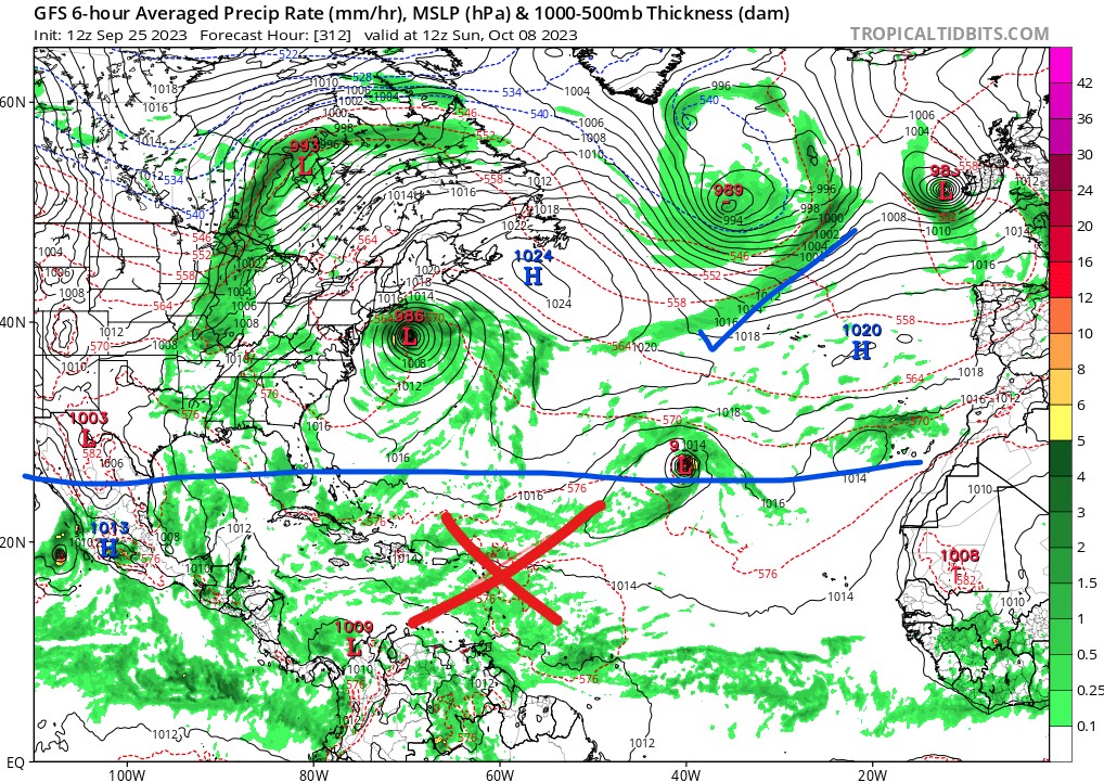
ThunderForce wrote:It seems to get choked out by dry air and wind shear in the operational 00z GFS run before moving southwestward into the Yucatan very slowly as a weak TD or low pressure. The fact the 0z GEFS ensembles are showing more members getting strong than before and possibly stalling in the Gulf is extremely worrisome, though.


A stall in late sept or oct is unlikely. Another member sharp hooks it into Pasco County as a major as well. I expect a shift back east. Remember the GFS would send Ian more west out in the Gulf until it corrected. I doubt we see an Elena here. The slow movement though is similar to another storm.
1 likes   

User avatar
ThunderForce
Tropical Storm
Tropical Storm
Posts: 208
Age: 25
Joined: Tue Sep 27, 2022 6:20 pm
Location: Calhoun County, Florida

Re: 2023 Global Model Runs Discussion (Out thru day 16)

#1564 Postby ThunderForce » Mon Sep 25, 2023 3:27 am

The differences between the 00z GFS and Euro are like night and day right now. Both models are showing wildly different outcomes just a few days out for not only Philippe and 91L, but also vary wildly regarding the possible CAG storm.

Philippe:
GFS develops Philippe into a hurricane, and then has Philippe move northward into a weakness in the ridge. Euro does not have Philippe strengthen much if at all, with it drifting northwestward and weakening into a low pressure area a fair bit north of the eastern Caribbean around the 29th instead.

91L (Rina/Sean?):
GFS doesn't develop it much before it ends up getting sucked towards Philippe and absorbed when it heads northward. Euro, on the other hand, develops 91L into a tropical storm around the same time Philippe dissipates into a low. It then becomes a hurricane on the 1st of October.

CAG storm (92L/Rina/Sean?):
GFS tries to spin some vorticity up near the Yucatan and Belize in about three/four days that seems to come out of South America close to Columbia and Panama in less than 24 hours from now, before stalling and slowly being pushed southwestward into the Yucatan by what I'm assuming is dry air and wind shear (judging by the humidity and shear indexes around that timeframe).
GEFS ensembles have quite a few members coming from this that move northward into the Gulf with some quite strong. Some even stall in the Gulf and strengthen more before moving somewhere.
Euro appears to show some energy coming from the same area, but it's weaker and does not develop it much if at all. The energy gets yanked northeastward below Florida around the 26th/27th when it gets near the Yucatan, and is a good bit faster with the energy's movement in general than the GFS is. 00z EPS ensembles show some stuff, but they're much weaker (like above 1000 mbs) and most go northeastward compared to what 00z GEFS is showing.


In addition to all of the above, Euro has some sort of low pressure try to form near Florida in the Gulf around October 4th that appears to come from some sort of vorticity that comes off of Texas/Mexico. GFS meanwhile has the CAG storm still meandering slowly southwestward near the Yucatan around this timeframe and doesn't appear to have this vorticity at all.

How and why the two models are varying so much on these three despite the timeframe being only 2-5 days out is mind-boggling, to say the least.
3 likes   
Please refer to the NWS, NHC, SPC or a professional meteorologist for information and decision making during storms.

User avatar
SFLcane
S2K Supporter
S2K Supporter
Posts: 10163
Age: 47
Joined: Sat Jun 05, 2010 1:44 pm
Location: Lake Worth Florida

Re: 2023 Global Model Runs Discussion (Out thru day 16)

#1565 Postby SFLcane » Mon Sep 25, 2023 6:35 am

Gfs all but dropped this… oh wait it never had it. :lol:

Gefs now mostly into Mexico- Florida shields up.
1 likes   

Ianswfl
Category 1
Category 1
Posts: 482
Joined: Thu Mar 23, 2023 11:11 pm

Re: 2023 Global Model Runs Discussion (Out thru day 16)

#1566 Postby Ianswfl » Mon Sep 25, 2023 6:49 am

SFLcane wrote:Gfs all but dropped this… oh wait it never had it. :lol:

Gefs now mostly into Mexico- Florida shields up.


Because the high pushes it into mexico. 00z euro has the system end of run now
0 likes   

User avatar
ThunderForce
Tropical Storm
Tropical Storm
Posts: 208
Age: 25
Joined: Tue Sep 27, 2022 6:20 pm
Location: Calhoun County, Florida

Re: 2023 Global Model Runs Discussion (Out thru day 16)

#1567 Postby ThunderForce » Mon Sep 25, 2023 7:48 am

Ianswfl wrote:
SFLcane wrote:Gfs all but dropped this… oh wait it never had it. :lol:

Gefs now mostly into Mexico- Florida shields up.


Because the high pushes it into mexico. 00z euro has the system end of run now

I think that's a different system. It seems to form from some sort of vorticity coming off of Texas/Mexico.
0 likes   
Please refer to the NWS, NHC, SPC or a professional meteorologist for information and decision making during storms.

User avatar
SFLcane
S2K Supporter
S2K Supporter
Posts: 10163
Age: 47
Joined: Sat Jun 05, 2010 1:44 pm
Location: Lake Worth Florida

Re: 2023 Global Model Runs Discussion (Out thru day 16)

#1568 Postby SFLcane » Mon Sep 25, 2023 9:56 am

0 likes   

Ianswfl
Category 1
Category 1
Posts: 482
Joined: Thu Mar 23, 2023 11:11 pm

Re: 2023 Global Model Runs Discussion (Out thru day 16)

#1569 Postby Ianswfl » Mon Sep 25, 2023 10:01 am


Except with the ensembles later in the period they eventually eject it to the northeast and strong. The member into tampa bay snd the other one same area as michael. Just takes longer.

The 06z euro ensembles are now

showing this. Very weak, td intensity in the eastern gulf but its showing it now. It's more easterly though.

Oh and the 06z ensembles from the euro has the east atl stuff heading more west now!
0 likes   

User avatar
SFLcane
S2K Supporter
S2K Supporter
Posts: 10163
Age: 47
Joined: Sat Jun 05, 2010 1:44 pm
Location: Lake Worth Florida

Re: 2023 Global Model Runs Discussion (Out thru day 16)

#1570 Postby SFLcane » Mon Sep 25, 2023 11:13 am

Ianswfl wrote:


Except with the ensembles later in the period they eventually eject it to the northeast and strong. The member into tampa bay snd the other one same area as michael. Just takes longer.

The 06z euro ensembles are now

showing this. Very weak, td intensity in the eastern gulf but its showing it now. It's more easterly though.

Oh and the 06z ensembles from the euro has the east atl stuff heading more west now!


Not much to see for now gfs takes weak low west into CA big ridge over southeast. Rain for florida surely

Looking for development watch north of 30n.
0 likes   

AutoPenalti
Category 5
Category 5
Posts: 4030
Age: 29
Joined: Mon Aug 17, 2015 4:16 pm
Location: Ft. Lauderdale, Florida

Re: 2023 Global Model Runs Discussion (Out thru day 16)

#1571 Postby AutoPenalti » Mon Sep 25, 2023 11:28 am

SFLcane wrote:
Ianswfl wrote:


Except with the ensembles later in the period they eventually eject it to the northeast and strong. The member into tampa bay snd the other one same area as michael. Just takes longer.

The 06z euro ensembles are now

showing this. Very weak, td intensity in the eastern gulf but its showing it now. It's more easterly though.

Oh and the 06z ensembles from the euro has the east atl stuff heading more west now!


Not much to see for now gfs takes weak low west into CA big ridge over southeast. Rain for florida surely

Looking for development watch north of 30n.

Probably just going to watch the ensembles for now.
0 likes   
The posts in this forum are NOT official forecasts and should not be used as such. They are just the opinion of the poster and may or may not be backed by sound meteorological data. They are NOT endorsed by any professional institution or STORM2K. For official information, please refer to products from the NHC and NWS.


Model Runs Cheat Sheet:
GFS (5:30 AM/PM, 11:30 AM/PM)
HWRF, GFDL, UKMET, NAVGEM (6:30-8:00 AM/PM, 12:30-2:00 AM/PM)
ECMWF (1:45 AM/PM)

TCVN
is a weighted averaged

User avatar
SFLcane
S2K Supporter
S2K Supporter
Posts: 10163
Age: 47
Joined: Sat Jun 05, 2010 1:44 pm
Location: Lake Worth Florida

Re: 2023 Global Model Runs Discussion (Out thru day 16)

#1572 Postby SFLcane » Mon Sep 25, 2023 12:00 pm

Image
0 likes   

mantis83
Tropical Storm
Tropical Storm
Posts: 198
Joined: Fri Dec 05, 2003 4:47 pm

Re: 2023 Global Model Runs Discussion (Out thru day 16)

#1573 Postby mantis83 » Mon Sep 25, 2023 12:15 pm

no major landfalling systems on the horizon....good news! 8-)
2 likes   

Ianswfl
Category 1
Category 1
Posts: 482
Joined: Thu Mar 23, 2023 11:11 pm

Re: 2023 Global Model Runs Discussion (Out thru day 16)

#1574 Postby Ianswfl » Mon Sep 25, 2023 2:01 pm

12z euro has last night's weak gulf system again only a bit more further east and develops right near swfl. Looks like land interaction and shear but its tsking the eastern route while gfs buried it. of course if it can form a few miles more west off shore it will be stronger obviously.

Image

Image
0 likes   

User avatar
ThunderForce
Tropical Storm
Tropical Storm
Posts: 208
Age: 25
Joined: Tue Sep 27, 2022 6:20 pm
Location: Calhoun County, Florida

Re: 2023 Global Model Runs Discussion (Out thru day 16)

#1575 Postby ThunderForce » Mon Sep 25, 2023 6:44 pm

Yeah, that low pressure on the Euro model near/in Florida around the 4th/5th of October doesn't appear to be related to the CAG storm that GFS/GEFS was showing development for. If you look closely, you can see the energy related to that being yanked northeastward below Florida and near Cuba in this Euro run between the 26th and 27th of September.

You can also see Philippe on the far right on the 27th of September. After dissipating it also appears that most of Philippe's energy gets absorbed by 91L, which can be seen at the very end of this GIF.
0 likes   
Please refer to the NWS, NHC, SPC or a professional meteorologist for information and decision making during storms.

zzzh
Category 3
Category 3
Posts: 834
Joined: Thu Sep 02, 2021 1:13 pm

Re: 2023 Global Model Runs Discussion (Out thru day 16)

#1576 Postby zzzh » Mon Sep 25, 2023 9:01 pm

There is a healthy wave in the Caribbean. Upper level wind look favorable.
2 likes   

Ianswfl
Category 1
Category 1
Posts: 482
Joined: Thu Mar 23, 2023 11:11 pm

Re: 2023 Global Model Runs Discussion (Out thru day 16)

#1577 Postby Ianswfl » Mon Sep 25, 2023 11:28 pm

00z gfs thru 198 hr is goofy as heck! Totally different map than 18z.

2 storms in the open atl, one in the BOC and trying to form something over southern FL.

Image
0 likes   

Ianswfl
Category 1
Category 1
Posts: 482
Joined: Thu Mar 23, 2023 11:11 pm

Re: 2023 Global Model Runs Discussion (Out thru day 16)

#1578 Postby Ianswfl » Mon Sep 25, 2023 11:34 pm

GFS caving to the Euro with that system near FL next week in the same time frame now!

Image
0 likes   

User avatar
AJC3
Admin
Admin
Posts: 3999
Age: 61
Joined: Tue Aug 31, 2004 7:04 pm
Location: Ballston Spa, New York
Contact:

Re: 2023 Global Model Runs Discussion (Out thru day 16)

#1579 Postby AJC3 » Tue Sep 26, 2023 12:26 am

Any lowering of pressure near Florida beyond day 5 isn't tropical at all. If it were to occur, it would be along a stalled weak inverted surface trough, beneath a mid to upper level trough, in an area of strong baroclinic forcing (i.e. upper divergence). #ContextIsImportant here.
3 likes   

LarryWx
S2K Supporter
S2K Supporter
Posts: 6305
Joined: Sun Sep 07, 2003 2:04 pm
Location: GA

Re: 2023 Global Model Runs Discussion (Out thru day 16)

#1580 Postby LarryWx » Tue Sep 26, 2023 4:19 am

AJC3 wrote:Any lowering of pressure near Florida beyond day 5 isn't tropical at all. If it were to occur, it would be along a stalled weak inverted surface trough, beneath a mid to upper level trough, in an area of strong baroclinic forcing (i.e. upper divergence). #ContextIsImportant here.


I see that there is some suggestion by the ensembles that there may be a sfc low located near FL or off the SE coast beneath a pretty strong NE US around mid next week. Is that what you’re referring to?
0 likes   
Personal Forecast Disclaimer:
The posts in this forum are NOT official forecasts and should not be used as such. They are just the opinion of the poster and may or may not be backed by sound meteorological data. They are NOT endorsed by any professional institution or storm2k.org. For official information, please refer to the NHC and NWS products.


Return to “Talkin' Tropics”

Who is online

Users browsing this forum: Fancy1002 and 24 guests