ATL: LEE - Post-Tropical - Discussion
Moderator: S2k Moderators
-
Sciencerocks
- Category 5

- Posts: 10194
- Age: 40
- Joined: Thu Jul 06, 2017 1:51 am
Re: ATL: LEE - Hurricane - Discussion
lee's appearance is MUCH less impressive compared to January's hurricane that hit east of here. That is just reality....That hurricane had a eye and everything!
0 likes
-
Sciencerocks
- Category 5
- Posts: 10194
- Age: 40
- Joined: Thu Jul 06, 2017 1:51 am

-
dukeblue219
- S2K Supporter

- Posts: 556
- Joined: Fri Sep 30, 2016 3:52 pm
Re: ATL: LEE - Hurricane - Discussion
Sciencerocks wrote:https://imagizer.imageshack.com/img924/5711/UQbuac.gif
That is not a hurricane. Crazy.
1 likes
-
Hybridstorm_November2001

- S2K Supporter
- Posts: 2817
- Joined: Sat Aug 21, 2004 2:50 pm
- Location: SW New Brunswick, Canada
- Contact:
Re: ATL: LEE - Hurricane - Discussion
dukeblue219 wrote:Sciencerocks wrote:https://imagizer.imageshack.com/img924/5711/UQbuac.gif
That is not a hurricane. Crazy.
Indeed, structurally it is either subtropical or fully extratropical by now. But as I posted in the Dorain thread years ago getting hit at full speed by a transport truck versus getting hit at full speed by a train matters little to the person who gets hit.
Last edited by Hybridstorm_November2001 on Fri Sep 15, 2023 10:29 pm, edited 1 time in total.
5 likes

Re: ATL: LEE - Hurricane - Discussion
I think if this was OTS it would have been declared post-tropical at the latest at the 5PM, not that extratropical storms can't still pack quite a punch, especially recent transitioned ones.
1 likes
My Storms:
Earl 2010, Arthur 2014, Dorian 2019, Teddy 2020 and Fiona 2022
Storms that had a major impact on my area are bolded.
Earl 2010, Arthur 2014, Dorian 2019, Teddy 2020 and Fiona 2022
Storms that had a major impact on my area are bolded.
-
Sciencerocks
- Category 5
- Posts: 10194
- Age: 40
- Joined: Thu Jul 06, 2017 1:51 am
-
PavelGaborik10
- Category 1

- Posts: 472
- Joined: Tue Sep 04, 2018 3:23 pm
Re: ATL: LEE - Hurricane - Discussion
Pressure mostly steady, though peak winds seem to be down to around 60 KTS now.
NHC have been pretty generous with Lee, so I'm expecting them to hold him at 65 KTS for another little while.
NHC have been pretty generous with Lee, so I'm expecting them to hold him at 65 KTS for another little while.
0 likes
-
cycloneye

- Admin

- Posts: 149846
- Age: 69
- Joined: Thu Oct 10, 2002 10:54 am
- Location: San Juan, Puerto Rico
Re: ATL: LEE - Post-Tropical - Discussion
LEE BECOMES POST-TROPICAL AS IT APPROACHES NOVA SCOTIA, BUT IT IS STILL PRODUCING HURRICANE-FORCE WINDS.
1 likes
Visit the Caribbean-Central America Weather Thread where you can find at first post web cams,radars
and observations from Caribbean basin members Click Here
and observations from Caribbean basin members Click Here
Re: ATL: LEE - Post-Tropical - Discussion
That buoy reported max sustained wind of 40.8 kts , gusting to 58.3 kts. Pressure bottomed at 969.4.
Cam closest to landfall. https://www.novascotiawebcams.com/webca ... cent-beach
Cam closest to landfall. https://www.novascotiawebcams.com/webca ... cent-beach
0 likes
Personal Forecast Disclaimer:
The posts in this forum are NOT official forecast and should not be used as such. They are just the opinion of the poster and may or may not be backed by sound meteorological data. For official information, please refer to the NHC and NWS products.
The posts in this forum are NOT official forecast and should not be used as such. They are just the opinion of the poster and may or may not be backed by sound meteorological data. For official information, please refer to the NHC and NWS products.
-
WalterWhite

- Category 1
- Posts: 342
- Joined: Fri Mar 17, 2023 5:53 pm
Re: ATL: LEE - Post-Tropical - Discussion
Bye, Lee! It was nice knowing you!
Lee appears to have completed its transition to a post-tropical
cyclone. The cloud pattern is comma shaped, and there has been no
significant central deep convection for the past 12 hours or so.
The cyclone is now frontal but likely still has a warm core,
indicating that it is a warm seclusion-type of extratropical
cyclone. Despite this transition, it remains a potent cyclone, and
the initial intensity remains 70 kt since the Air Force Reserve
Hurricane Hunters measured SFMR winds as high as 66 kt about 110 n
mi southwest of the center.
0 likes
-
tolakram
- Admin
- Posts: 20189
- Age: 62
- Joined: Sun Aug 27, 2006 8:23 pm
- Location: Florence, KY (name is Mark)
Re: ATL: LEE - Post-Tropical - Discussion
Sat views as Lee comes ashore
https://weather.cod.edu/satrad/?parms=local-S_Maine-02-24-1-100-1&checked=map&colorbar=undefined
https://weather.cod.edu/satrad/?parms=local-New_Brunswick-02-24-1-100-1&checked=map&colorbar=undefined
Floater: https://weather.cod.edu/satrad/?parms=meso-meso1-02-24-1-100-1&checked=map&colorbar=undefined
GOES image viewer: https://www.star.nesdis.noaa.gov/GOES/floater.php?stormid=AL132023#homePageLink
0 likes
M a r k
- - - - -
Join us in chat: Storm2K Chatroom Invite. Android and IOS apps also available.
The posts in this forum are NOT official forecasts and should not be used as such. Posts are NOT endorsed by any professional institution or STORM2K.org. For official information and forecasts, please refer to NHC and NWS products.
-
wxman57

- Moderator-Pro Met

- Posts: 23178
- Age: 68
- Joined: Sat Jun 21, 2003 8:06 pm
- Location: Houston, TX (southwest)
Re: ATL: LEE - Post-Tropical - Discussion
Plane is finding that there may be some 50 kt max wind, nothing more. Strongest wind observation I can find at present is in Halifax, about 175 miles from the center. Wind gusts to 48 kts at present, but were as high as 57 kts. Not even any 25 mph sustained in Boston. Some gusts to TS strength in Cape Cod, but no sustained 34kt+ wind.
3 likes
Re: ATL: LEE - Post-Tropical - Discussion
looks like center is still heading due north and not turning right as it's supposed to by now?
0 likes
Personal Forecast Disclaimer:
The posts in this forum are NOT official forecast and should not be used as such. They are just the opinion of the poster and may or may not be backed by sound meteorological data. For official information, please refer to the NHC and NWS products.
The posts in this forum are NOT official forecast and should not be used as such. They are just the opinion of the poster and may or may not be backed by sound meteorological data. For official information, please refer to the NHC and NWS products.
-
Sciencerocks
- Category 5
- Posts: 10194
- Age: 40
- Joined: Thu Jul 06, 2017 1:51 am

-
wxman57
- Moderator-Pro Met
- Posts: 23178
- Age: 68
- Joined: Sat Jun 21, 2003 8:06 pm
- Location: Houston, TX (southwest)
Re: ATL: LEE - Post-Tropical - Discussion
sikkar wrote:looks like center is still heading due north and not turning right as it's supposed to by now?
Yep, it's missing the tip of Nova Scotia. Nothing really associated with the center, though. Strongest winds are over 100 miles east. "Landfall" looks like near the border of Maine and New Brunswick. However, it could make that expected right turn at any point now.
https://www.tropicaltidbits.com/sat/satlooper.php?region=13L&product=vis
1 likes
-
PavelGaborik10
- Category 1
- Posts: 472
- Joined: Tue Sep 04, 2018 3:23 pm
Re: ATL: LEE - Post-Tropical - Discussion
I too am confused with the NHC insisting on keeping this at 65 KTS.
Can't find anything that justifies anywhere near that intensitly, finds were roughly double in Fiona.
Can't find anything that justifies anywhere near that intensitly, finds were roughly double in Fiona.
0 likes
-
Sciencerocks
- Category 5
- Posts: 10194
- Age: 40
- Joined: Thu Jul 06, 2017 1:51 am


Re: ATL: LEE - Post-Tropical - Discussion
This image speaks volumes on how proficient the NHC has become at track forecasting:
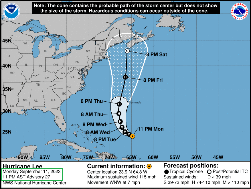
With the advent of quantum computing, I believe their intensity forecasting will become just as accurate in about 15 to 20 years' time.
With the advent of quantum computing, I believe their intensity forecasting will become just as accurate in about 15 to 20 years' time.
4 likes
-
wxman57
- Moderator-Pro Met
- Posts: 23178
- Age: 68
- Joined: Sat Jun 21, 2003 8:06 pm
- Location: Houston, TX (southwest)
Re: ATL: LEE - Post-Tropical - Discussion
PavelGaborik10 wrote:I, too, am confused with the NHC insisting on keeping this at 65 KTS.
Can't find anything that justifies anywhere near that intensity, winds were roughly double in Fiona.
The NHC's primary goal is to keep people safe. To do that, they tend to be very cautious when a storm is approaching the coast. If they lower their wind estimate, then the public might ignore warnings and put themselves in harm's way. I know most of the forecasters there. They're good meteorologists. Of course, there is a problem with being so cautious. The next time a real hurricane approaches the same area, the public will think it's no big deal an they may not heed the warnings.
As a private meteorologist, the only internal requirements that we have is to not disagree with the NHC's classification. If they're calling it a hurricane, we must do so, too. However, we can tell customers what the winds really are in our discussion and in our site forecasts. We tried calling such a storm as Lee a tropical storm way back, when the NHC was calling whatever the storm was a hurricane. That did not go over well with our clients. How can you call it a TS when the NHC calls it a hurricane, they'd say. So, we call it a hurricane, say it's not really a hurricane, and adjust our forecasts so as not to forecast such high winds.
6 likes
-
cycloneye
- Admin
- Posts: 149846
- Age: 69
- Joined: Thu Oct 10, 2002 10:54 am
- Location: San Juan, Puerto Rico
Re: ATL: LEE - Post-Tropical - Discussion
1 likes
Visit the Caribbean-Central America Weather Thread where you can find at first post web cams,radars
and observations from Caribbean basin members Click Here
and observations from Caribbean basin members Click Here
Who is online
Users browsing this forum: No registered users and 41 guests