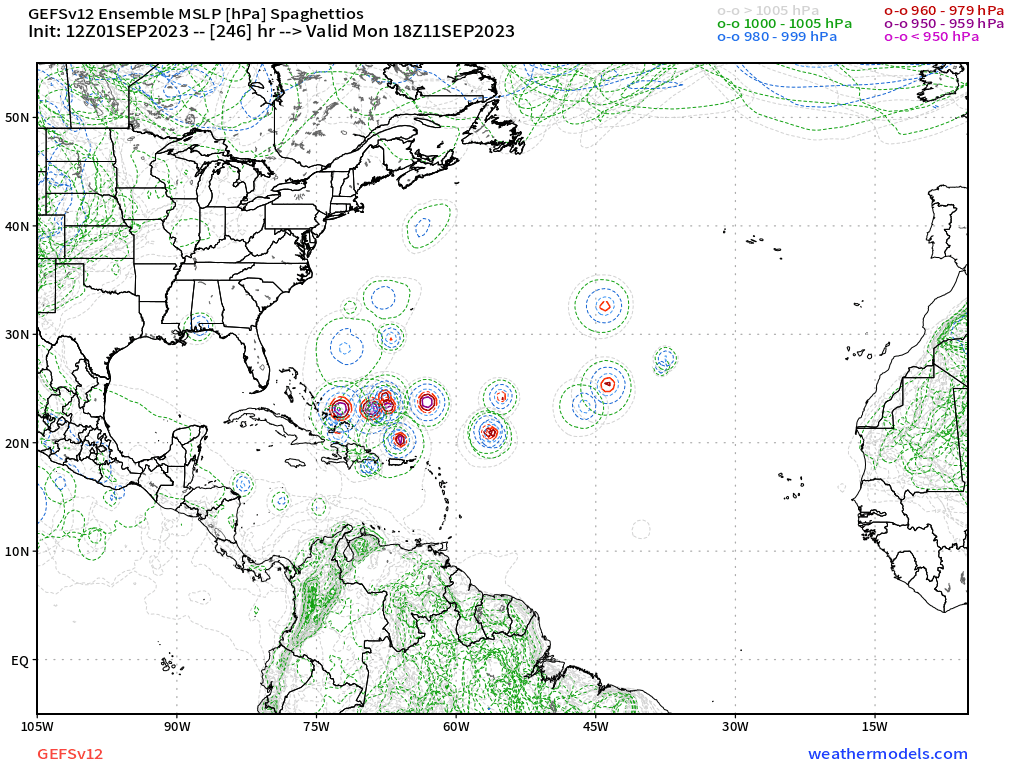
#118 Postby LarryWx » Fri Sep 01, 2023 1:33 pm
12Z UKMET: still has TCG but unlike the prior run having TCG on Sunday, this waits til Wednesday (9/6). With the delay, it is notably weaker but is still in a potentially dangerous position at 168 (9/8) 300 miles E of the Leewards moving WNW at 15 mph:
NEW TROPICAL CYCLONE FORECAST TO DEVELOP AFTER 120 HOURS
FORECAST POSITION AT T+120 : 14.2N 44.1W
LEAD CENTRAL MAXIMUM WIND
VERIFYING TIME TIME POSITION PRESSURE (MB) SPEED (KNOTS)
-------------- ---- -------- ------------- -------------
1200UTC 06.09.2023 120 14.2N 44.1W 1010 27
0000UTC 07.09.2023 132 14.1N 46.7W 1009 29
1200UTC 07.09.2023 144 14.9N 49.0W 1007 37
0000UTC 08.09.2023 156 15.4N 51.8W 1007 31
1200UTC 08.09.2023 168 16.1N 54.9W 1007 34
Last edited by
LarryWx on Fri Sep 01, 2023 1:34 pm, edited 2 times in total.
0 likes
Personal Forecast Disclaimer:
The posts in this forum are NOT official forecasts and should not be used as such. They are just the opinion of the poster and may or may not be backed by sound meteorological data. They are NOT endorsed by any professional institution or storm2k.org. For official information, please refer to the NHC and NWS products.