2023 Indicators (SST, SAL, MSLP, Wind shear, Steering, Instability) and Day 16+ Models

This is the general tropical discussion area. Anyone can take their shot at predicting a storms path.

Moderator: S2k Moderators

Forum rules

The posts in this forum are NOT official forecasts and should not be used as such. They are just the opinion of the poster and may or may not be backed by sound meteorological data. They are NOT endorsed by any professional institution or STORM2K. For official information, please refer to products from the National Hurricane Center and National Weather Service.

Help Support Storm2K
Message
Author
User avatar
SFLcane
S2K Supporter
S2K Supporter
Posts: 10163
Age: 47
Joined: Sat Jun 05, 2010 1:44 pm
Location: Lake Worth Florida

Re: 2023 Indicators (SST, SAL, MSLP, Wind shear, Steering, Instability) and Day 16+ Models

#1361 Postby SFLcane » Mon Aug 28, 2023 9:33 am

toad strangler wrote:
SFLcane wrote:
tolakram wrote:
Complete BS in my opinion. Make up some dates and if a storm happens, NAILED IT. That is not verification.


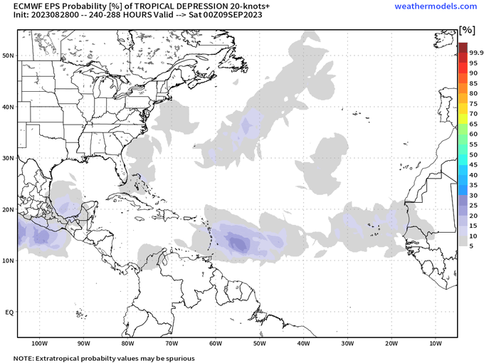
Call it what you want those maps were made in march. Guess they got lucky not once but two times now this season. Maybe they get lucky again In Sept. :lol:


That's like old school Farmers Almanac stuff right there lol. A gillion years ago growing up in the NE we couldn't wait to see when a blizzard was coming when tha Almanac came out. 7 months before :lol:


I get ya lol just pointing out the fact they have already gotten lucky 2 times this season. Currently highlighting the eastcoast in early sept and eps has some hurricanes moving into the bahamas around same time frame.
1 likes   

User avatar
SFLcane
S2K Supporter
S2K Supporter
Posts: 10163
Age: 47
Joined: Sat Jun 05, 2010 1:44 pm
Location: Lake Worth Florida

Re: 2023 Indicators (SST, SAL, MSLP, Wind shear, Steering, Instability) and Day 16+ Models

#1362 Postby SFLcane » Mon Aug 28, 2023 9:36 am

Image
1 likes   

jconsor
Professional-Met
Professional-Met
Posts: 551
Joined: Mon Jun 30, 2008 9:31 pm
Location: Jerusalem, Israel
Contact:

Re: 2023 Indicators (SST, SAL, MSLP, Wind shear, Steering, Instability) and Day 16+ Models

#1363 Postby jconsor » Mon Aug 28, 2023 11:20 am

It's quite rare to see a major US landfall in a moderate to strong El Nino. If Idalia makes landfall as a cat 3+, it would be very notable.

 https://twitter.com/yconsor/status/1695886444781277212


5 likes   

jconsor
Professional-Met
Professional-Met
Posts: 551
Joined: Mon Jun 30, 2008 9:31 pm
Location: Jerusalem, Israel
Contact:

Re: 2023 Indicators (SST, SAL, MSLP, Wind shear, Steering, Instability) and Day 16+ Models

#1364 Postby jconsor » Mon Aug 28, 2023 11:55 am

This year has been remarkably more active than a typical El Nino.

 https://twitter.com/yconsor/status/1696203969452818836


6 likes   


User avatar
weeniepatrol
Category 5
Category 5
Posts: 1273
Joined: Sat Aug 22, 2020 5:30 pm
Location: WA State

Re: 2023 Indicators (SST, SAL, MSLP, Wind shear, Steering, Instability) and Day 16+ Models

#1366 Postby weeniepatrol » Mon Aug 28, 2023 6:19 pm

El Nino!!
3 likes   

User avatar
Category5Kaiju
Category 5
Category 5
Posts: 4097
Joined: Thu Dec 24, 2020 12:45 pm
Location: Seattle

Re: 2023 Indicators (SST, SAL, MSLP, Wind shear, Steering, Instability) and Day 16+ Models

#1367 Postby Category5Kaiju » Mon Aug 28, 2023 6:21 pm

Another interesting thing is, recent years (with the exception of 2021) haven't really had more than one major hurricane by September 1 (yes, not even 2017 and 2020). With Franklin and what-Idalia-will-likely-become-in-the-next-several-days, who knew that a moderate El Nino year would be capable of doing just that? :lol:
9 likes   
Unless explicitly stated, all info in my posts is based on my own opinions and observations. Tropical storms and hurricanes can be extremely dangerous. Do not think you can beat Mother Nature. Refer to an accredited weather research agency or meteorologist if you need to make serious decisions regarding an approaching storm.

User avatar
Category5Kaiju
Category 5
Category 5
Posts: 4097
Joined: Thu Dec 24, 2020 12:45 pm
Location: Seattle

Re: 2023 Indicators (SST, SAL, MSLP, Wind shear, Steering, Instability) and Day 16+ Models

#1368 Postby Category5Kaiju » Mon Aug 28, 2023 7:27 pm

I would also like to add that we still have to get through September. It's very likely that somewhere in the basin, there will be at least one Cat 3 or stronger hurricane during that month (El Nino years historically and typically see their major hurricanes in September anyways). The idea that this season could end with 3-5 MHs may really not be something from an Alice-In-Wonderland fantasy after all.
3 likes   
Unless explicitly stated, all info in my posts is based on my own opinions and observations. Tropical storms and hurricanes can be extremely dangerous. Do not think you can beat Mother Nature. Refer to an accredited weather research agency or meteorologist if you need to make serious decisions regarding an approaching storm.

User avatar
Steve
S2K Supporter
S2K Supporter
Posts: 9621
Joined: Sat Apr 05, 2003 11:41 pm
Location: Not a state-caster

Re: 2023 Indicators (SST, SAL, MSLP, Wind shear, Steering, Instability) and Day 16+ Models

#1369 Postby Steve » Mon Aug 28, 2023 9:48 pm

Category5Kaiju wrote:I would also like to add that we still have to get through September. It's very likely that somewhere in the basin, there will be at least one Cat 3 or stronger hurricane during that month (El Nino years historically and typically see their major hurricanes in September anyways). The idea that this season could end with 3-5 MHs may really not be something from an Alice-In-Wonderland fantasy after all.


Yeah but to be fair I’m sure most people threw a bone to the season having 2-3 majors. Also to be fair I don’t think even a small percentage of the site’s voters would have said by August or simultaneous in August. So 2 or 3 more the rest of the way isn’t remotely far fetched.
1 likes   

User avatar
Hammy
Category 5
Category 5
Posts: 5849
Age: 41
Joined: Fri May 25, 2012 5:25 pm
Contact:

Re: 2023 Indicators (SST, SAL, MSLP, Wind shear, Steering, Instability) and Day 16+ Models

#1370 Postby Hammy » Tue Aug 29, 2023 2:17 am

Amazing to look at this year compared to last, I'm sure if most of us were told one year would be at 9/2/1 with another hurricane (possibly major) on the way in the Gulf, and one was not even on the D storm by the end of August--with nothing forming for nearly two months--we'd all guess wrong as to which year was the El Nino one.
10 likes   
The above post is not official and should not be used as such. It is the opinion of the poster and may or may not be backed by sound meteorological data. It is not endorsed by any professional institution or storm2k.org. For official information, please refer to the NHC and NWS products.

User avatar
NDG
S2K Supporter
S2K Supporter
Posts: 15446
Joined: Sun Jul 09, 2006 10:14 pm
Location: Orlando, FL

Re: 2023 Indicators (SST, SAL, MSLP, Wind shear, Steering, Instability) and Day 16+ Models

#1371 Postby NDG » Tue Aug 29, 2023 5:25 am

Idalia is a great example that even with a persistent -NAO pattern in the Atlantic Basin, the same troughiness pattern in the eastern US can pull a system north out of the western Caribbean into the US during the middle of the hurricane season.
An event many of us always warned about.
2 likes   

User avatar
Category5Kaiju
Category 5
Category 5
Posts: 4097
Joined: Thu Dec 24, 2020 12:45 pm
Location: Seattle

Re: 2023 Indicators (SST, SAL, MSLP, Wind shear, Steering, Instability) and Day 16+ Models

#1372 Postby Category5Kaiju » Tue Aug 29, 2023 9:29 am

Hammy wrote:Amazing to look at this year compared to last, I'm sure if most of us were told one year would be at 9/2/1 with another hurricane (possibly major) on the way in the Gulf, and one was not even on the D storm by the end of August--with nothing forming for nearly two months--we'd all guess wrong as to which year was the El Nino one.


At this point I think I'm reasonably comfortable to say that the abnormally warm Atlantic does indeed play a role in allowing the basin to overachieve compared to what would be expected with a moderate El Nino. It was understandable to be initially skeptical of this idea, considering many moderate Nino years in recent times were below average seasons, but clearly this year has several rather uncanny, pro-activity factors that aren't typical of El Nino years.
1 likes   
Unless explicitly stated, all info in my posts is based on my own opinions and observations. Tropical storms and hurricanes can be extremely dangerous. Do not think you can beat Mother Nature. Refer to an accredited weather research agency or meteorologist if you need to make serious decisions regarding an approaching storm.

User avatar
Teban54
Category 5
Category 5
Posts: 3204
Joined: Sat May 19, 2018 1:19 pm

Re: 2023 Indicators (SST, SAL, MSLP, Wind shear, Steering, Instability) and Day 16+ Models

#1373 Postby Teban54 » Wed Aug 30, 2023 1:07 am

With Idalia now upgraded to a major hurricane at 2am EDT, we now have two simultaneous major hurricanes in the western Atlantic.

Has this ever happened in August of an El Nino year before?
0 likes   

IcyTundra
Category 5
Category 5
Posts: 1205
Joined: Mon Jun 07, 2021 9:32 pm
Location: Dickinson, Texas

Re: 2023 Indicators (SST, SAL, MSLP, Wind shear, Steering, Instability) and Day 16+ Models

#1374 Postby IcyTundra » Wed Aug 30, 2023 1:15 am

Teban54 wrote:With Idalia now upgraded to a major hurricane at 2am EDT, we now have two simultaneous major hurricanes in the western Atlantic.

Has this ever happened in August of an El Nino year before?


I believe the only other times that it has occurred are 1886 and 1893.
0 likes   

hurricanes1234
Category 5
Category 5
Posts: 2907
Joined: Sat Jul 28, 2012 6:19 pm
Location: Trinidad and Tobago

Re: 2023 Indicators (SST, SAL, MSLP, Wind shear, Steering, Instability) and Day 16+ Models

#1375 Postby hurricanes1234 » Wed Aug 30, 2023 2:15 am

Atlantic really said "what El Niño?"

Image

Image
5 likes   
PLEASE NOTE: With the exception of information from weather agencies that I may copy and paste here, my posts will NEVER be official, since I am NOT a meteorologist. They are solely my amateur opinion, and may or may not be accurate. Therefore, please DO NOT use them as official details, particularly when making important decisions. Thank you.

User avatar
weeniepatrol
Category 5
Category 5
Posts: 1273
Joined: Sat Aug 22, 2020 5:30 pm
Location: WA State

Re: 2023 Indicators (SST, SAL, MSLP, Wind shear, Steering, Instability) and Day 16+ Models

#1376 Postby weeniepatrol » Wed Aug 30, 2023 4:34 am

 https://twitter.com/philklotzbach/status/1696816407445680272


#Idalia is now a Category 4 #hurricane. #Franklin was formerly a Cat. 4. Only six other years on record have had two Atlantic Category 4 hurricanes by August 30th: 1933, 1958, 1999, 2004, 2005, 2010.
0 likes   

User avatar
Category5Kaiju
Category 5
Category 5
Posts: 4097
Joined: Thu Dec 24, 2020 12:45 pm
Location: Seattle

Re: 2023 Indicators (SST, SAL, MSLP, Wind shear, Steering, Instability) and Day 16+ Models

#1377 Postby Category5Kaiju » Wed Aug 30, 2023 9:41 am

weeniepatrol wrote:https://twitter.com/philklotzbach/status/1696816407445680272

#Idalia is now a Category 4 #hurricane. #Franklin was formerly a Cat. 4. Only six other years on record have had two Atlantic Category 4 hurricanes by August 30th: 1933, 1958, 1999, 2004, 2005, 2010.


Image

You might have seen this image/gif countless times on wx social media, so I'll finish the catchphrase for you.

El Nino is Spanish for....an inability to stop another dangerous major Gulf landfall and a high-end Category 4 hurricane near Bermuda, ultimately making the Atlantic perform in an above-average manner! :lol:
3 likes   
Unless explicitly stated, all info in my posts is based on my own opinions and observations. Tropical storms and hurricanes can be extremely dangerous. Do not think you can beat Mother Nature. Refer to an accredited weather research agency or meteorologist if you need to make serious decisions regarding an approaching storm.

User avatar
Ntxw
Storm2k Moderator
Storm2k Moderator
Posts: 22785
Joined: Wed Oct 21, 2009 6:34 pm
Location: DFW, Texas

Re: 2023 Indicators (SST, SAL, MSLP, Wind shear, Steering, Instability) and Day 16+ Models

#1378 Postby Ntxw » Wed Aug 30, 2023 9:56 am

There's still about 1.5 to ~2 weeks left for favorable tropical forcing. After that sinking motion will likely return to the Africa-MC window in anticipation of Pacific forcing and sub-seasonal movement ends over the IO-MC. Not clear given the Nino low freq signal, but the next possible tropical forcing movement might be early or mid October.

Image
2 likes   
The above post and any post by Ntxw is NOT an official forecast and should not be used as such. It is just the opinion of the poster and may or may not be backed by sound meteorological data. It is NOT endorsed by any professional institution including Storm2k. For official information, please refer to NWS products.

  Help support Storm2K!
Help Support Storm2K

zzzh
Category 3
Category 3
Posts: 834
Joined: Thu Sep 02, 2021 1:13 pm

Re: 2023 Indicators (SST, SAL, MSLP, Wind shear, Steering, Instability) and Day 16+ Models

#1379 Postby zzzh » Wed Aug 30, 2023 10:05 am

EPS has trended on a faster and weaker Pacific MJO, and has the rising motion in the Atlantic in late September.
0 likes   

User avatar
CyclonicFury
Category 5
Category 5
Posts: 2025
Age: 26
Joined: Sun Jul 02, 2017 12:32 pm
Location: NC
Contact:

Re: 2023 Indicators (SST, SAL, MSLP, Wind shear, Steering, Instability) and Day 16+ Models

#1380 Postby CyclonicFury » Wed Aug 30, 2023 10:12 am

The Atlantic has already produced more ACE than many full El Niño seasons before 2000: 1977, 1982, 1986, 1987, 1991, 1994 and 1997.

We should pass 2009 shortly as well. It's hard not to say the record +AMO isn't having any effect when ACE is nearing the top 10 through this date. If September produces at least average ACE, a below average season will pretty much be impossible.
1 likes   
NCSU B.S. in Meteorology Class of 2021. Tropical weather blogger at http://www.cyclonicfury.com. My forecasts and thoughts are NOT official, for official forecasts please consult the National Hurricane Center.


Return to “Talkin' Tropics”

Who is online

Users browsing this forum: Google Adsense [Bot], KeysRedWine, Steve H., TomballEd and 54 guests