2023 EPAC Season

This is the general tropical discussion area. Anyone can take their shot at predicting a storms path.

Moderator: S2k Moderators

Forum rules

The posts in this forum are NOT official forecasts and should not be used as such. They are just the opinion of the poster and may or may not be backed by sound meteorological data. They are NOT endorsed by any professional institution or STORM2K. For official information, please refer to products from the National Hurricane Center and National Weather Service.

Help Support Storm2K
Message
Author
User avatar
cycloneye
Admin
Admin
Posts: 145303
Age: 68
Joined: Thu Oct 10, 2002 10:54 am
Location: San Juan, Puerto Rico

Re: 2023 EPAC Season

#261 Postby cycloneye » Sun Jul 09, 2023 6:50 am

5 AM PDT TWO still has no changes in the percentages.

Offshore of Southern Mexico:
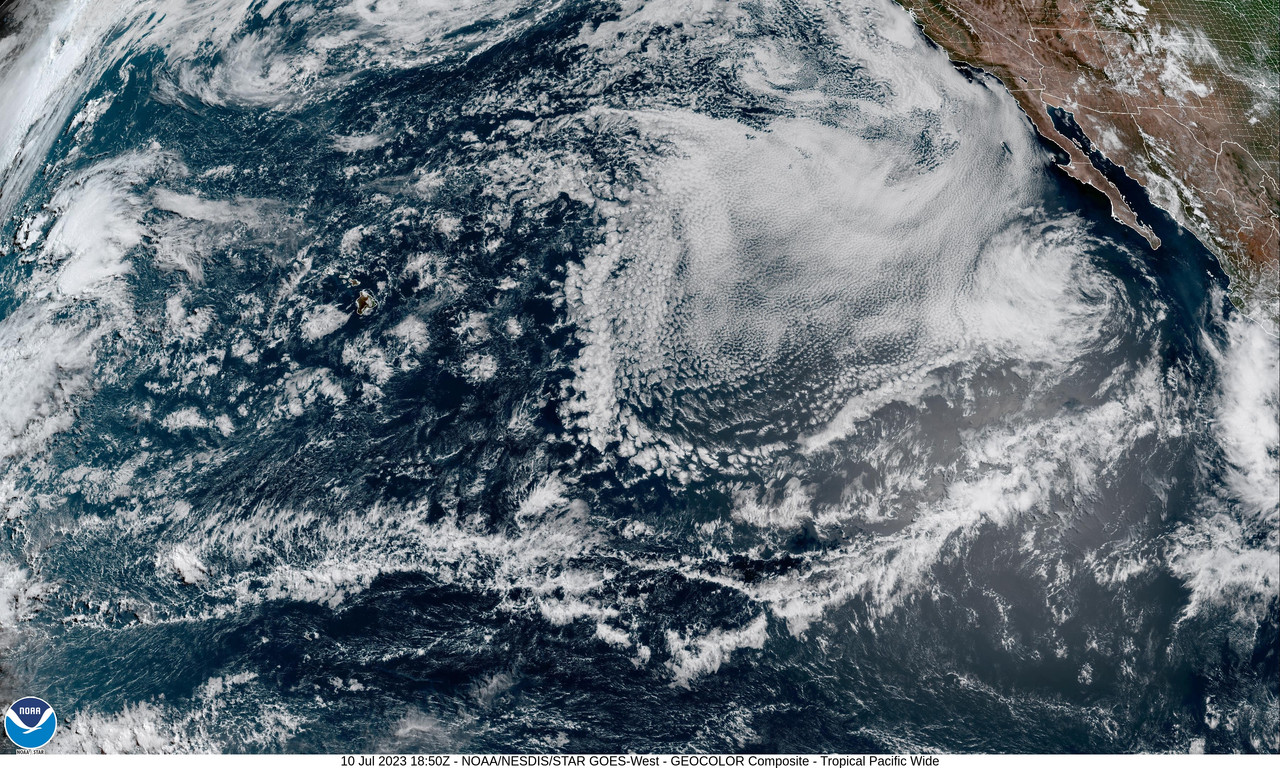
A trough of low pressure a few hundred miles south of southern
Mexico is producing disorganized showers and thunderstorms.
Environmental conditions are expected to be conducive for gradual
development during the next several days, and a tropical depression
is likely to form during the middle of the week. The system is
expected to move westward to west-northwestward, remaining well
offshore of the coast of southern and southwestern Mexico.
* Formation chance through 48 hours...low...20 percent.
* Formation chance through 7 days...high...80 percent.
0 likes   
Visit the Caribbean-Central America Weather Thread where you can find at first post web cams,radars
and observations from Caribbean basin members Click Here

User avatar
cycloneye
Admin
Admin
Posts: 145303
Age: 68
Joined: Thu Oct 10, 2002 10:54 am
Location: San Juan, Puerto Rico

Re: 2023 EPAC Season

#262 Postby cycloneye » Sun Jul 09, 2023 2:25 pm

Looks like the 20/80 AOI is slowly trying to start the organization proccess.

Image
0 likes   
Visit the Caribbean-Central America Weather Thread where you can find at first post web cams,radars
and observations from Caribbean basin members Click Here

User avatar
cycloneye
Admin
Admin
Posts: 145303
Age: 68
Joined: Thu Oct 10, 2002 10:54 am
Location: San Juan, Puerto Rico

Re: 2023 EPAC Season

#263 Postby cycloneye » Sun Jul 09, 2023 6:36 pm

2. Offshore of Southern Mexico:
Shower activity associated with a trough of low pressure a few
hundred miles south of southern Mexico has become a little better
organized since yesterday. Environmental conditions are expected to
be conducive for gradual development during the next several days,
and a tropical depression is likely to form during the middle to
latter part of this week. The system is expected to move westward to
west-northwestward, remaining well offshore of the coast of southern
and southwestern Mexico.
* Formation chance through 48 hours...low...30 percent.
* Formation chance through 7 days...high...80 percent.
0 likes   
Visit the Caribbean-Central America Weather Thread where you can find at first post web cams,radars
and observations from Caribbean basin members Click Here

User avatar
cycloneye
Admin
Admin
Posts: 145303
Age: 68
Joined: Thu Oct 10, 2002 10:54 am
Location: San Juan, Puerto Rico

Re: 2023 EPAC Season

#264 Postby cycloneye » Mon Jul 10, 2023 2:48 am

Will this basin have it's first longtracker of the season with 94E?
0 likes   
Visit the Caribbean-Central America Weather Thread where you can find at first post web cams,radars
and observations from Caribbean basin members Click Here

User avatar
NDG
S2K Supporter
S2K Supporter
Posts: 15446
Joined: Sun Jul 09, 2006 10:14 pm
Location: Orlando, FL

Re: 2023 EPAC Season

#265 Postby NDG » Mon Jul 10, 2023 11:08 am

cycloneye wrote:Will this basin have it's first longtracker of the season with 94E?


After the big fail with 93E I am not believing the models past their 72 hr range. Just from 4 days ago we were supposed to see two strong Tropical Storms if not hurricanes by today.
Anything that tries to track near or north of the 12-15th latitude west of 115W will have a hard time deepening in cooler SSTs & more stable air.

Image
1 likes   

User avatar
Hurricane2022
Category 5
Category 5
Posts: 1541
Joined: Tue Aug 23, 2022 11:38 pm
Location: Araçatuba, Brazil

Re: 2023 EPAC Season

#266 Postby Hurricane2022 » Mon Jul 10, 2023 12:36 pm

Well... ... :lol: ?
Image
0 likes   
Sorry for the bad English sometimes...!
For reliable and detailed information for any meteorological phenomenon, please consult the National Hurricane Center, Joint Typhoon Warning Center , or your local Meteo Center.

--------

Una cvm Christo, pro Christo, et in Christo. Sit nomen Domini benedictvm.

User avatar
Kingarabian
S2K Supporter
S2K Supporter
Posts: 15980
Joined: Sat Aug 08, 2009 3:06 am
Location: Honolulu, Hawaii

Re: 2023 EPAC Season

#267 Postby Kingarabian » Mon Jul 10, 2023 2:22 pm

Don't need water vapor filters to see how dry half the EPAC is right now.
Image

Dry air in the EPAC is stable air from colder than normal waters. Haven't seen it like this since 2010-2013.
3 likes   
RIP Kobe Bryant

tolakram
Admin
Admin
Posts: 20009
Age: 62
Joined: Sun Aug 27, 2006 8:23 pm
Location: Florence, KY (name is Mark)

Re: 2023 EPAC Season

#268 Postby tolakram » Mon Jul 10, 2023 2:44 pm

I have not read every post over the past few days, sorry if this is a duplicate.

Wouldn't it be interesting if a super warm Atlantic did not mean an active Atlantic season during an el nino but instead simply killed the EPAC season?
0 likes   
M a r k
- - - - -
Join us in chat: Storm2K Chatroom Invite. Android and IOS apps also available.

The posts in this forum are NOT official forecasts and should not be used as such. Posts are NOT endorsed by any professional institution or STORM2K.org. For official information and forecasts, please refer to NHC and NWS products.

User avatar
Yellow Evan
Professional-Met
Professional-Met
Posts: 16143
Age: 27
Joined: Fri Jul 15, 2011 12:48 pm
Location: Henderson, Nevada/Honolulu, HI
Contact:

Re: 2023 EPAC Season

#269 Postby Yellow Evan » Mon Jul 10, 2023 3:25 pm

NDG wrote:
cycloneye wrote:Will this basin have it's first longtracker of the season with 94E?


After the big fail with 93E I am not believing the models past their 72 hr range. Just from 4 days ago we were supposed to see two strong Tropical Storms if not hurricanes by today.
Anything that tries to track near or north of the 12-15th latitude west of 115W will have a hard time deepening in cooler SSTs & more stable air.

https://i.imgur.com/3aINhh3.png


It is important to understand why certain model solutions fail rather than merely they just failed. The GFS is regularly overly aggressive in the medium range in any TC basin with a monsoon trough which is why unless there’s a strong MJO event there I am very skeptical of its solution in most basins until there has been consistency. 93E also failed because it was too large to generate central convection needed for pressure falls at the surface and to develop a secondary circulation aloft. 94E is much more compact so it won’t fail for that reason.
4 likes   

User avatar
Kingarabian
S2K Supporter
S2K Supporter
Posts: 15980
Joined: Sat Aug 08, 2009 3:06 am
Location: Honolulu, Hawaii

Re: 2023 EPAC Season

#270 Postby Kingarabian » Mon Jul 10, 2023 3:28 pm

tolakram wrote:I have not read every post over the past few days, sorry if this is a duplicate.

Wouldn't it be interesting if a super warm Atlantic did not mean an active Atlantic season during an el nino but instead simply killed the EPAC season?

It would be interesting but I doubt the Atlantic is limiting the EPAC more than the
-PDO/-PMM combo.
0 likes   
RIP Kobe Bryant

User avatar
Kingarabian
S2K Supporter
S2K Supporter
Posts: 15980
Joined: Sat Aug 08, 2009 3:06 am
Location: Honolulu, Hawaii

Re: 2023 EPAC Season

#271 Postby Kingarabian » Mon Jul 10, 2023 3:52 pm

Yellow Evan wrote:
NDG wrote:
cycloneye wrote:Will this basin have it's first longtracker of the season with 94E?


After the big fail with 93E I am not believing the models past their 72 hr range. Just from 4 days ago we were supposed to see two strong Tropical Storms if not hurricanes by today.
Anything that tries to track near or north of the 12-15th latitude west of 115W will have a hard time deepening in cooler SSTs & more stable air.

https://i.imgur.com/3aINhh3.png


It is important to understand why certain model solutions fail rather than merely they just failed. The GFS is regularly overly aggressive in the medium range in any TC basin with a monsoon trough which is why unless there’s a strong MJO event there I am very skeptical of its solution in most basins until there has been consistency. 93E also failed because it was too large to generate central convection needed for pressure falls at the surface and to develop a secondary circulation aloft. 94E is much more compact so it won’t fail for that reason.

Good points. 94E if it remains on a more WNW heading should fair much better despite the current easterly shear affecting it.
1 likes   
RIP Kobe Bryant

User avatar
NDG
S2K Supporter
S2K Supporter
Posts: 15446
Joined: Sun Jul 09, 2006 10:14 pm
Location: Orlando, FL

Re: 2023 EPAC Season

#272 Postby NDG » Mon Jul 10, 2023 4:17 pm

Kingarabian wrote:Don't need water vapor filters to see how dry half the EPAC is right now.
https://i.postimg.cc/3wV30qMX/20231911850-GOES18-ABI-tpw-GEOCOLOR-3600x2160.jpg

Dry air in the EPAC is stable air from colder than normal waters. Haven't seen it like this since 2010-2013.


That's why I'm having a hard time believing the GFS in 94E reaching the Hawaiian Islands as a TS.
1 likes   

User avatar
cycloneye
Admin
Admin
Posts: 145303
Age: 68
Joined: Thu Oct 10, 2002 10:54 am
Location: San Juan, Puerto Rico

Re: 2023 EPAC Season

#273 Postby cycloneye » Mon Jul 10, 2023 6:53 pm

NDG wrote:
Kingarabian wrote:Don't need water vapor filters to see how dry half the EPAC is right now.
https://i.postimg.cc/3wV30qMX/20231911850-GOES18-ABI-tpw-GEOCOLOR-3600x2160.jpg

Dry air in the EPAC is stable air from colder than normal waters. Haven't seen it like this since 2010-2013.


That's why I'm having a hard time believing the GFS in 94E reaching the Hawaiian Islands as a TS.


See what Yellow Evan posted at the 94E thread where he posted about that.
0 likes   
Visit the Caribbean-Central America Weather Thread where you can find at first post web cams,radars
and observations from Caribbean basin members Click Here

User avatar
cycloneye
Admin
Admin
Posts: 145303
Age: 68
Joined: Thu Oct 10, 2002 10:54 am
Location: San Juan, Puerto Rico

EPAC: CALVIN - Tropical Storm - Discussion

#274 Postby cycloneye » Wed Jul 12, 2023 1:04 pm

Does anyone know the name of that tiny island in the Eastern Pacific around 10.3N-109.5W? Calvins core passed it to the north.

Image
0 likes   
Visit the Caribbean-Central America Weather Thread where you can find at first post web cams,radars
and observations from Caribbean basin members Click Here

User avatar
Yellow Evan
Professional-Met
Professional-Met
Posts: 16143
Age: 27
Joined: Fri Jul 15, 2011 12:48 pm
Location: Henderson, Nevada/Honolulu, HI
Contact:

Re: 2023 EPAC Season

#275 Postby Yellow Evan » Wed Jul 12, 2023 2:20 pm

Clipperton Island.
2 likes   

User avatar
cycloneye
Admin
Admin
Posts: 145303
Age: 68
Joined: Thu Oct 10, 2002 10:54 am
Location: San Juan, Puerto Rico

Re: 2023 EPAC Season

#276 Postby cycloneye » Wed Jul 12, 2023 4:30 pm

No people live in Clipperton Island that is from France. Found details at wiki.

Image

https://en.wikipedia.org/wiki/Clipperton_Island
0 likes   
Visit the Caribbean-Central America Weather Thread where you can find at first post web cams,radars
and observations from Caribbean basin members Click Here

User avatar
Hurricane2022
Category 5
Category 5
Posts: 1541
Joined: Tue Aug 23, 2022 11:38 pm
Location: Araçatuba, Brazil

Re: 2023 EPAC Season

#277 Postby Hurricane2022 » Wed Jul 12, 2023 10:08 pm

0 likes   
Sorry for the bad English sometimes...!
For reliable and detailed information for any meteorological phenomenon, please consult the National Hurricane Center, Joint Typhoon Warning Center , or your local Meteo Center.

--------

Una cvm Christo, pro Christo, et in Christo. Sit nomen Domini benedictvm.

User avatar
cycloneye
Admin
Admin
Posts: 145303
Age: 68
Joined: Thu Oct 10, 2002 10:54 am
Location: San Juan, Puerto Rico

Re: 2023 EPAC Season

#278 Postby cycloneye » Thu Jul 13, 2023 9:38 am

The 2023 season so far=The 3 storms turned to hurricanes.
0 likes   
Visit the Caribbean-Central America Weather Thread where you can find at first post web cams,radars
and observations from Caribbean basin members Click Here

User avatar
cycloneye
Admin
Admin
Posts: 145303
Age: 68
Joined: Thu Oct 10, 2002 10:54 am
Location: San Juan, Puerto Rico

Re: 2023 EPAC Season

#279 Postby cycloneye » Thu Jul 13, 2023 1:04 pm

South of Southwestern Mexico:
An area of low pressure could form well south of the coast of
southwestern Mexico during the early to middle part of next week.
Some gradual development of this system is possible thereafter as it
moves westward to west-northwestward over the central potion of the
eastern Pacific basin.
* Formation chance through 48 hours...low...near 0 percent.
* Formation chance through 7 days...low...20 percent.
0 likes   
Visit the Caribbean-Central America Weather Thread where you can find at first post web cams,radars
and observations from Caribbean basin members Click Here

User avatar
Kingarabian
S2K Supporter
S2K Supporter
Posts: 15980
Joined: Sat Aug 08, 2009 3:06 am
Location: Honolulu, Hawaii

Re: 2023 EPAC Season

#280 Postby Kingarabian » Thu Jul 13, 2023 1:17 pm

cycloneye wrote:
South of Southwestern Mexico:
An area of low pressure could form well south of the coast of
southwestern Mexico during the early to middle part of next week.
Some gradual development of this system is possible thereafter as it
moves westward to west-northwestward over the central potion of the
eastern Pacific basin.
* Formation chance through 48 hours...low...near 0 percent.
* Formation chance through 7 days...low...20 percent.

Very weak Euro and CMC support.
0 likes   
RIP Kobe Bryant


Return to “Talkin' Tropics”

Who is online

Users browsing this forum: Noots and 47 guests