
Euro has it a TD/TS in 48h
Moderator: S2k Moderators


NDG wrote:12z Euro really likes 93L, better than TD3, at least in the short term.
https://i.imgur.com/ZuR1B08.gif


Hurricane2022 wrote:https://imageshack.com/i/po5kU2sTp
https://imageshack.com/i/pob9ictzp
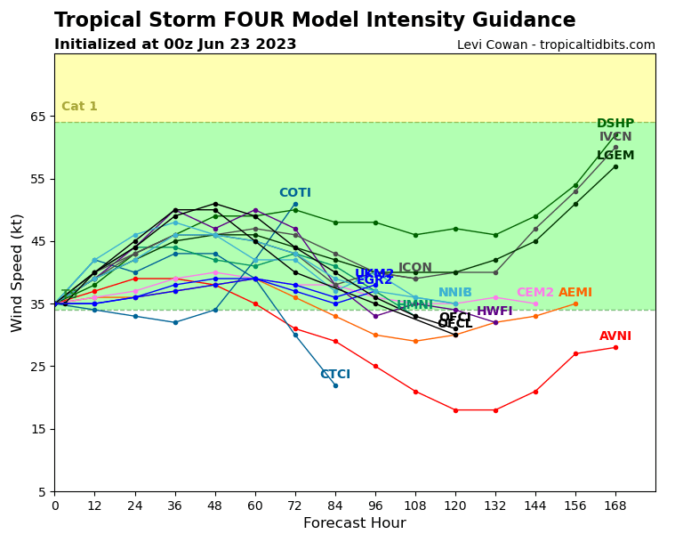
HWRF wants a strong hurricane from 93L, while HAFS A & B only shows a moderate and sheared tropical storm

Hypercane_Kyle wrote:00z GFS back in the hurricane camp in about six days.


Users browsing this forum: No registered users and 34 guests


