LARanger wrote:
I was composing a lengthy reply to Hammy's now-also-removed response, in which Hammy indicated that there was no evidence for a Cat4 landfall and proposed arguments against what's been referred to as a Cat5-level surge as being indicative of the wind strength. I fully agree that the surge is not relevant (excepting that it destroyed evidence for wind speeds), nor would it constitute part of my argument for Katrina as a 4 at landfall.
...
I would argue that without much firmer evidence that effectively rules out the original Cat4 designation, then the "ruling on the field" should stand. I further find it peculiar to assert that Katrina lost thirty miles per hour in a mere fifty miles inland but then only lost twenty miles per hour for the next 100 miles, especially given that higher wind speeds were felt inland at my location than would have been supported by the official speed as the eye passed. I mean, was she somehow a super-coupler of wind to surface?
...
Edit: For a similar case, see this cat's argument for a Cat4 (or less!) Camille from 2012 and compare that to the 2016 reanalysis that, even with the questionable speed cut from 190 to 175, still has her at 175mph.
Regarding the comparison with Camille, the reasoning of it being a Cat 4 never made any sense and wasn't really based on anything concrete.
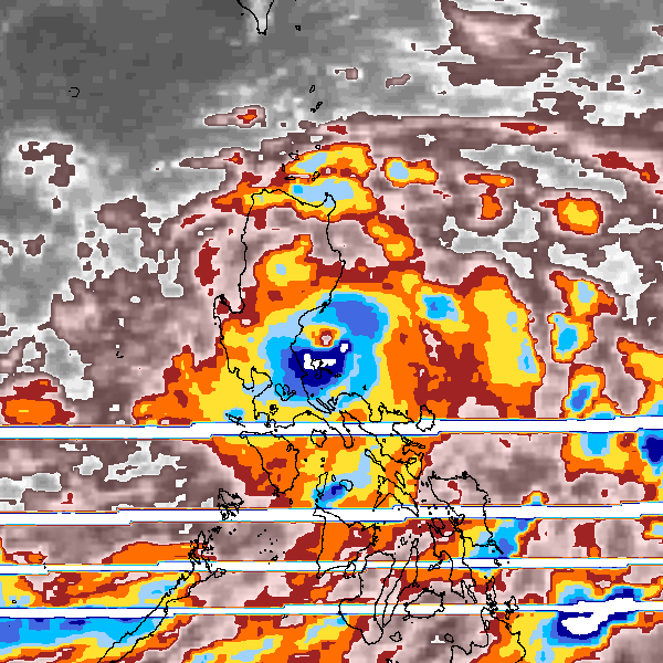
A big reason for the weakening was ingesting continental air--I've seen quite a few posts over the years that talk about that preventing the air from mixing to the surface which likely contributed to the degree of weakening, as well as the wind field expanding (flatter pressure gradient) and if I recall (I could be wrong) being in a lower pressure environment in general. NHC notes that the structural changes were unusual and the flight level reduction would likely have over-estimated the intensity .
These data reveal an unusual,
broad, and elevated wind maximum in the 2-4 km layer (centered near the 700 mb flight level),
well above the more typical location of the maximum wind near the top of the boundary layer
(~500 m) that had been observed on 28 August.
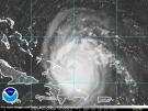
That said, it is not out of the realm of possibility of a Cat 4 coastal impact, even if the winds had weakened by the time of actual landfall:
It is worth noting that Katrina was likely at
Category 4 strength with maximum sustained winds of about 115 kt near 0900 UTC 29 August, a
couple of hours before the center made landfall near Buras, LA. Due to the large (~25-30 n mi)
radius of maximum winds, it is possible that sustained winds of Category 4 strength briefly
impacted the extreme southeastern tip of Louisiana in advance of landfall of the center.
From the NHC post-storm report: https://www.nhc.noaa.gov/data/tcr/AL122005_Katrina.pdf