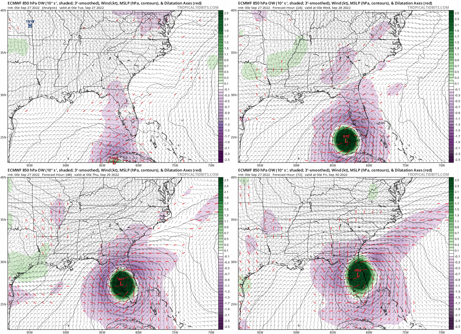
00z ECMWF… 72 hrs moving NE over Florida
Moderator: S2k Moderators


Blown Away wrote:[url]https://i.postimg.cc/76y2BXsd/86-A9-B617-5-B31-4-E8-F-A4-F4-67-BAD326-A870.jpg [/url]
00z ECMWF… 48 hrs landfall just N of Sanibel


Blown Away wrote:[url]https://i.postimg.cc/0N9Tv1BC/ec-fast-ow850-seus-fh0-96.gif [/url]
00z ECMWF… Another E shift… Landfall S of Tampa

Teban54 wrote:Blown Away wrote:[url]https://i.postimg.cc/0N9Tv1BC/ec-fast-ow850-seus-fh0-96.gif [/url]
00z ECMWF… Another E shift… Landfall S of Tampa
The 48 hrs landfall location is actually a tiny bit NW of 18z.


NDG wrote:Wow, 06z GFS shifted well south of Tampa Bay, looks like.


Bocadude85 wrote:6z TVCN is south of Tampa, down around Sarasota/Bradenton.
Nimbus wrote:Bocadude85 wrote:6z TVCN is south of Tampa, down around Sarasota/Bradenton.
TVCN is a consensus model, NHC mentioned it in the 5 AM update.
Last night I saw the HMON flip from south of Tallahassee to the Atlantic headed for south Carolina.
If you have 3 members of a consensus model and they vary widely it isn't a forecast tool.
Lets say there is a 33% chance Ian powers up and his outflow overcomes the trough so he tracks for the big bend area.
Now there may also be a 33% chance that the trough digs fast and strong undercutting Ians CDO so that he limps east over Sarasota across the state of Florida to the Atlantic.
And that leaves a 33% chance that the trough remnants will potentially steer the perfect storm towards Tampa bay area between the two outliers.
Now since the consensus follows the middle track towards Tampa there is actually only a 33% chance of verifying.
NHC really can't do much better forecasting trough interactions out beyond 24 hours and they repeated this in the 5 AM update.
"There continues to be larger-than-normal
spread in the track guidance by 36-48 hours, however the trend in
the global models has been more southward and eastward over the
last cycle or two."

Users browsing this forum: No registered users and 8 guests