otowntiger wrote:viberama wrote:skyline385 wrote:
Never heard of a missing data before, he also hasn't responded to folks asking for further clarification to the tweet. I would hold off until we get confirmation or details from more mets about it.
Eric Buress at WESH 2 is a decent meteorologist but can be melodramatic sometimes. I wouldn't read too much into it.
But in this case he’s being the opposite of be melodramatic, right? He’s in Orlando- if he wanted to be melodramatic he’d be hyping the latest Euro, not calling for it to be thrown out.
No, I do not call his statement undramatic. He might have been thinking out loud and just posted that tweet without actually thinking about it! Who knows.


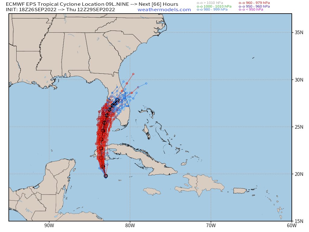
 ensembles now all south of Tampa!