

Steve wrote:SFLcane wrote:AutoPenalti wrote:We have afternoon showers that were stronger than that.
In all seriousness, still far out in time so this will change.
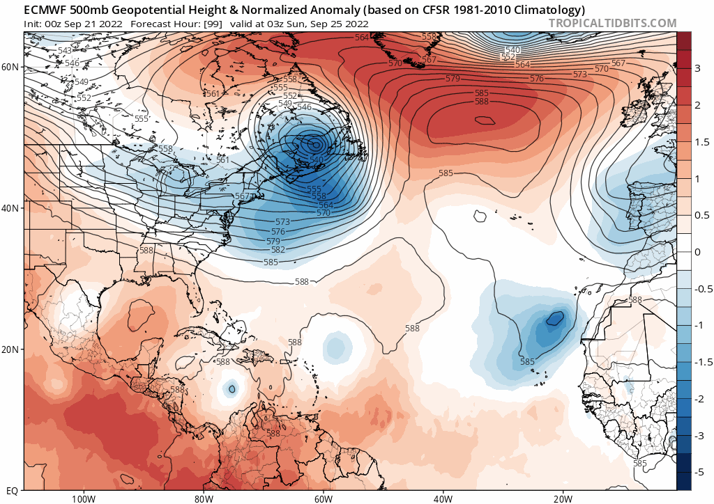
I can't see how this gets far north in the gulf without getting yanked eastward sooner rather then later IF the euro is right.
https://i.postimg.cc/gj5JpZNZ/ecmtt.gif
It's 8 days out. It's not going to be 100% right. What you can or should be able to see is high pressure building back over the top though that doesn't really happen all that much later in the year - more of an earlier in the season dynamic. I'd agree that the likelihood of a NE pull makes sense, but I'm not basing that off an upper model that far out - not the specifics anyway.
Indeed thats why the use of ensembles is the way to go. For example the GFS ensemble mean has been the right of the OP since this started it seems.


